Area Overview for PE33 0AA
Photos of PE33 0AA
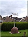


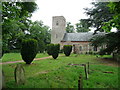
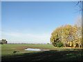
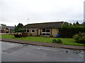

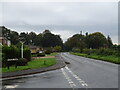

22 photos from this area
Area Information
Key information about the PE33 0AA including its size, population, and administrative classification.
- Area Type
- Postcode
- Area Size
- 42.6 hectares
- Population
- 1384
- Population Density
- 37 people/km²
House Prices in PE33 0AA
38
Properties
£245,662
Average Sold Price
£69,995
Lowest Price
£550,000
Highest Price
Showing 38 properties
| Address | Type | Beds | Baths | Last Sale Price | Last Sale Date | |
|---|---|---|---|---|---|---|
| Brathay, 30 Common Road, Runcton Holme, PE33 0AA | Bungalow | 3 | 1 | £260,000 | Aug 2025 | |
| Moonfleet, 87 Common Road, Runcton Holme, PE33 0AA | Bungalow | 3 | 1 | £339,000 | Jun 2025 | |
| Penny Fields, 48 Common Road, Runcton Holme, PE33 0AA | Bungalow | - | - | £550,000 | Feb 2023 | |
| Roanne, 72 Common Road, Runcton Holme, PE33 0AA | Bungalow | 3 | 1 | £250,000 | Dec 2022 | |
| 24 Common Road, Runcton Holme, PE33 0AA | Bungalow | 3 | 1 | £325,000 | Aug 2022 | |
| Mulberry House, 83 Common Road, Runcton Holme, PE33 0AA | Chalet | 4 | 2 | £243,000 | Jul 2019 | |
| 56 Common Road, Runcton Holme, PE33 0AA | Bungalow | 5 | 2 | £402,000 | Mar 2019 | |
| 26 Common Road, Runcton Holme, PE33 0AA | Bungalow | 2 | - | £184,000 | Apr 2018 | |
| The Haven, 78 Common Road, Runcton Holme, PE33 0AA | Bungalow | 4 | 1 | £230,000 | May 2016 | |
| Westley, 74 Common Road, Runcton Holme, PE33 0AA | Bungalow | - | - | £215,000 | Apr 2016 |
Page 1 of 4
Energy Efficiency in PE33 0AA
Amenities
Schools
| Rank | School | Type | Entry gender | Ages |
|---|
Explore more schools in this area
Go to Schools tabDemographics
Household Size
Two person
most common
Accommodation Type
Houses
most common
Tenure
74
majority
Ethnic Group
White
most common
Religion
N/A
most common
Household Composition
N/A
most common
Age
47
median
Adults (30-64 years)
most common
Household Deprivation
N/A
with no deprivation
NS-SEC
29
in Lower managerial occupations
Explore more demographic insights in this area
Go to Demographics tabPlanning
Planning Constraints
- Flood RiskPremium
- Ramsar Wetland SitesPremium
- Area of Outstanding Natural BeautyPremium
- Protected Nature ReservePremium
- Protected WoodlandPremium