Area Overview for PE33 0AB
Photos of PE33 0AB
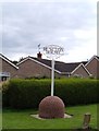
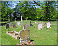
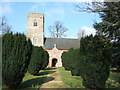
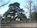
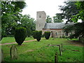
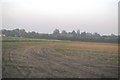
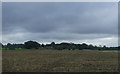
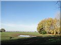
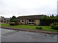
22 photos from this area
Area Information
Key information about the PE33 0AB including its size, population, and administrative classification.
- Area Type
- Postcode
- Area Size
- 9.1 hectares
- Population
- 1384
- Population Density
- 37 people/km²
House Prices in PE33 0AB
18
Properties
£192,607
Average Sold Price
£47,000
Lowest Price
£390,000
Highest Price
Showing 18 properties
| Address | Type | Beds | Baths | Last Sale Price | Last Sale Date | |
|---|---|---|---|---|---|---|
| 6 Holme Close, Runcton Holme, PE33 0AB | Bungalow | 2 | 1 | £215,000 | Mar 2023 | |
| 1 Holme Close, Runcton Holme, PE33 0AB | Bungalow | - | - | £390,000 | Mar 2022 | |
| 8 Holme Close, Runcton Holme, PE33 0AB | Bungalow | - | - | £300,000 | Oct 2021 | |
| 19 Holme Close, Runcton Holme, PE33 0AB | Bungalow | - | - | £160,000 | Jul 2021 | |
| 21 Holme Close, Runcton Holme, PE33 0AB | Bungalow | - | - | £265,000 | May 2021 | |
| 23 Holme Close, Runcton Holme, PE33 0AB | Bungalow | 3 | 1 | £270,000 | Mar 2020 | |
| 3 Holme Close, Runcton Holme, PE33 0AB | Bungalow | 3 | 1 | £240,000 | Nov 2017 | |
| 5 Holme Close, Runcton Holme, PE33 0AB | Detached | 2 | 1 | £195,000 | Oct 2017 | |
| 27 Holme Close, Runcton Holme, PE33 0AB | Bungalow | - | - | £180,000 | Jul 2010 | |
| 15 Holme Close, Runcton Holme, PE33 0AB | Bungalow | 3 | 2 | £128,000 | Sep 2003 |
Page 1 of 2
Energy Efficiency in PE33 0AB
Amenities
Schools
| Rank | School | Type | Entry gender | Ages |
|---|
Explore more schools in this area
Go to Schools tabDemographics
Household Size
Two person
most common
Accommodation Type
Houses
most common
Tenure
74
majority
Ethnic Group
White
most common
Religion
N/A
most common
Household Composition
N/A
most common
Age
47
median
Adults (30-64 years)
most common
Household Deprivation
N/A
with no deprivation
NS-SEC
29
in Lower managerial occupations
Explore more demographic insights in this area
Go to Demographics tabPlanning
Planning Constraints
- Flood RiskPremium
- Ramsar Wetland SitesPremium
- Area of Outstanding Natural BeautyPremium
- Protected Nature ReservePremium
- Protected WoodlandPremium