Area Overview for NR33 9RL
Photos of NR33 9RL

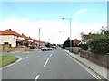
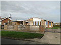
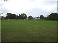
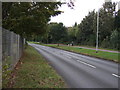
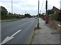
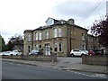
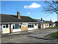
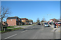
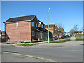
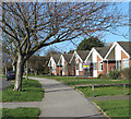
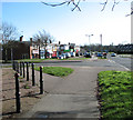
23 photos from this area
Area Information
Key information about the NR33 9RL including its size, population, and administrative classification.
- Area Type
- Postcode
- Area Size
- 1.3 hectares
- Population
- 1416
- Population Density
- 3083 people/km²
House Prices in NR33 9RL
28
Properties
£151,903
Average Sold Price
£28,000
Lowest Price
£228,000
Highest Price
Showing 28 properties
| Address | Type | Beds | Baths | Last Sale Price | Last Sale Date | |
|---|---|---|---|---|---|---|
| 82 Westwood Avenue, Lowestoft, NR33 9RL | Bungalow | - | - | £228,000 | Feb 2021 | |
| 88 Westwood Avenue, Lowestoft, NR33 9RL | Semi-detached | 3 | 1 | £200,000 | May 2020 | |
| 90 Westwood Avenue, Lowestoft, NR33 9RL | Semi-detached | 3 | 1 | £210,000 | Jun 2018 | |
| 94 Westwood Avenue, Lowestoft, NR33 9RL | Semi-detached | 3 | 1 | £181,500 | Aug 2017 | |
| 112 Westwood Avenue, Lowestoft, NR33 9RL | house | - | - | £192,500 | Oct 2016 | |
| 118 Westwood Avenue, Lowestoft, NR33 9RL | house | - | - | £180,000 | Aug 2016 | |
| 76 Westwood Avenue, Lowestoft, NR33 9RL | Detached | 4 | - | £185,000 | Jun 2015 | |
| 74 Westwood Avenue, Lowestoft, NR33 9RL | Detached | 4 | 2 | £192,000 | May 2015 | |
| 72A Westwood Avenue, Lowestoft, NR33 9RL | Detached | 3 | 3 | £125,000 | Nov 2014 | |
| 78 Westwood Avenue, Lowestoft, NR33 9RL | Bungalow | - | - | £149,995 | Dec 2012 |
Page 1 of 3
Energy Efficiency in NR33 9RL
Amenities
Schools
| Rank | School | Type | Entry gender | Ages |
|---|
Explore more schools in this area
Go to Schools tabDemographics
Household Size
Two person
most common
Accommodation Type
Houses
most common
Tenure
92
majority
Ethnic Group
White
most common
Religion
N/A
most common
Household Composition
N/A
most common
Age
47
median
Adults (30-64 years)
most common
Household Deprivation
N/A
with no deprivation
NS-SEC
26
in Lower managerial occupations
Explore more demographic insights in this area
Go to Demographics tabPlanning
Planning Constraints
- Flood RiskPremium
- Ramsar Wetland SitesPremium
- Area of Outstanding Natural BeautyPremium
- Protected Nature ReservePremium
- Protected WoodlandPremium