Area Overview for NR33 9RS
Photos of NR33 9RS

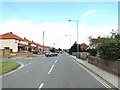
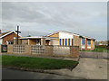
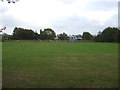
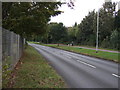
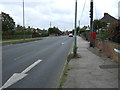
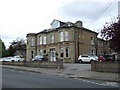
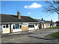
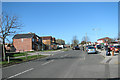
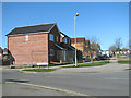
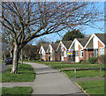
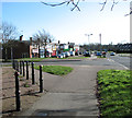
23 photos from this area
Area Information
Key information about the NR33 9RS including its size, population, and administrative classification.
- Area Type
- Postcode
- Area Size
- 1.4 hectares
- Population
- 1416
- Population Density
- 3083 people/km²
House Prices in NR33 9RS
24
Properties
£169,622
Average Sold Price
£54,500
Lowest Price
£345,000
Highest Price
Showing 24 properties
| Address | Type | Beds | Baths | Last Sale Price | Last Sale Date | |
|---|---|---|---|---|---|---|
| 117 Westwood Avenue, Lowestoft, NR33 9RS | Semi-detached | 5 | 2 | £345,000 | Sep 2023 | |
| 115 Westwood Avenue, Lowestoft, NR33 9RS | house | 4 | - | £240,000 | Jun 2020 | |
| 103 Westwood Avenue, Lowestoft, NR33 9RS | Semi-detached | 4 | 2 | £270,000 | Nov 2018 | |
| 81 Westwood Avenue, Lowestoft, NR33 9RS | Bungalow | 2 | - | £220,000 | Sep 2018 | |
| 101 Westwood Avenue, Lowestoft, NR33 9RS | house | 4 | 2 | £225,000 | Nov 2017 | |
| 111 Westwood Avenue, Lowestoft, NR33 9RS | Semi-detached | 4 | 2 | £211,500 | Nov 2017 | |
| 75 Westwood Avenue, Lowestoft, NR33 9RS | Detached | - | - | £175,000 | Oct 2017 | |
| 91 Westwood Avenue, Lowestoft, NR33 9RS | house | - | - | £165,000 | Dec 2014 | |
| 77 Westwood Avenue, Lowestoft, NR33 9RS | Bungalow | 3 | - | £149,000 | Apr 2014 | |
| 89 Westwood Avenue, Lowestoft, NR33 9RS | house | - | - | £184,000 | Jul 2013 |
Page 1 of 3
Energy Efficiency in NR33 9RS
Amenities
Schools
| Rank | School | Type | Entry gender | Ages |
|---|
Explore more schools in this area
Go to Schools tabDemographics
Household Size
Two person
most common
Accommodation Type
Houses
most common
Tenure
92
majority
Ethnic Group
White
most common
Religion
N/A
most common
Household Composition
N/A
most common
Age
47
median
Adults (30-64 years)
most common
Household Deprivation
N/A
with no deprivation
NS-SEC
26
in Lower managerial occupations
Explore more demographic insights in this area
Go to Demographics tabPlanning
Planning Constraints
- Flood RiskPremium
- Ramsar Wetland SitesPremium
- Area of Outstanding Natural BeautyPremium
- Protected Nature ReservePremium
- Protected WoodlandPremium