Area Overview for NR33 7RQ
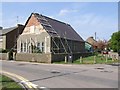
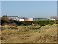
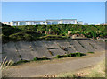
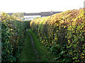
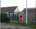
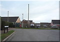
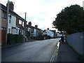
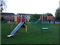
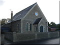
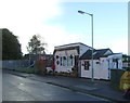
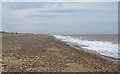
Photos of NR33 7RQ

Area Information
NR33 7RQ defines a compact residential cluster in England that spreads across 6.5 hectares. This specific postcode area accommodates a population of 1,489 people, resulting in a density of 423 people per square kilometre. Living in NR33 7RQ means residing in a tightly knit neighbourhood where housing is concentrated within a relatively small footprint. The scale of the area suggests a community where residents interact frequently due to the proximity of homes. A resident navigating this cluster experiences a sense of intimacy often found in villages or subtleties of larger towns. The physical boundaries are clear, distinguishing this postcode from the broader surrounding region. Daily life centres on moving short distances between home and local centres. This structure supports a lifestyle where much of the necessary infrastructure remains within immediate reach. The area represents a distinct choice for those seeking a defined residential space rather than sprawling suburbs.
- Area Type
- Postcode
- Area Size
- 6.5 hectares
- Population
- 1489
- Population Density
- 423 people/km²
Homes in NR33 7RQ form a market characterised by strong ownership ratios and traditional housing stock. With 76 per cent of the population owning their homes, the area functions primarily as an owner-occupied community rather than a hub for private renting. The accommodation type data confirms that houses dominate the local landscape, offering the typical garden space and structural space associated with this dwelling style. Buyers looking at the immediate surroundings should expect a stock consisting of standalone residences rather than apartment blocks or conversions. This housing mix supports a lifestyle where external grounds and lower-density living take precedence over the high-rise or terrace living found in other districts. The stability of the ownership model often correlates with slower turnover rates compared to rental-heavy zones. Prospective buyers seeking a house to settle into for decades will find this postcode offers a stock aligned with that long-term intent.
House Prices in NR33 7RQ
Showing 55 properties
| Address | Type | Beds | Baths | Last Sale Price | Last Sale Date | |
|---|---|---|---|---|---|---|
| 50, Seaview Holiday Estate, Green Lane, Kessingland, NR33 7RQ | Bungalow | 3 | - | £68,000 | Nov 2018 | |
| 8, Seaview Holiday Estate, Green Lane, Kessingland, NR33 7RQ | Mobile Home | 3 | - | £55,000 | Aug 2018 | |
| 5, Seaview Holiday Estate, Green Lane, Kessingland, NR33 7RQ | Chalet | 3 | 1 | £62,500 | May 2018 | |
| 42, Seaview Holiday Estate, Green Lane, Kessingland, NR33 7RQ | Mobile Home | - | - | £69,950 | May 2017 | |
| 6, Seaview Holiday Estate, Green Lane, Kessingland, NR33 7RQ | Land | - | - | £51,000 | Oct 2010 | |
| 1, Seaview Holiday Estate, Green Lane, Kessingland, NR33 7RQ | Mobile Home | - | - | £51,000 | Dec 2008 | |
| 7, Seaview Holiday Estate, Green Lane, Kessingland, NR33 7RQ | Chalet | 3 | 1 | £54,000 | Aug 2008 | |
| 36, Seaview Holiday Estate, Green Lane, Kessingland, NR33 7RQ | Chalet | 3 | 1 | £65,000 | Sep 2007 | |
| 52, Seaview Holiday Estate, Green Lane, Kessingland, NR33 7RQ | Bungalow | 3 | - | £62,995 | Dec 2006 | |
| 43, Seaview Holiday Estate, Green Lane, Kessingland, NR33 7RQ | Chalet | 3 | - | £66,750 | Oct 2006 |
Energy Efficiency in NR33 7RQ
Living in NR33 7RQ places you within practical reach of five retail options, including Co-op Kessingland, Spar, and Morrisons Pakefield. These specific venues provide necessities like groceries and household supplies without the need for long travel. You can access five rail facilities nearby, such as Oulton Broad South Railway Station, which connects the area to wider networks. Beccles Airport sits just one location away, offering an alternative transport route for certain journeys. This proximity to named retailers and transport hubs simplifies the logistics of weekly shopping and occasional travel. The local amenities ensure that residents do not have to drive far for everyday services. Your daily errands can be tackled efficiently using these five retail points and the nearby rail interchange.
Amenities
Schools
| Rank | School | Type | Entry gender | Ages |
|---|
Explore more schools in this area
Go to Schools tabDemographics
The community within NR33 7RQ reflects a mature demographic profile, with a median age of 47 years. Adults in the 30 to 64 year age range form the most common group among the local population. This age distribution indicates a neighbourhood populated largely by households in their prime working years or early retirement. Home ownership stands at 76 per cent, showing that the majority of residents own their properties outright or via mortgage rather than renting. The accommodation type in this area consists primarily of houses, contrasting with the prevalence of flats found in urban centres. The predominant ethnic group is White, which aligns with typical settlement patterns in parts of Suffolk. These figures paint a picture of established families and individuals who have remained in the area for some time. The high rate of ownership suggests long-term stability and a community invested in the locality rather than transient residents.
Household Size
Accommodation Type
Tenure
Ethnic Group
Religion
Household Composition
Age
Household Deprivation
NS-SEC
Explore more demographic insights in this area
Go to Demographics tabPlanning
Planning Constraints
- Flood RiskPremium
- Ramsar Wetland SitesPremium
- Area of Outstanding Natural BeautyPremium
- Protected Nature ReservePremium
- Protected WoodlandPremium