Area Overview for NR33 7RJ
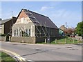
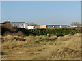
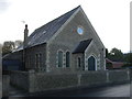
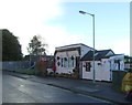
Photos of NR33 7RJ


Area Information
Living in NR33 7RJ means residing within a compact residential cluster defined by its specific postcode. This small area covers 481 square metres and holds a population of 1,489 people. The density reaches 423 people per square kilometre, creating a neighbourhood that feels intimate yet distinct. You are part of a community where daily life revolves around practical convenience and established local roots. The location sits comfortably away from major planning constraints, with no coverage of protected nature reserves or areas of outstanding natural beauty. This clarity ensures that development patterns remain straightforward for residents. The zone functions as a self-contained pocket of domestic life where the built environment prioritises housing over open conservation land. You can rely on a stable demographic composition without the complexity of rapid demographic shifts. The area maintains a clear residential identity, offering a predictable environment for those seeking a settled home base. Neighbours here understand the rhythm of suburban living in this specific postcode sector.
- Area Type
- Postcode
- Area Size
- 481 m²
- Population
- 1489
- Population Density
- 423 people/km²
The property market in NR33 7RJ is heavily skewed towards owner-occupied living. With 76 per cent of residents owning their homes, the area functions as a classic legacy market rather than a rental hub. Houses dominate the accommodation landscape, offering various configurations suited to families and established households. This high ownership rate means that sellers typically have been living in the property for several years, often providing a step-up ladder opportunity for buyers entering the market. The postcode covers a small residential cluster, so stock turnover may be slower than in larger urban centres. You are looking at a stock primarily defined by traditional English housing forms rather than modern developments. The lack of protected planning constraints, such as no Ramsar wetland sites or areas of outstanding natural beauty, allows for standard housing developments where permitted. Buyers here seek solid investments in a stable area rather than speculative lets. The market reflects a community that values permanence over investment flipping.
House Prices in NR33 7RJ
Showing 3 properties
| Address | Type | Beds | Baths | Last Sale Price | Last Sale Date | |
|---|---|---|---|---|---|---|
| 3, Beaconsfield Place, Green Lane, Kessingland, NR33 7RJ | Terraced | 2 | 1 | £180,000 | May 2024 | |
| 2, Beaconsfield Place, Green Lane, Kessingland, NR33 7RJ | Retail | 3 | 1 | £245,000 | Jan 2023 | |
| 1, Beaconsfield Place, Green Lane, Kessingland, NR33 7RJ | Terraced | 4 | 2 | £124,995 | Nov 2014 |
Energy Efficiency in NR33 7RJ
Your lifestyle in NR33 7RJ benefits from immediate access to essential retail and transport links. Five key amenities sit within practical reach, including Co-op Kessingland, Spar, and Morrisons Pakefield. These shops provide the daily groceries and essentials you require without needing a long journey. Transport connectivity is supported by multiple rail access points, with five notable stations serving the wider region. You can travel to Oulton Broad South Railway Station or utilising Entrance1 and Entrance3 points for daily commutes. Beccles Airport offers an additional link for regional travel or occasional flights. This combination of retail and rail access means you do not need to drive into Norwich for basic shopping or local travel. The proximity to these named venues structures your weekly routine efficiently. You can visit the Spar for quick items or the Coop for larger stocks comfortably. The mix of services ensures that daily errands remain manageable and low-stress.
Amenities
Schools
| Rank | School | Type | Entry gender | Ages |
|---|
Explore more schools in this area
Go to Schools tabDemographics
The community in NR33 7RJ presents a mature profile with a median age of 47 years. Most residents fall into the 30-to-64-year-old bracket, indicating a family-focused population rather than a retirement or student zone. Home ownership stands at 76 per cent, which signals long-term stability within the neighbourhood. You will find that the majority of properties are owned outright or with a mortgage rather than rented through a landlord. White residents form the predominant ethnic group, reflecting a traditional, established character typical of many English towns. Houses make up the primary accommodation type, meaning you are likely to encounter terraced, semi-detached, or detached dwellings rather than large blocks of flats. The high ownership rate suggests that people view this as a home for generations. There is little evidence of transient populations or short-term leases dominating the streets. This demographic balance creates a quiet, settled atmosphere where residents have invested time and capital into their immediate neighbourhood.
Household Size
Accommodation Type
Tenure
Ethnic Group
Religion
Household Composition
Age
Household Deprivation
NS-SEC
Explore more demographic insights in this area
Go to Demographics tabPlanning
Planning Constraints
- Flood RiskPremium
- Ramsar Wetland SitesPremium
- Area of Outstanding Natural BeautyPremium
- Protected Nature ReservePremium
- Protected WoodlandPremium