Area Overview for NR33 7RD
Photos of NR33 7RD
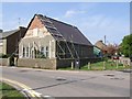
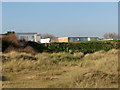
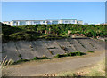
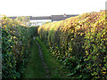
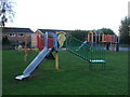

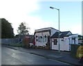
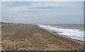
67 photos from this area
Area Information
Key information about the NR33 7RD including its size, population, and administrative classification.
- Area Type
- Postcode
- Area Size
- 9493 m²
- Population
- 1489
- Population Density
- 423 people/km²
House Prices in NR33 7RD
16
Properties
£205,145
Average Sold Price
£48,500
Lowest Price
£320,000
Highest Price
Showing 16 properties
| Address | Type | Beds | Baths | Last Sale Price | Last Sale Date | |
|---|---|---|---|---|---|---|
| 16 Beaconsfield Road, Kessingland, NR33 7RD | Bungalow | 2 | 1 | £315,000 | Aug 2023 | |
| 9A Beaconsfield Road, Kessingland, NR33 7RD | Detached | 3 | 2 | £300,000 | Apr 2019 | |
| 2 Beaconsfield Road, Kessingland, NR33 7RD | Semi-detached | 3 | 1 | £245,000 | Mar 2018 | |
| 9 Beaconsfield Road, Kessingland, NR33 7RD | Semi-detached | 3 | 2 | £320,000 | May 2015 | |
| 5 Beaconsfield Road, Kessingland, NR33 7RD | house | 3 | - | £134,950 | Jul 2014 | |
| 4 Beaconsfield Road, Kessingland, NR33 7RD | Semi-detached | - | - | £210,000 | Sep 2007 | |
| 11 Beaconsfield Road, Kessingland, NR33 7RD | house | - | - | £275,000 | Aug 2006 | |
| 10 Beaconsfield Road, Kessingland, NR33 7RD | Detached | - | - | £134,995 | May 2006 | |
| 3 Beaconsfield Road, Kessingland, NR33 7RD | Semi-detached | - | - | £48,500 | Oct 1999 | |
| 8 Beaconsfield Road, Kessingland, NR33 7RD | Detached | - | - | £68,000 | Jun 1995 |
Page 1 of 2
Energy Efficiency in NR33 7RD
Amenities
Schools
| Rank | School | Type | Entry gender | Ages |
|---|
Explore more schools in this area
Go to Schools tabDemographics
Household Size
Two person
most common
Accommodation Type
Houses
most common
Tenure
76
majority
Ethnic Group
White
most common
Religion
N/A
most common
Household Composition
N/A
most common
Age
47
median
Adults (30-64 years)
most common
Household Deprivation
N/A
with no deprivation
NS-SEC
26
in Lower managerial occupations
Explore more demographic insights in this area
Go to Demographics tabPlanning
Planning Constraints
- Flood RiskPremium
- Ramsar Wetland SitesPremium
- Area of Outstanding Natural BeautyPremium
- Protected Nature ReservePremium
- Protected WoodlandPremium