Area Overview for NR33 0TZ
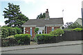
Photos of NR33 0TZ

Area Information
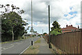
NR33 0TZ represents a specific residential cluster in England, covering a very compact footprint of 7,245 square metres. This small postcode area serves a population of 1,276 people, creating an environment where residents are likely to know their neighbours through close physical proximity. The sheer density of 176,110 people per square kilometre indicates a highly concentrated living space, though this figure reflects the tiny geographic area defined by the post code rather than typical urban sprawl. Daily life here is characterised by a sense of locality within a compact shell of housing. You live in NR33 0TZ in a setting defined by its small scale and immediate boundaries. The area functions as a distinct residential node, separate from the broader towns nearby yet connected by the surrounding infrastructure. It is a place where the village feel persists despite its integration into the wider Norfolk landscape.
- Area Type
- Postcode
- Area Size
- 7245 m²
- Population
- 1276
- Population Density
- 2504 people/km²
Homes in NR33 0TZ are characterised by a stock that is overwhelmingly owner-occupied, with statistics showing that 69 per cent of dwellings are held by their occupants. The accommodation type is exclusively houses, meaning you will not find flats or high-rise apartments within this specific postcode boundary. This housing choice aligns with the age profile of adults aged 30 to 64 years, who often prefer single-family homes for raising families or retiring. Because the area is so small, covering just 7,245 square metres, the property market is likely tight and reflects the specific needs of a settled population rather than transient buyers. The high home ownership percentage indicates that most residents purchased their properties at some point in the past, likely building equity over decades. For anyone looking to buy, this suggests a market driven by local demand and established values rather than speculative investment or short-term letting.
House Prices in NR33 0TZ
Showing 31 properties
| Address | Type | Beds | Baths | Last Sale Price | Last Sale Date | |
|---|---|---|---|---|---|---|
| 66 Kimberley Road, Lowestoft, NR33 0TZ | Semi-detached | 3 | 1 | £192,500 | May 2024 | |
| 68 Kimberley Road, Lowestoft, NR33 0TZ | Semi-detached | 3 | 1 | £210,000 | Apr 2023 | |
| 28 Kimberley Road, Lowestoft, NR33 0TZ | house | - | - | £122,500 | Nov 2019 | |
| 24 Kimberley Road, Lowestoft, NR33 0TZ | Terraced | 3 | 1 | £122,500 | Jul 2019 | |
| 76 Kimberley Road, Lowestoft, NR33 0TZ | Semi-detached | 3 | 1 | £120,000 | Mar 2018 | |
| 74 Kimberley Road, Lowestoft, NR33 0TZ | Semi-detached | 3 | 1 | £146,000 | Jul 2017 | |
| 54 Kimberley Road, Lowestoft, NR33 0TZ | Semi-detached | 4 | 2 | £120,000 | Mar 2017 | |
| 52 Kimberley Road, Lowestoft, NR33 0TZ | Semi-detached | 3 | - | £125,000 | May 2014 | |
| 18 Kimberley Road, Lowestoft, NR33 0TZ | Terraced | - | - | £50,000 | Nov 2012 | |
| 62 Kimberley Road, Lowestoft, NR33 0TZ | house | - | - | £115,000 | Oct 2011 |
Energy Efficiency in NR33 0TZ
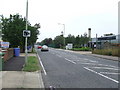
Retail and transport options are within practical reach for everyone living in NR33 0TZ. You can shop at Asda Lowestoft, Co-op Kirkley, and Lidl Oulton, which collectively provide a diverse range of grocery and retail choices. There are five retail outlets nearby, ensuring you do not need to travel far for daily necessities. For commuters, rail access is available via Lowestoft Railway Station and Oulton Broad North Railway Station, with five stations noted in the broader vicinity. Beccles Airport is also one station away, offering air travel options. These five transport links mean you can access regional and national travel without being isolated. The presence of multiple retail and rail hubs indicates that NR33 0TZ is well-integrated into the local transport and shopping network, providing a convenient lifestyle that balances quiet living with access to wider amenities.
Amenities
Schools
Families living in NR33 0TZ have access to a range of educational institutions nearby. Kirkley Community High School serves as a primary option in the area. You also have access to East Point Academy, which holds an Ofsted rating of good. The presence of both a community school and an academy provides a mix of educational approaches for children in the vicinity. While East Point Academy carries a positive Ofsted designation, the specific ofsted rating for Kirkley Community High School is not recorded in the current data. This variety means parents have choices between different school structures without needing to travel significant distances for education. The proximity of these schools supports the residential nature of the area, ensuring that schooling is a convenient part of daily life for households with children.
| Rank | School | Type | Entry gender | Ages |
|---|
Explore more schools in this area
Go to Schools tabDemographics
The community within NR33 0TZ is predominantly settled, with 69 per cent of residents owning their homes outright. This high rate of ownership suggests stability and a long-term commitment to the area. Houses form the primary accommodation type, reinforcing the residential nature of this postcode. The demographic profile skews older, with a median age of 47 years. Adults between the ages of 30 and 64 constitute the most common age range, forming the backbone of the local community. White residents make up the predominant ethnic group in this cluster. The large proportion of owner-occupiers indicates that this is not a commuter belt dominated by short-term renters but a community where families and individuals have put down roots. This demographic structure is typical of many established residential zones where homeowners prioritize local stability.
Household Size
Accommodation Type
Tenure
Ethnic Group
Religion
Household Composition
Age
Household Deprivation
NS-SEC
Explore more demographic insights in this area
Go to Demographics tabPlanning
Planning Constraints
- Flood RiskPremium
- Ramsar Wetland SitesPremium
- Area of Outstanding Natural BeautyPremium
- Protected Nature ReservePremium
- Protected WoodlandPremium