Area Overview for NR33 0UF
Photos of NR33 0UF
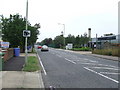
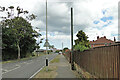
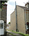
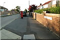
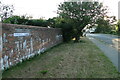
63 photos from this area
Area Information
Key information about the NR33 0UF including its size, population, and administrative classification.
- Area Type
- Postcode
- Area Size
- 2.6 hectares
- Population
- 1276
- Population Density
- 48693 people/km²
House Prices in NR33 0UF
62
Properties
£114,748
Average Sold Price
£27,720
Lowest Price
£188,500
Highest Price
Showing 62 properties
| Address | Type | Beds | Baths | Last Sale Price | Last Sale Date | |
|---|---|---|---|---|---|---|
| 63 Notley Road, Lowestoft, NR33 0UF | Terraced | 3 | 1 | £162,500 | Jul 2024 | |
| 33 Notley Road, Lowestoft, NR33 0UF | Terraced | 3 | 1 | £125,000 | Nov 2023 | |
| 87 Notley Road, Lowestoft, NR33 0UF | Terraced | 3 | 1 | £188,500 | Jul 2023 | |
| 101 Notley Road, Lowestoft, NR33 0UF | Terraced | 3 | 1 | £170,000 | Jun 2023 | |
| 15 Notley Road, Lowestoft, NR33 0UF | house | 3 | 2 | £180,000 | Sep 2022 | |
| 31 Notley Road, Lowestoft, NR33 0UF | Terraced | 3 | 1 | £110,000 | Jul 2019 | |
| 47 Notley Road, Lowestoft, NR33 0UF | house | - | - | £130,000 | Aug 2018 | |
| 95 Notley Road, Lowestoft, NR33 0UF | Terraced | 3 | 2 | £115,000 | Apr 2018 | |
| 115 Notley Road, Lowestoft, NR33 0UF | Terraced | 3 | 1 | £105,500 | Mar 2018 | |
| 25 Notley Road, Lowestoft, NR33 0UF | Terraced | 3 | 1 | £108,000 | Dec 2017 |
Page 1 of 7
Energy Efficiency in NR33 0UF
Amenities
Schools
| Rank | School | Type | Entry gender | Ages |
|---|
Explore more schools in this area
Go to Schools tabDemographics
Household Size
Family (3-5 people)
most common
Accommodation Type
Houses
most common
Tenure
69
majority
Ethnic Group
White
most common
Religion
N/A
most common
Household Composition
N/A
most common
Age
47
median
Adults (30-64 years)
most common
Household Deprivation
N/A
with no deprivation
NS-SEC
19
in Lower managerial occupations
Explore more demographic insights in this area
Go to Demographics tabPlanning
Planning Constraints
- Flood RiskPremium
- Ramsar Wetland SitesPremium
- Area of Outstanding Natural BeautyPremium
- Protected Nature ReservePremium
- Protected WoodlandPremium