Area Overview for NR33 0UE
Photos of NR33 0UE
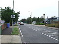
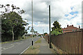
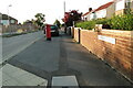
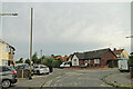
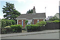
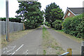
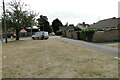
63 photos from this area
Area Information
Key information about the NR33 0UE including its size, population, and administrative classification.
- Area Type
- Postcode
- Area Size
- 2.5 hectares
- Population
- 1276
- Population Density
- 2504 people/km²
House Prices in NR33 0UE
56
Properties
£130,103
Average Sold Price
£26,500
Lowest Price
£280,000
Highest Price
Showing 56 properties
| Address | Type | Beds | Baths | Last Sale Price | Last Sale Date | |
|---|---|---|---|---|---|---|
| 143 Kimberley Road, Lowestoft, NR33 0UE | Detached | 2 | 1 | £150,000 | Oct 2025 | |
| 109 Kimberley Road, Lowestoft, NR33 0UE | Bungalow | 2 | 1 | £189,000 | Dec 2024 | |
| 205 Kimberley Road, Lowestoft, NR33 0UE | Semi-detached | 2 | 2 | £155,000 | Aug 2024 | |
| 127 Kimberley Road, Lowestoft, NR33 0UE | house | - | - | £280,000 | Feb 2024 | |
| 199 Kimberley Road, Lowestoft, NR33 0UE | Semi-detached | 3 | 1 | £245,000 | Jul 2023 | |
| 159 Kimberley Road, Lowestoft, NR33 0UE | Semi-detached | 3 | 1 | £195,000 | Jul 2021 | |
| 197 Kimberley Road, Lowestoft, NR33 0UE | house | - | - | £193,000 | Jun 2021 | |
| 149 Kimberley Road, Lowestoft, NR33 0UE | Semi-detached | 2 | - | £160,000 | Nov 2020 | |
| 105 Kimberley Road, Lowestoft, NR33 0UE | Bungalow | 2 | 1 | £153,000 | Sep 2020 | |
| 125 Kimberley Road, Lowestoft, NR33 0UE | Semi-detached | 3 | 1 | £155,000 | Aug 2020 |
Page 1 of 6
Energy Efficiency in NR33 0UE
Amenities
Schools
| Rank | School | Type | Entry gender | Ages |
|---|
Explore more schools in this area
Go to Schools tabDemographics
Household Size
Family (3-5 people)
most common
Accommodation Type
Houses
most common
Tenure
69
majority
Ethnic Group
White
most common
Religion
N/A
most common
Household Composition
N/A
most common
Age
47
median
Adults (30-64 years)
most common
Household Deprivation
N/A
with no deprivation
NS-SEC
19
in Lower managerial occupations
Explore more demographic insights in this area
Go to Demographics tabPlanning
Planning Constraints
- Flood RiskPremium
- Ramsar Wetland SitesPremium
- Area of Outstanding Natural BeautyPremium
- Protected Nature ReservePremium
- Protected WoodlandPremium