Area Overview for NR29 5LR
Photos of NR29 5LR
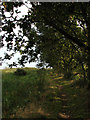
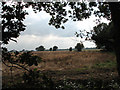
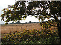
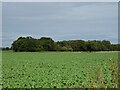
17 photos from this area
Area Information
Key information about the NR29 5LR including its size, population, and administrative classification.
- Area Type
- Postcode
- Area Size
- 38.2 hectares
- Population
- 1814
- Population Density
- 122 people/km²
House Prices in NR29 5LR
10
Properties
£161,667
Average Sold Price
£60,000
Lowest Price
£295,000
Highest Price
Showing 10 properties
| Address | Type | Beds | Baths | Last Sale Price | Last Sale Date | |
|---|---|---|---|---|---|---|
| Togo Cottage, Church Lane, Potter Heigham, NR29 5LR | house | - | - | £150,000 | Mar 2014 | |
| Sandhill Place, Church Lane, Potter Heigham, NR29 5LR | Bungalow | - | - | £178,000 | Oct 2010 | |
| Stone Cottage, Church Lane, Potter Heigham, NR29 5LR | Cottage | 3 | 1 | £295,000 | Jul 2006 | |
| Cameo Cottage, Church Lane, Potter Heigham, NR29 5LR | Detached | - | - | £175,000 | Aug 2003 | |
| Rosemere, Church Lane, Potter Heigham, NR29 5LR | Detached | 3 | 2 | £112,000 | Mar 2002 | |
| Terra-nova, Church Lane, Potter Heigham, NR29 5LR | Bungalow | 3 | 2 | £60,000 | May 1999 | |
| 2, Thatched Cottage, Church Lane, Potter Heigham, NR29 5LR | Semi-detached | - | - | - | - | |
| 1, Thatched Cottage, Church Lane, Potter Heigham, NR29 5LR | Semi-detached | - | - | - | - | |
| Woodbine Cottage, Church Lane, Potter Heigham, NR29 5LR | Detached | - | - | - | - | |
| Rose Farm, Church Lane, Potter Heigham, NR29 5LR | house | - | - | - | - |
Energy Efficiency in NR29 5LR
Amenities
Schools
| Rank | School | Type | Entry gender | Ages |
|---|
Explore more schools in this area
Go to Schools tabDemographics
Household Size
Two person
most common
Accommodation Type
Houses
most common
Tenure
82
majority
Ethnic Group
White
most common
Religion
N/A
most common
Household Composition
N/A
most common
Age
47
median
Elderly (65+ years)
most common
Household Deprivation
N/A
with no deprivation
NS-SEC
29
in Lower managerial occupations
Explore more demographic insights in this area
Go to Demographics tabPlanning
Planning Constraints
- Flood RiskPremium
- Ramsar Wetland SitesPremium
- Area of Outstanding Natural BeautyPremium
- Protected Nature ReservePremium
- Protected WoodlandPremium