Area Overview for NR29 5LN
Photos of NR29 5LN
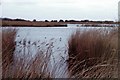
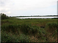

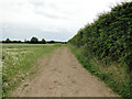
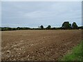
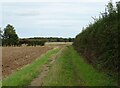
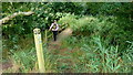
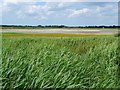
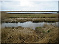
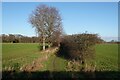
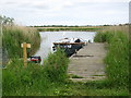
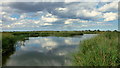
13 photos from this area
Area Information
Key information about the NR29 5LN including its size, population, and administrative classification.
- Area Type
- Postcode
- Area Size
- 2.0 km²
- Population
- 1814
- Population Density
- 122 people/km²
House Prices in NR29 5LN
22
Properties
£315,863
Average Sold Price
£180,000
Lowest Price
£540,000
Highest Price
Showing 22 properties
| Address | Type | Beds | Baths | Last Sale Price | Last Sale Date | |
|---|---|---|---|---|---|---|
| Candledyke Cottage, Marsh Road, Potter Heigham, NR29 5LN | Detached | 3 | 2 | £482,000 | Mar 2023 | |
| Puddle Dyke Cottage, Marsh Road, Potter Heigham, NR29 5LN | Bungalow | 3 | - | £400,000 | Sep 2021 | |
| Longmeadow, Marsh Road, Potter Heigham, NR29 5LN | Detached | 5 | 2 | £540,000 | Sep 2020 | |
| Soundings, Marsh Road, Potter Heigham, NR29 5LN | house | 3 | - | £319,995 | Jun 2017 | |
| Cherryholme, Marsh Road, Potter Heigham, NR29 5LN | Bungalow | 3 | - | £280,000 | May 2017 | |
| Marsh Farmhouse, Marsh Road, Potter Heigham, NR29 5LN | house | 3 | - | £325,000 | Oct 2014 | |
| The Anchorage, Marsh Road, Potter Heigham, NR29 5LN | Detached | 5 | - | £225,000 | Aug 2014 | |
| Five Acres, Marsh Road, Potter Heigham, NR29 5LN | Bungalow | - | - | £312,500 | Aug 2011 | |
| Stone Cottage, Marsh Road, Potter Heigham, NR29 5LN | Detached | - | - | £200,000 | Feb 2008 | |
| Rose Cottage, Marsh Road, Potter Heigham, NR29 5LN | Detached | - | - | £210,000 | May 2005 |
Page 1 of 3
Energy Efficiency in NR29 5LN
Amenities
Schools
| Rank | School | Type | Entry gender | Ages |
|---|
Explore more schools in this area
Go to Schools tabDemographics
Household Size
Two person
most common
Accommodation Type
Houses
most common
Tenure
82
majority
Ethnic Group
White
most common
Religion
N/A
most common
Household Composition
N/A
most common
Age
47
median
Elderly (65+ years)
most common
Household Deprivation
N/A
with no deprivation
NS-SEC
29
in Lower managerial occupations
Explore more demographic insights in this area
Go to Demographics tabPlanning
Planning Constraints
- Flood RiskPremium
- Ramsar Wetland SitesPremium
- Area of Outstanding Natural BeautyPremium
- Protected Nature ReservePremium
- Protected WoodlandPremium