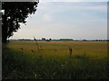
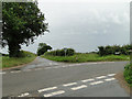
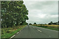
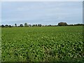
Area Overview for NR29 5LP
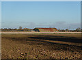
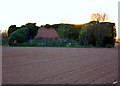
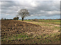
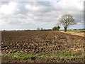
Photos of NR29 5LP

Area Information
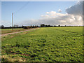
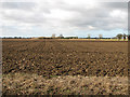
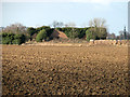
Living in NR29 5LP means settling into a specific residential cluster in Norfolk, England. This postcode covers a precise land area of 24.3 hectares and serves 1,814 residents. The community is compact, resulting in a population density of just 122 people per square kilometre. Such low density indicates spacious surroundings and a pulse that is noticeably slower than found in larger towns. This area represents a small, defined neighbourhood rather than a sprawling district. Residents here experience a lifestyle centred on local familiarity and proximity to the wider Cleethorpes region. Daily life revolves around the practicalities of this specific postcode location. You are part of a community where people know their neighbours, a feature supported by the small population size. The area does not sprawl into a large town but remains a concentrated cluster of homes. This structure fosters a sense of belonging without offering the anonymity of a major urban centre. Homebuyers considering this location find a setting defined by its scale and containment within the NR29 zone. It is a place where the boundaries of the residential area are well understood by those who live within the 24.3 hectares.
- Area Type
- Postcode
- Area Size
- 24.3 hectares
- Population
- 1814
- Population Density
- 122 people/km²
The property market in NR29 5LP is characterised by a strong owner-occupier base. With 82% of residents owning their homes, the tail end of the rental market or speculative investment looks limited in this specific postcode. The accommodation type data indicates that houses dominate the housing stock, making this area unsuitable for those seeking apartments or flats. Buyers looking for terraced housing or modern flats will find very few options within this 24.3-hectare cluster. Homes in NR29 5LP cater primarily to permanent residents rather than short-term tenants. The high home ownership percentage suggests that most properties are passed down through families or purchased for long-term living rather than as rental units. This stability creates a market where values are driven by local demand from the existing community rather than speculative turnover. The predominance of houses aligns with the median age of 47 and the high concentration of residents over 65, indicating a market focused on permanent family homes or retirement properties. For new buyers, this environment means competition is likely localised within the specific houses available. The market does not exhibit the volatility often seen in areas with high rental yields or student populations. Instead, transactions reflect the steady needs of the 1,814 residents living here. Understanding this ownership dynamic is crucial for anyone evaluating homes in NR29 5LP, as the supply is consistent with the needs of an established, owner-led demographic.
House Prices in NR29 5LP
Showing 17 properties
| Address | Type | Beds | Baths | Last Sale Price | Last Sale Date | |
|---|---|---|---|---|---|---|
| 2 Green Lane, Potter Heigham, NR29 5LP | Cottage | 3 | 1 | £223,000 | Jan 2024 | |
| 4 Green Lane, Potter Heigham, NR29 5LP | Semi-detached | 2 | 1 | £200,000 | Jul 2023 | |
| 3 Green Lane, Potter Heigham, NR29 5LP | house | - | - | £185,000 | Oct 2020 | |
| Corner Cottage, Green Lane, Potter Heigham, NR29 5LP | Bungalow | 3 | 1 | £220,000 | Dec 2019 | |
| Farm View, Green Lane, Potter Heigham, NR29 5LP | Bungalow | 2 | 2 | £250,000 | Sep 2019 | |
| Rose Farm, Green Lane, Potter Heigham, NR29 5LP | Bungalow | - | - | £325,000 | Jun 2018 | |
| 5 Green Lane, Potter Heigham, NR29 5LP | Semi-detached | 4 | 1 | £235,000 | Sep 2017 | |
| 6 Green Lane, Potter Heigham, NR29 5LP | house | - | - | £115,000 | Apr 2012 | |
| Orchard House, Green Lane, Potter Heigham, NR29 5LP | Detached | 4 | 2 | £109,000 | Jul 2001 | |
| Eastdene, Green Lane, Potter Heigham, NR29 5LP | house | - | - | £94,950 | Dec 2000 |
Energy Efficiency in NR29 5LP
Daily life in NR29 5LP revolves around a small toolkit of essential amenities within practical reach of your home. Residents have access to five retail outlets, including two branches of the East of England Co-operative Co and a Morrisons Daily. These stores form the backbone of local shopping, providing groceries and essential household items without the need to travel far into larger towns. The presence of multiple cooperative and supermarket branches indicates a focus on self-sufficiency and local convenience for the 1,814 residents in this area. For commuting and longer journeys, the nearest rail facility is Acle Railway Station. This station connects the postcode to broader regional travel networks, although specific service times and destinations are managed by the rail operator outside this dataset. The rail link ensures that residents are not entirely cut off from the outside world, allowing for occasional trips to Norwich or London when necessary. This combination of local retail and a rail head makes the area viable for those who value self-containment but still require regional access. The character of lifestyle here is defined by these essential services rather than leisure complexes or diverse dining scenes. You will find your shopping and daily necessities concentrated around the cooperative societies and the Morrisons Daily. This setup suits a community that values simplicity and practicality. There are no large shopping centres, cinemas, or extensive leisure parks listed as immediate neighbours, reinforcing the rural and semi-rural nature of this residential cluster. Your daily routine will likely centre on these key locations for food and transport needs.
Amenities
Schools
Education provision for families in NR29 5LP is anchored by Potter Heigham First School. This is the primary school listed in the immediate vicinity of the postcode. As a primary institution, it serves children in the early stages of compulsory education, providing a foundational learning environment for local youngsters. Potte Heigham First School offers the main in-school option for residents before children transition to secondary education elsewhere within Norfolk or Suffolk. The presence of a single primary school suggests a modest educational infrastructure typical of smaller residential clusters. Parents in NR29 5LP rely on this specific school for their youngest children while securing secondary education through broader catchment zones not detailed here. This arrangement is common in rural areas where the student population is too small to support a comprehensive secondary academy within the immediate postcode boundaries. Homebuyers must consider that arranging secondary schooling will require commuting to a larger town nearby. The availability of Potter Heigham First School provides a local educational anchor for families settling in this area. The school's primary designation aligns with the demographic profile of the neighbourhood, serving the needs of children whose parents are either active professionals or retirees with granddaughters or grandsons of school age. Without secondary or tertiary institutions nearby, the daily logistics of schooling rely heavily on this one local provider for the primary phase. Families view Potter Heigham First School as the key educational gateway for children growing up in NR29 5LP.
| Rank | School | Type | Entry gender | Ages |
|---|
Explore more schools in this area
Go to Schools tabDemographics
The community in NR29 5LP reflects a mature demographic profile with a distinct age distribution. The median age for residents is 47 years, suggesting a population composed largely of middle-aged adults and older individuals. Data confirms that the elderly, defined as those aged 65 years and over, form the most common age range within the neighbourhood. This concentration points towards an area favoured by retirees or families with grown children who have moved to quieter surroundings. Housing tenure in NR29 5LP is heavily weighted towards owner-occupation. According to current figures, 82% of the population owns their homes outright or has a mortgage. This high ownership rate signals stability and long-term commitment from residents to this specific postcode area. The accommodation type is predominantly houses, aligning with the preference of the older demographic for single-family dwellings. Furthermore, the predominant ethnic group in this area is White, consistent with the broader rural and semi-rural character of many North Norfolk postcodes. The social fabric here is built on established household types rather than transient populations. The high level of home ownership correlates with a community that is likely to be deeply rooted locally. With 118 resident households derived from the population and housing stock, the social network is tight and interdependent. This demographic profile creates a living environment where familiarity is high and community history likely spans several decades. Buyers seeking a stable, owner-led community will find this profile matches their requirements for NR29 5LP.
Household Size
Accommodation Type
Tenure
Ethnic Group
Religion
Household Composition
Age
Household Deprivation
NS-SEC
Explore more demographic insights in this area
Go to Demographics tabPlanning
Planning Constraints
- Flood RiskPremium
- Ramsar Wetland SitesPremium
- Area of Outstanding Natural BeautyPremium
- Protected Nature ReservePremium
- Protected WoodlandPremium