Area Overview for NR29 3AZ
Photos of NR29 3AZ
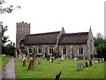
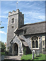
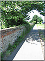
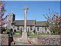
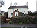
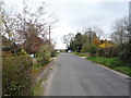
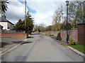
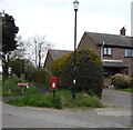
32 photos from this area
Area Information
Key information about the NR29 3AZ including its size, population, and administrative classification.
- Area Type
- Postcode
- Area Size
- 2.6 hectares
- Population
- 1495
- Population Density
- 165 people/km²
House Prices in NR29 3AZ
31
Properties
£188,324
Average Sold Price
£48,500
Lowest Price
£379,000
Highest Price
Showing 31 properties
| Address | Type | Beds | Baths | Last Sale Price | Last Sale Date | |
|---|---|---|---|---|---|---|
| 3 Royden Way, Fleggburgh, NR29 3AZ | Bungalow | 3 | 1 | £290,000 | Mar 2025 | |
| 1 Royden Way, Fleggburgh, NR29 3AZ | Bungalow | 4 | 1 | £265,000 | May 2023 | |
| 6 Royden Way, Fleggburgh, NR29 3AZ | Bungalow | - | - | £183,000 | Jan 2021 | |
| 34 Royden Way, Fleggburgh, NR29 3AZ | Detached | 2 | - | £248,000 | Aug 2020 | |
| 18 Royden Way, Fleggburgh, NR29 3AZ | Bungalow | 4 | 3 | £240,000 | Aug 2018 | |
| 17 Royden Way, Fleggburgh, NR29 3AZ | Bungalow | 3 | 1 | £180,000 | Jan 2018 | |
| Morningside, Royden Way, Fleggburgh, NR29 3AZ | Bungalow | 3 | 1 | £200,000 | Aug 2017 | |
| Merryways, Royden Way, Fleggburgh, NR29 3AZ | Bungalow | 4 | 3 | £350,000 | Feb 2017 | |
| Springfield, Royden Way, Fleggburgh, NR29 3AZ | Bungalow | 3 | 2 | £200,000 | Oct 2016 | |
| 12 Royden Way, Fleggburgh, NR29 3AZ | Bungalow | 2 | - | £170,000 | Nov 2015 |
Page 1 of 4
Energy Efficiency in NR29 3AZ
Amenities
Schools
| Rank | School | Type | Entry gender | Ages |
|---|
Explore more schools in this area
Go to Schools tabDemographics
Household Size
Two person
most common
Accommodation Type
Houses
most common
Tenure
86
majority
Ethnic Group
White
most common
Religion
N/A
most common
Household Composition
N/A
most common
Age
47
median
Adults (30-64 years)
most common
Household Deprivation
N/A
with no deprivation
NS-SEC
34
in Lower managerial occupations
Explore more demographic insights in this area
Go to Demographics tabPlanning
Planning Constraints
- Flood RiskPremium
- Ramsar Wetland SitesPremium
- Area of Outstanding Natural BeautyPremium
- Protected Nature ReservePremium
- Protected WoodlandPremium