Area Overview for NR29 3AU
Photos of NR29 3AU
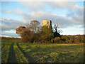
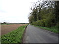
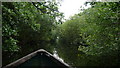
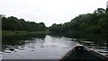
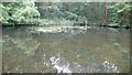
22 photos from this area
Area Information
Key information about the NR29 3AU including its size, population, and administrative classification.
- Area Type
- Postcode
- Area Size
- 33.3 hectares
- Population
- 1495
- Population Density
- 165 people/km²
House Prices in NR29 3AU
10
Properties
£244,125
Average Sold Price
£89,000
Lowest Price
£495,000
Highest Price
Showing 10 properties
| Address | Type | Beds | Baths | Last Sale Price | Last Sale Date | |
|---|---|---|---|---|---|---|
| Wood End, Tower Road, Fleggburgh, NR29 3AU | Bungalow | 2 | 1 | £215,000 | Jun 2023 | |
| Tower Lodge, Tower Road, Fleggburgh, NR29 3AU | Bungalow | - | - | £495,000 | Dec 2020 | |
| Firtree House, Tower Road, Fleggburgh, NR29 3AU | Semi-detached | 4 | 1 | £248,500 | Oct 2019 | |
| Nutkin, Tower Road, Fleggburgh, NR29 3AU | Detached | 3 | 2 | £210,000 | Apr 2018 | |
| Field View, Tower Road, Fleggburgh, NR29 3AU | Bungalow | 4 | 1 | £215,500 | Aug 2016 | |
| The Lodge, Tower Road, Fleggburgh, NR29 3AU | Bungalow | - | - | £242,000 | Feb 2010 | |
| Sycamore House, Tower Road, Fleggburgh, NR29 3AU | Semi-detached | - | - | £238,000 | Dec 2007 | |
| Cherry Cottage, Tower Road, Fleggburgh, NR29 3AU | Semi-detached | - | - | £89,000 | May 2001 | |
| Summerfield House, Tower Road, Fleggburgh, NR29 3AU | Detached | 5 | 3 | - | - | |
| Chez Nous, Tower Road, Fleggburgh, NR29 3AU | Semi-detached | - | - | - | - |
Energy Efficiency in NR29 3AU
Amenities
Schools
| Rank | School | Type | Entry gender | Ages |
|---|
Explore more schools in this area
Go to Schools tabDemographics
Household Size
Two person
most common
Accommodation Type
Houses
most common
Tenure
86
majority
Ethnic Group
White
most common
Religion
N/A
most common
Household Composition
N/A
most common
Age
47
median
Adults (30-64 years)
most common
Household Deprivation
N/A
with no deprivation
NS-SEC
34
in Lower managerial occupations
Explore more demographic insights in this area
Go to Demographics tabPlanning
Planning Constraints
- Flood RiskPremium
- Ramsar Wetland SitesPremium
- Area of Outstanding Natural BeautyPremium
- Protected Nature ReservePremium
- Protected WoodlandPremium