Area Overview for NR20 4TQ
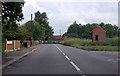
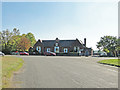
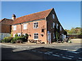
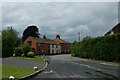
Photos of NR20 4TQ
Area Information
Living in NR20 4TQ offers a distinct experience within a compact residential cluster spreading across 1.5 hectares. This specific postcode area is home to 2,468 people, creating a neighbourhood defined by a lower density of 74 people per square kilometre. The small scale of the area suggests a quieter daily rhythm compared to larger towns, yet residents benefit from the proximity to established settlements. You are living in an environment where the physical boundaries are clear, allowing for a sense of defined community space. The area functions as a concentrated pocket of housing within the wider Norfolk landscape. Daily life here involves navigating a relatively small footprint, which can reduce travel times between homes and local access points. The density figures indicate that while it is suburban in nature, it lacks the sprawling feel of major urban conurbations. This concentration supports a manageable infrastructure for a population of just over two thousand. Understanding the scale of NR20 4TQ helps you appreciate what characterises this specific living environment, balancing privacy with accessibility.
- Area Type
- Postcode
- Area Size
- 1.5 hectares
- Population
- 2468
- Population Density
- 74 people/km²
The housing stock in NR20 4TQ is characterised almost entirely by houses, with a limited presence of flats or apartments. This structure defines the property market within this 1.5-hectare zone and its immediate surroundings. With 78 per cent of residents owning their homes, the market reflects a strong preference for traditional family housing. This high ownership rate means that rental stock is relatively scarce compared to the available owned properties. Buyers looking at homes in this postcode area will primarily encounter houses designed for owner-occupiers rather than investment rentals. The lack of flats suggests that the area is not catering to high-density urban living or second-home investors seeking apartments. You are likely to find properties that have been maintained for long-term family living within a low-density setting. The accommodation type data confirms that the built environment prioritises house plots over smaller units. This configuration supports a quieter lifestyle, appealing to those who prefer gardens and traditional neighbourhood streets. The market here is likely driven by local movement rather than external rental demand.
House Prices in NR20 4TQ
Showing 36 properties
| Address | Type | Beds | Baths | Last Sale Price | Last Sale Date | |
|---|---|---|---|---|---|---|
| 6 Two Fields Way, Bawdeswell, NR20 4TQ | house | 4 | 1 | £297,500 | Apr 2024 | |
| 10 Two Fields Way, Bawdeswell, NR20 4TQ | Semi-detached | 3 | - | £286,000 | Mar 2023 | |
| South View, 1 Two Fields Way, Bawdeswell, NR20 4TQ | Bungalow | 3 | 1 | £345,000 | Oct 2022 | |
| 22 Two Fields Way, Bawdeswell, NR20 4TQ | Semi-detached | 4 | 1 | £280,000 | Aug 2022 | |
| 30 Two Fields Way, Bawdeswell, NR20 4TQ | house | - | - | £260,000 | Jul 2022 | |
| 21 Two Fields Way, Bawdeswell, NR20 4TQ | Detached | 2 | 1 | £175,000 | Dec 2019 | |
| 24 Two Fields Way, Bawdeswell, NR20 4TQ | Semi-detached | 2 | 1 | £175,000 | Feb 2019 | |
| 25 Two Fields Way, Bawdeswell, NR20 4TQ | Semi-detached | 2 | 1 | £170,000 | Mar 2018 | |
| 19 Two Fields Way, Bawdeswell, NR20 4TQ | house | - | - | £150,950 | Jan 2017 | |
| 17 Two Fields Way, Bawdeswell, NR20 4TQ | Detached | 2 | 1 | £154,500 | Jan 2017 |
Energy Efficiency in NR20 4TQ
Daily living in NR20 4TQ is supported by a small but functional range of local amenities located within practical reach. Retail options include Morrisons Daily, Spar, and Budgens Lenwade, offering essential grocery needs without requiring a trip to a larger town. Only one metro station serves the immediate vicinity, situated in Dereham, which acts as the primary hub for rail or tram connections to the wider region. This single transport node means that accessing further amenities or employment centres requires planning around the connections available at Dereham. The retail score indicates five key shops are close enough for walking or short drives, ensuring basic conveniences are met. While major leisure complexes or large shopping centres are not listed in the immediate accessibility data, residents have access to these specific stores. The presence of sub-markets like Spar and Budgens suggests a focus on convenience over extensive product ranges. You will find that daily shopping is manageable locally, though speciality goods may require travel to this one main transport interchange. The lifestyle here balances local self-sufficiency with the need to travel to Dereham for broader opportunities.
Amenities
Schools
Families living in NR20 4TQ have several primary education options within their catchment or practical reach. Bawdeswell Community Primary School holds a good Ofsted rating and serves as a established educational provider in the vicinity. Lyng Church of England Primary Academy and Lyng Church of England Primary School offer additional primary choices for households in the area. Tutorial Centre is also located nearby, providing alternative education or training services for those seeking specific curricula. The presence of multiple primary institutions ensures that most children in NR20 4TQ can access education without needing to travel far beyond their immediate neighbourhood. The mix includes community-led schools and church-affiliated academies, offering distinct educational philosophies beyond the generic primary stage. There are no secondary schools listed in the immediate data set, meaning older children may need to commute further for their secondary education. School types are exclusively primary in the detailed list provided. This concentration of primary schools suggests the area is well-suited for young families, though the absence of nearby secondary listings requires you to check catchment zones for teenage children. The variety of providers allows parents to choose based on specific teaching methods or religious expectations.
| Rank | School | Type | Entry gender | Ages |
|---|
Explore more schools in this area
Go to Schools tabDemographics
The community in NR20 4TQ reflects a mature demographic profile with a median age of 47 years. Most households consist of adults aged between 30 and 64, suggesting the area attracts established families or individuals settled in their careers. Homeownership stands at 78 per cent, indicating a strong tendency for residents to own their properties rather than rent. This high level of tenure points to a stable population with deep local roots. The accommodation type is predominantly houses, aligning with the preference for detached or semi-detected living often found in this age bracket. The predominant ethnic group is White, which mirrors the broader national demographic composition. There are no significant recent influxes of transient populations, reinforcing the established character of the neighbourhood. This age distribution means that the area appeals to those seeking stability over rapid growth. You should expect a environment where long-term residents dominate the social fabric. The high homeownership rate also implies that many properties have remained in the same hands for extended periods, contributing to a settled atmosphere.
Household Size
Accommodation Type
Tenure
Ethnic Group
Religion
Household Composition
Age
Household Deprivation
NS-SEC
Explore more demographic insights in this area
Go to Demographics tabPlanning
Planning Constraints
- Flood RiskPremium
- Ramsar Wetland SitesPremium
- Area of Outstanding Natural BeautyPremium
- Protected Nature ReservePremium
- Protected WoodlandPremium