Area Overview for NR20 4SN
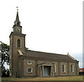
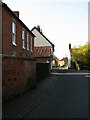
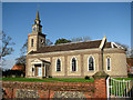
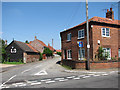
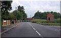
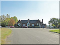
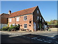
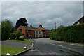
Photos of NR20 4SN
Area Information
Living in NR20 4SN means residing within a compact residential cluster defined by postcode NR20 4SN. This specific area covers 3,597 square metres and houses a population of 2,468 individuals. You are settling into a defined space where every resident knows there are approximately 74 people per square kilometre. The environment is situated in England, offering a specific trajectory for daily life rather than a sprawling urban sprawl. The small footprint of NR20 4SN creates an immediate sense of proximity between homes and essentials. Daily routines centre on this close-knit configuration. You move through a landscape designed for a community of about 2,500 people. The physical limits of the postcode influence how you experience your surroundings. There is no vague hinterland; the community is contained and measurable. When you consider homes in NR20 4SN, you are looking at a distinct settlement with clear boundaries. Life here is shaped by the fact that the entire controlled area is just over three and a half square kilometres. This density dictates the pace of neighbourhood interaction. You do not drive into unknown zones; you navigate a known cluster. The area serves as a contained residential unit within the broader English county structure. Understanding the size of NR20 4SN helps you grasp the scale of your future investment. It is a place where geography defines community.
- Area Type
- Postcode
- Area Size
- 3597 m²
- Population
- 2468
- Population Density
- 74 people/km²
The property market in NR20 4SN is defined by a strong culture of ownership. A staggering 78% of households choose to own their homes rather than rent. This high percentage indicates a stable investment environment for buyers considering homes in NR20 4SN. The accommodation type is predominantly houses. You will not find a high concentration of flats or high-density apartment blocks in this specific postcode area. The housing stock aligns with the demographic profile of a 47-year-old median resident. This suggests a preference for established, single-family dwellings. When you look at the property market here, you see evidence of long-term settling. The area supports 2,468 people within a 3,597 square metre footprint. This high density relative to the area size reinforces the importance of residential land usage. There is little scope for major commercial or mixed-use development within the current boundaries. The market reflects a desire for space and traditional housing forms. Buyers should expect to compete primarily with other owners. The 78% ownership figure is a concrete indicator of market sentiment. You are not entering a transient rental zone; you are joining a sector of permanent residents. This stability reduces vacancy rates and supports consistent property values. The dominance of houses means limited inventory variety outside of this specific category. Understanding that the area is owner-occupied helps you frame your expectations for competition and buying speed. NR20 4SN remains a territory of homeowners.
House Prices in NR20 4SN
Showing 9 properties
| Address | Type | Beds | Baths | Last Sale Price | Last Sale Date | |
|---|---|---|---|---|---|---|
| 6 Black Horse Close, Bawdeswell, NR20 4SN | Terraced | - | - | £80,350 | Jul 2001 | |
| 4 Black Horse Close, Bawdeswell, NR20 4SN | Bungalow | - | - | - | - | |
| 2 Black Horse Close, Bawdeswell, NR20 4SN | Bungalow | - | - | - | - | |
| 1 Black Horse Close, Bawdeswell, NR20 4SN | Bungalow | - | - | - | - | |
| 3 Black Horse Close, Bawdeswell, NR20 4SN | Bungalow | - | - | - | - | |
| 7 Black Horse Close, Bawdeswell, NR20 4SN | house | - | - | - | - | |
| 9 Black Horse Close, Bawdeswell, NR20 4SN | Bungalow | - | - | - | - | |
| 8 Black Horse Close, Bawdeswell, NR20 4SN | Bungalow | - | - | - | - | |
| 5 Black Horse Close, Bawdeswell, NR20 4SN | house | - | - | - | - |
Energy Efficiency in NR20 4SN
Daily life in NR20 4SN revolves around a limited but practical network of amenities. Retail options are concentrated around the nearest point of interest, with five locations available within practical reach. You can shop for groceries at Morrisons Daily, Spar, or Budgens Lenwade. These specific venues provide your essential weekly food and household supplies. Transportation links are minimal, with just one metro location identified nearby at Dereham. This suggests you manage most travel by car or public bus rather than train. The retail count of five indicates a localized economy rather than a shopping district. Dining and leisure options are not explicitly named in the amenity data. Your lifestyle therefore relies heavily on these few retail anchors. You will find that your trips for consumer goods are short and direct. The presence of Budgens Lenwade and Spar ensures you do not need to travel far for basics. This convenience suits a population of 2,468 people who value time efficiency. The area is not a hub for cultural events or major commercial centres. Instead, it is a residential zone where convenience is defined by proximity to a handful of shops. If you commute to Dereham, it is your main public transport gateway. The retail landscape is functional rather than expansive. Ownership levels of 78% imply that residents already know where to buy and how to get there. You find a straightforward approach to daily consumption. NR20 4SN offers practical living with a dependency on personal transport for broader opportunities.
Amenities
Schools
There are several educational institutions serving families near NR20 4SN. You will find primary education options including Bawdeswell Community Primary School and Lyng Church of England Primary School. Bawdeswell Community Primary School holds a good Ofsted rating, providing a verified standard of quality for primary learners. Lyng Church of England Primary Academy offers a secondary option within the primary sector, though it does not carry a stated Ofsted rating in this dataset. The Tutorial Centre appears in the list of nearby schools but is classified under the 'other' category. Its exact function remains unlabelled compared to the primary academies. This mix of educational types means families must plan their schooling route carefully. If you are moving to NR20 4SN, you have access to at least one primary school with a recognised good rating. Bawdeswell stands out as the most positively assessed option currently. The presence of multiple primary schools suggests some local diversity in catchment zones. However, there are no secondary schools with specific ratings listed for immediate proximity in this data. You must consider transport to find broader secondary education. The availability of Bawdeswell Community Primary School is a key asset for those prioritising rated education. Lyng Church of England Primary School provides an alternative for those seeking a faith-based or different community setting. The Tutorial Centre remains an unclassified option nearby. Residents of NR20 4SN navigate these schools daily.
| Rank | School | Type | Entry gender | Ages |
|---|
Explore more schools in this area
Go to Schools tabDemographics
The community in NR20 4SN is shaped by a clear age profile and household structure. The median age stands at 47 years, indicating a predominantly mature neighbourhood. Most residents fall into the adult age range between 30 and 64 years. This demographic reality suggests a stable environment focused on established families or empty nesters. Households in NR20 4SN are characterised by high stability, with a 78% home ownership rate. This figure confirms that the majority of adults own their properties outright. You will find few rental properties compared to owner-occupied dwellings. The most common form of accommodation consists of houses rather than flats or apartments. This reflects the suburban nature of the settlement. The predominant ethnic group in the area is White, defining the social composition of the cluster. Deprivation levels are not highlighted in the available statistics for this specific viewpoint. Instead, the data points to a standardised residential pattern. You are entering a market where long-term residents dominate. The population of 2,468 spreads across single-family units. This configuration supports a specific type of neighbourly interaction. When you review demographics for NR20 4SN, you see a settled, older cohort. The age range of 30 to 64 years suggests active participation in local governance and school runs. Ownership rates reflect financial security within the boundaries of NR20 4SN.
Household Size
Accommodation Type
Tenure
Ethnic Group
Religion
Household Composition
Age
Household Deprivation
NS-SEC
Explore more demographic insights in this area
Go to Demographics tabPlanning
Planning Constraints
- Flood RiskPremium
- Ramsar Wetland SitesPremium
- Area of Outstanding Natural BeautyPremium
- Protected Nature ReservePremium
- Protected WoodlandPremium