Area Overview for NR20 4TA
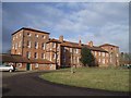
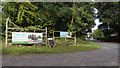
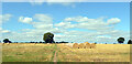
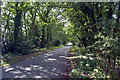
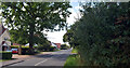
Photos of NR20 4TA
Area Information
Living in NR20 4TA offers a quiet residential experience within a compact settlement of just 1.1 hectares. This specific postcode cluster accommodates a population of 2,423 people, creating a close-knit environment with a density of 88 people per square kilometre. The area functions as a small residential hub where daily life revolves around local proximity and community familiarity. You will find yourself surrounded by houses rather than high-rise blocks, contributing to a low-traffic atmosphere that many residents value. The setting avoids major planning constraints such as protected woodlands or nature reserves, allowing for a straightforward living environment without complex conservation restrictions. Residents here enjoy a sense of space relative to the population size, though the limited geographical footprint means amenities are concentrated a short distance away. The area sits comfortably outside designations like Areas of Outstanding Natural Beauty or Ramsar sites, which simplifies future local development while maintaining its current character. For those seeking a stable neighbourhood where life moves at a measured pace, this postcode delivers understated charm. The small scale ensures that neighbours know one another, fostering a practical, unpretentious community life suitable for households of all sizes who prefer a grounded, non-urban setting.
- Area Type
- Postcode
- Area Size
- 1.1 hectares
- Population
- 2423
- Population Density
- 88 people/km²
The housing market in NR20 4TA is defined by its accommodation type and tenure patterns. Almost all dwellings fall under the category of houses, as flats and apartments are not recorded within this specific postcode. This structural reality means buyers looking across NR20 4TA should expect standalone properties or semi-detached homes rather than shared-conhold units. The 83% home ownership rate strongly indicates that the local stock is predominantly owner-occupied rather than supplied through the private rental sector. For prospective buyers, this suggests a market driven by families and working professionals seeking to establish a permanent home base. The low density of 88 people per square kilometre further supports the idea that properties are spaced out with larger gardens or private outdoor areas. You will not find the high turnover typical of rentalised urban estates here. Instead, the local estate market likely revolves around property extensions, refurbishments, or standard sales between established owners. This stability provides confidence for purchasers who value security over short-term investment liquidity. The absence of flats removes competition from apartment-style buyers, focusing value on house-based amenities and land.
House Prices in NR20 4TA
Showing 9 properties
| Address | Type | Beds | Baths | Last Sale Price | Last Sale Date | |
|---|---|---|---|---|---|---|
| 2 Maple Close, Beetley, NR20 4TA | Detached | 3 | 1 | £322,000 | Feb 2024 | |
| 8 Maple Close, Beetley, NR20 4TA | Detached | 3 | 2 | £270,000 | Apr 2022 | |
| 3 Maple Close, Beetley, NR20 4TA | Bungalow | 2 | 2 | £255,000 | Oct 2020 | |
| 7 Maple Close, Beetley, NR20 4TA | Detached | 3 | - | £157,500 | Sep 2013 | |
| 6 Maple Close, Beetley, NR20 4TA | Detached | - | - | £130,000 | May 2005 | |
| 4 Maple Close, Beetley, NR20 4TA | Detached | - | - | £59,995 | Feb 2001 | |
| 9 Maple Close, Beetley, NR20 4TA | Detached | - | - | £76,500 | Jul 1999 | |
| 5 Maple Close, Beetley, NR20 4TA | Detached | - | - | £42,000 | Apr 1997 | |
| 1 Maple Close, Beetley, NR20 4TA | Detached | - | - | - | - |
Energy Efficiency in NR20 4TA
Residents of NR20 4TA access a limited but functional range of amenities within practical reach. Within the immediate locality, you will find five retail outlets including East of England Co-operative Co, Co-op East, and Iceland East. These superstores provide essentials for daily shopping without the need to travel far into larger urban centres. For air travel or regional connections, the nearest major airport is Dereham, though the Metro category placeholder suggests a localized transport node or minor airfield in that direction. The retail presence means you can purchase groceries, fuel, and household necessities nearby, supporting independent living for those who manage without driving constantly. Dining and leisure options are not explicitly listed in the immediate amenity data, so expectations should remain focused on the supermarket and high-street provisioning available. The small number of retail venues highlights the area's quiet nature, which may appeal to those seeking a low-stimulation lifestyle. You will need to plan ahead for special shopping trips or entertainment that requires travelling beyond the immediate neighbourhood. The reliance on a few key retailers like the Co-op and Iceland reinforces the self-sufficient character of daily life here.
Amenities
Schools
Families residing in NR20 4TA benefit from a selection of primary schools located within practical commuting distance of the postcode. The nearest educational institutions include Mileham Primary School and St Mary's Community Primary School in Beetley, which currently carries an Ofsted rating of satisfactory. Additionally, residents have access to Brisley Church of England Voluntary Aided Primary School and Brisley Church of England Primary Academy. The latter holds a Ofsted rating of good, offering a solid educational option nearby. All listed facilities are primary schools, meaning the immediate area does not host secondary institutions within walking distance. This arrangement implies that local pupils will likely travel to NR20 4TA for junior education before transitioning to high schools elsewhere. The presence of multiple primary options gives parents some choice regarding curriculum styles and denominational affiliations, as evidenced by the Church of England providers. Families considering homes in NR20 4TA should plan their commute routes to these specific schools to accommodate daily drop-offs and pick-ups. The mix of voluntary aided and community schools reflects a traditional approach to local education provision in this part of the county.
| Rank | School | Type | Entry gender | Ages |
|---|
Explore more schools in this area
Go to Schools tabDemographics
The community profile for NR20 4TA reflects a mature population with a median age of 47 years. The most common age range consists of adults between 30 and 64 years old, indicating a neighbourhood dominated by established households rather than young families or retirees. This demographic skew suggests a area where long-term residents have put down roots, often passing knowledge of local services from one generation to the next. Home ownership stands at a solid 83%, signalling that the majority of residents live in their own homes rather than renting. This high rate of ownership typically points to a stable community with lower transient rates and residents who are deeply invested in their local surroundings. The predominant ethnic group is White, which aligns with the broader national profile for many rural and semi-rural English locations. Because most occupants own their dwellings, the area likely features a higher proportion of long-staying homeowners compared to private rental blocks. This demographic structure creates a predictable, family-oriented environment where neighbours often spend lunchtime on doorsteps. The age distribution reinforces the idea that NR20 4TA is a place for settled living where children have grown up, young adult couples are buying their first major home, and older residents remain for their final years in one place.
Household Size
Accommodation Type
Tenure
Ethnic Group
Religion
Household Composition
Age
Household Deprivation
NS-SEC
Explore more demographic insights in this area
Go to Demographics tabPlanning
Planning Constraints
- Flood RiskPremium
- Ramsar Wetland SitesPremium
- Area of Outstanding Natural BeautyPremium
- Protected Nature ReservePremium
- Protected WoodlandPremium