Area Overview for NR20 4HR
Photos of NR20 4HR
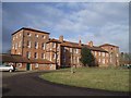
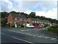
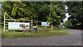
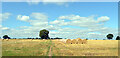
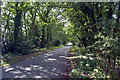
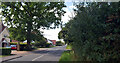
44 photos from this area
Area Information
Key information about the NR20 4HR including its size, population, and administrative classification.
- Area Type
- Postcode
- Area Size
- 1.1 hectares
- Population
- 2423
- Population Density
- 88 people/km²
House Prices in NR20 4HR
18
Properties
£221,113
Average Sold Price
£45,950
Lowest Price
£420,000
Highest Price
Showing 18 properties
| Address | Type | Beds | Baths | Last Sale Price | Last Sale Date | |
|---|---|---|---|---|---|---|
| 14 Beech Road, Beetley, NR20 4HR | Bungalow | 2 | 1 | £235,000 | May 2025 | |
| 6 Beech Road, Beetley, NR20 4HR | Semi-detached | 3 | 1 | £290,000 | Mar 2025 | |
| 26 Beech Road, Beetley, NR20 4HR | Semi-detached | 4 | 2 | £220,000 | Mar 2025 | |
| 12 Beech Road, Beetley, NR20 4HR | house | 2 | 1 | £210,000 | Nov 2024 | |
| 8 Beech Road, Beetley, NR20 4HR | Semi-detached | 3 | 1 | £230,000 | Jul 2023 | |
| 34 Beech Road, Beetley, NR20 4HR | Detached | 4 | - | £390,000 | Jun 2021 | |
| 32 Beech Road, Beetley, NR20 4HR | Detached | 3 | - | £420,000 | Dec 2020 | |
| 30 Beech Road, Beetley, NR20 4HR | Detached | 4 | 2 | £365,000 | Nov 2019 | |
| 2 Beech Road, Beetley, NR20 4HR | Detached | 4 | - | £249,000 | Apr 2015 | |
| 42 Beech Road, Beetley, NR20 4HR | Detached | 3 | - | £173,500 | Jan 2014 |
Page 1 of 2
Energy Efficiency in NR20 4HR
Amenities
Schools
| Rank | School | Type | Entry gender | Ages |
|---|
Explore more schools in this area
Go to Schools tabDemographics
Household Size
Two person
most common
Accommodation Type
Houses
most common
Tenure
83
majority
Ethnic Group
White
most common
Religion
N/A
most common
Household Composition
N/A
most common
Age
47
median
Adults (30-64 years)
most common
Household Deprivation
N/A
with no deprivation
NS-SEC
34
in Lower managerial occupations
Explore more demographic insights in this area
Go to Demographics tabPlanning
Planning Constraints
- Flood RiskPremium
- Ramsar Wetland SitesPremium
- Area of Outstanding Natural BeautyPremium
- Protected Nature ReservePremium
- Protected WoodlandPremium