Area Overview for NR20 4PT
Photos of NR20 4PT
Area Information
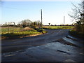
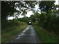
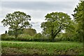
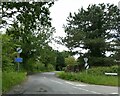
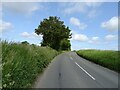
Living in NR20 4PT offers a quiet residential experience within a postcode covering a small cluster of homes. This specific area spans 45.7 hectares and houses a population of 2348 residents. The density stands at 223 people per square kilometre, indicating a low-density living environment where space is not at a premium. You will find that daily life here is defined by a lack of overcrowding and a community feel that benefits from ample room. The location acts as a small, contained neighbourhood rather than a sprawling urban zone, which appeals to those seeking tranquillity without complete isolation. Because the area is designated as a specific postcode cluster, it maintains its own distinct identity separate from larger surrounding towns, yet it remains functionally connected to wider networks. Residents navigate a landscape where plots are generous and movement between properties is unhurried. This setting suits individuals who prioritise peace over proximity to high-density activity. You move through a zone where the built environment does not overwhelm the natural surroundings. The size of the area ensures that noise pollution is minimal, preserving the calm atmosphere that defines this postcode. For anyone considering homes in this region, the scale of the locality guarantees a manageable pace of life.
- Area Type
- Postcode
- Area Size
- 45.7 hectares
- Population
- 2348
- Population Density
- 223 people/km²
The market in NR20 4PT is characterised by a strong owner-occupier presence. With 75 per cent home ownership, the area functions less as a rental hub and more as a destination for people looking to settle down permanently. You will predominantly find houses on the market rather than flats or apartments, reinforcing the residential nature of this 45.7 hectare post code. This high ownership percentage implies that property prices here offer stability and reflect long-term investments rather than speculative fluctuations common in high-turnover rental zones. Buyers looking at the immediate surroundings can expect a stock of homes suited to families and singles seeking quiet retirement. The low density of 223 people per square kilometre suggests that land values may be influenced by space rather than proximity to city centres. Consequently, the value of a property in this postcode often correlates with the size of the garden or the condition of the house itself. Renting is less common, so competition for available rentals may be limited but demand for homes remains steady among those working in nearby towns. If you are considering purchasing a home, the market dynamics here favour those willing to commit to the locality. The scarcity of flats limits options for those requiring conversions or ground-floor living. The dominance of houses means that buyers should prioritise properties with sufficient external space. This market structure supports a community where homeowners take pride in maintaining their properties, contributing to the overall upkeep of the streetscape.
House Prices in NR20 4PT
Showing 3 properties
| Address | Type | Beds | Baths | Last Sale Price | Last Sale Date | |
|---|---|---|---|---|---|---|
| Walnut Tree Farm, Swanton Road, Dereham, NR20 4PT | Detached | 4 | 1 | £516,000 | Oct 2016 | |
| Cottage, Swanton Road, Dereham, NR20 4PT | Detached | - | - | - | - | |
| Swanton Road Farm, Swanton Road, Dereham, NR20 4PT | Detached | - | - | - | - |
Energy Efficiency in NR20 4PT
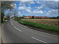
Your daily life in NR20 4PT is shaped by convenient access to key amenities just outside the immediate residential cluster. Dereham serves as the nearest metro area, providing a hub for broader shopping, dining, and leisure activities if you wish to venture beyond your neighbourhood. Within practical reach, you can visit five major retail outlets without needing long journeys. These include Iceland East, Morrisons Scarning, and Co-op East, all of which are located within easy commuting distance. These stores cover a range of needs from groceries and household essentials to daily food shopping. The presence of multiple supermarkets means you can choose between different pricing tiers and product ranges to suit your budget. You will find that local shopping trips are short and convenient, enhancing the quality of everyday life. Dining options and larger leisure facilities reside in Dereham, accessible via a pleasant drive or a dedicated journey. The convenience of having specific retailers like Morrisons Scarning nearby reduces the time spent travelling for mundane tasks. This layout allows you to enjoy the quiet of your own home while maintaining access to practical shopping. The proximity to these five retail locations ensures that you never lack for basic necessities. Whether you are stocking up on groceries or conducting quick errands, the local amenities support a seamless routine. Living here means you balance the peace of a small community with the accessibility of a nearby town centre.
Amenities
Schools
Families living in NR20 4PT have access to Dereham Neatherd High School, which serves the educational needs of the local children. The school operates under two distinct statuses within the data listing: one classification identifies it as a primary institution, while another designation marks it as an academy. This dual presentation indicates a complex administrative structure or a specific historical designation within the local education system. You should verify the current Ofsted rating directly through official government channels, as the provided data contains only the name and type classification without specific star ratings or inspection scores. The presence of Dereham Neatherd High School suggests that primary-aged children can attend within the immediate vicinity. Parents considering schools near this postcode will find this establishment as their principal option. The academy status often implies a degree of autonomy from local authority control, which can influence teaching methods and curriculum focus. You might find that the school attracts families from the wider Surarea due to its established reputation. The proximity of the school ensures that you do not need to drive far to ensure your children receive their education. This local provision supports the community's demographic profile, where adults are present in large numbers with children. The school acts as a central fixture for social interaction among families in the neighbourhood. Understanding the exact type and rating of the school is essential before making a decision on purchasing a home nearby.
| Rank | School | Type | Entry gender | Ages |
|---|
Explore more schools in this area
Go to Schools tabDemographics
The community profile in NR20 4PT reflects an established demographic with a median age of 47 years. Most residents fall into the adult age range between 30 and 64 years, signalling a population that comprises working families and retired individuals rather than transient students or young commuters alone. You will encounter a high level of stability within this neighbourhood. Home ownership stands at 75 per cent, meaning three out of four residents own their property outright or by mortgage. This figure highlights a settled community where long-term residents value their local surroundings. The housing stock consists primarily of houses, suggesting a preference for detached or semi-detached properties over flats or terraced accommodation. This structure aligns with the area's lower population density. The predominant ethnic group in the postcode is White, which mirrors the broader demographic trends of rural England. There are no significant statistical anomalies regarding deprivation or income that detract from the general standard of living observed here. The age distribution and ownership rates create a stable environment where neighbours know one another. Families with school-aged children often find themselves in the same demographic bracket as the majority of the population. This consistency fosters reliable local support networks. The 75 per cent ownership rate also reduces the prevalence of short-term tenancies, which can sometimes disrupt community cohesion.
Household Size
Accommodation Type
Tenure
Ethnic Group
Religion
Household Composition
Age
Household Deprivation
NS-SEC
Explore more demographic insights in this area
Go to Demographics tabPlanning
Planning Constraints
- Flood RiskPremium
- Ramsar Wetland SitesPremium
- Area of Outstanding Natural BeautyPremium
- Protected Nature ReservePremium
- Protected WoodlandPremium