Area Overview for NR20 4LT
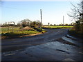
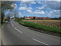
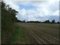
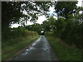
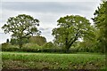
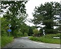
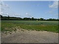
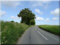
Photos of NR20 4LT

Area Information
Living in NR20 4LT involves settling into a compact residential cluster that spans exactly 4.0 hectares. This small postcode area accommodates a population of 1,608 people, resulting in a quiet environment with a density of 103 people per square kilometre. The location is defined by its manageable size, which fosters a sense of community while remaining close to nearby towns. As a specific residential pocket, the area offers a distinct character suitable for those seeking a low-impact lifestyle. Daily life here revolves around the immediate neighbourhood, knowing that your local surroundings are a significant part of your world. The compact nature of this site means you can walk to nearby facilities without traversing long distances across the county. Whether you are driving into Dereham or visiting local shops, the proximity to the coast and urban centres provides a balanced routine. This area functions as a stable home base where residents enjoy the benefits of a defined local footprint without the isolation of more remote locations. It is a place where the scale of the housing development remains human and personal, avoiding the anonymity of larger estates.
- Area Type
- Postcode
- Area Size
- 4.0 hectares
- Population
- 1608
- Population Density
- 103 people/km²
The property market in NR20 4LT is defined by its high rate of home ownership and a stock comprised almost entirely of houses. With 82% of homes classified as owner-occupied, the area functions primarily as an owner-occupied territory rather than a rental market. This statistic implies that the housing stock is filled with people who have purchased their homes and intend to stay. The Accommodation Type data confirms that houses are the standard, meaning you can expect a collection of detached, semi-detached, or terraced family homes rather than flats or apartments. This contrasts sharply with urban areas where rentals or multi-unit buildings might dominate such a small postcode. Buyers looking at homes in NR20 4LT should anticipate a market where properties change hands less frequently due to the high barrier to entry for new owners in an area of such high existing ownership. The small area size of 4.0 hectares limits the total number of available homes, potentially creating a tight selection for someone looking to buy specifically in this ZIP code. The dominance of houses suggests a preference for garden space and single-family living arrangements.
House Prices in NR20 4LT
Showing 7 properties
| Address | Type | Beds | Baths | Last Sale Price | Last Sale Date | |
|---|---|---|---|---|---|---|
| The Lodge, Dereham Road, Swanton Morley, NR20 4LT | house | - | - | £415,000 | Aug 2020 | |
| The Maples, Dereham Road, Swanton Morley, NR20 4LT | Bungalow | 4 | 2 | £390,000 | Aug 2018 | |
| Lincoln House Care Home, Dereham Road, Swanton Morley, NR20 4LT | Retirement | - | - | £1,650,000 | Sep 2014 | |
| Rose View, Dereham Road, Swanton Morley, NR20 4LT | Bungalow | - | - | £250,000 | Sep 2009 | |
| Avonhurst, Dereham Road, Swanton Morley, NR20 4LT | Bungalow | 6 | 2 | £163,000 | Jun 2006 | |
| Harrows, Dereham Road, Swanton Morley, NR20 4LT | Detached | - | - | - | - | |
| Strudwick, Dereham Road, Swanton Morley, NR20 4LT | Bungalow | - | - | - | - |
Energy Efficiency in NR20 4LT
Residents of NR20 4LT enjoy access to practical amenities located within a short driving distance. The nearest major town is Dereham, which serves as the main metro hub for the wider region. For everyday shopping needs, five retail outlets are within easy reach, including Iceland East, Morrisons Scarning, and Co-op East. These specific venues provide a comprehensive range of groceries and household items without the need for long journeys. The presence of these named supermarkets and shops ensures that daily errands are efficient and convenient for the 1,608 inhabitants. This mix of a vibrant town centre in Dereham and local retail options supports a lifestyle that balances convenience with access to broader services. You do not need to travel far for essential goods, as the nearby stores are sufficient for standard household requirements. The combination of a nearby town and immediate local retail creates a self-sufficient environment where the need to commute for basic necessities is greatly reduced.
Amenities
Schools
Families living in NR20 4LT have Swanton Morley VC Primary School located within practical reach as their nearest educational option. This institution is a primary school that holds a 'good' Ofsted rating, confirming its quality through official inspection standards. The availability of this single named school in the immediate vicinity indicates that the local provision focuses on early and middle childhood education. There is no data provided for secondary schools, meaning residents with older children may need to look beyond this specific postcode for further education needs. The presence of a school with a positive rating is a concrete benefit for households with children currently in the primary phase. This combination of a good-rated primary school and a predominantly owner-occupied, house-based community creates a supportive environment for raising children in the early years. The school's proximity ensures that educational commutes for younger families are short and manageable within the small residential cluster.
| Rank | School | Type | Entry gender | Ages |
|---|
Explore more schools in this area
Go to Schools tabDemographics
The community within NR20 4LT is characterised by a mature population, with a median age of 47 years. Most residents fall into the adult category between 30 and 64 years old, creating a stable demographic profile free from the volatility found in younger or older-dominated districts. An overwhelming majority of households, standing at 82%, are owner-occupied, indicating deep roots and long-term stability within the locality. This high ownership rate suggests that the people living here have invested heavily in their property and community. The accommodation type is predominantly houses, offering traditional living spaces rather than high-density flats or apartments. While the predominant ethnic group is White, the most significant sociological fact provided is the overwhelming home ownership rate which shapes the social fabric. There is no data available regarding deprivation levels, so the quality of life must be assessed against the known stability of the area. The age profile suggests a calm, settled neighbourhood where families and established couples are the primary demographic. This consistency in residency creates an environment where local knowledge is shared and retained across generations.
Household Size
Accommodation Type
Tenure
Ethnic Group
Religion
Household Composition
Age
Household Deprivation
NS-SEC
Explore more demographic insights in this area
Go to Demographics tabPlanning
Planning Constraints
- Flood RiskPremium
- Ramsar Wetland SitesPremium
- Area of Outstanding Natural BeautyPremium
- Protected Nature ReservePremium
- Protected WoodlandPremium