Area Overview for NR19 2HH
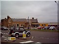
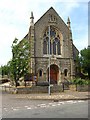
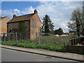
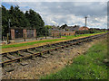
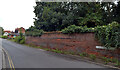
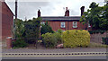
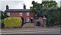
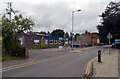
Photos of NR19 2HH
Area Information
Living in NR19 2HH means residing within a compact residential cluster covering just 1.4 hectares. This postcode serves 1,433 residents, creating a tight-knit environment where neighbours are often familiar faces. The area operates as a small settlement, distinct from the broader rural sprawl of the surrounding countryside. You will find a stable community where life moves at a measured pace, free from the congestion of larger urban centres. The low population density is not a highlight of neglect but a reflection of managed growth and planned living. Residents enjoy direct access to nearby towns while maintaining a sense of separation from the rush of city life. This specific postcode area functions as a gateway to popular local hubs. Daily living here involves a balance of privacy and accessibility. You are not in isolation, but you are far enough from the main thoroughfares to enjoy relative quiet. The character of NR19 2HH is defined by its modest scale. It does not offer the spectacle of a major town centre but provides a peaceful setting for family life. The area's size limits the volume of traffic and noise, contributing to a calm atmosphere. For those seeking a home outside the commuter belt, this postcode delivers functionality without pretension. It is a place where the boundary between rural tranquillity and modern convenience resides comfortably.
- Area Type
- Postcode
- Area Size
- 1.4 hectares
- Population
- 1433
- Population Density
- 4719 people/km²
The property market in NR19 2HH is defined by specific structural characteristics that you must understand before committing. With 57% of homes owner-occupied, the area leans towards a stable residential market rather than a volatile rental sector. This imbalance means fewer properties are available to short-term renters or corporate tenants compared to urban centres. The predominant accommodation type is Houses, which dictates the nature of the street layout and available space. You will find that the housing stock consists largely of detached or semi-detached structures suited for families. This configuration affects sale prices and availability in ways unique to a 1.4-hectare residential cluster. A high proportion of owner-occupied dwellings often implies lower turnover rates, making new listings less frequent. If you are looking to buy, patience is required as owners in NR19 2HH tend to stay put. The lack of multi-unit buildings reduces competition between different property types on the same estate. This results in a predictable market environment where local banks and estate agents focus on traditional single-family transactions. The 57% ownership figure serves as a strong indicator of the area's financial stability within the North Norfolk region.
House Prices in NR19 2HH
Showing 31 properties
| Address | Type | Beds | Baths | Last Sale Price | Last Sale Date | |
|---|---|---|---|---|---|---|
| 2 Swanton Road, Dereham, NR19 2HH | Semi-detached | 3 | 1 | £223,000 | Feb 2025 | |
| 6 Swanton Road, Dereham, NR19 2HH | Detached | 3 | 1 | £180,000 | Feb 2025 | |
| 11 Swanton Road, Dereham, NR19 2HH | house | - | - | £160,000 | Oct 2023 | |
| 27 Swanton Road, Dereham, NR19 2HH | Bungalow | 2 | 1 | £210,000 | Apr 2022 | |
| 5 Swanton Road, Dereham, NR19 2HH | Semi-detached | 3 | 1 | £194,000 | Sep 2018 | |
| 3 Swanton Road, Dereham, NR19 2HH | house | - | - | £175,000 | Oct 2017 | |
| 23 Swanton Road, Dereham, NR19 2HH | Bungalow | - | - | £185,000 | Jul 2017 | |
| 12 Swanton Road, Dereham, NR19 2HH | Semi-detached | 3 | - | £169,000 | Jun 2016 | |
| 7 Swanton Road, Dereham, NR19 2HH | house | - | - | £166,000 | Mar 2016 | |
| 14 Swanton Road, Dereham, NR19 2HH | Detached | 3 | 1 | £176,000 | Oct 2015 |
Energy Efficiency in NR19 2HH
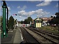
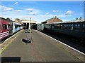
Residents of NR19 2HH enjoy convenient access to practical amenities within a short radius. The nearest retail options include Iceland East, Co-op East, and Morrisons Scarning. These five retail venues provide everything from groceries to household essentials without requiring a long drive. You can complete your weekly shopping trip efficiently from this selection. Public transport is supported by one nearby metro hub located in Dereham. This station connects the area to broader regional transport networks. The presence of a large supermarket like Morrisons Scarning adds a layer of self-sufficiency to daily life in NR19 2HH. You do not need to travel far for fresh food or daily necessities. Retail choices are specific and sufficient for a residential postcode of this size. The one metro station ensures that occasional trips to Lakenham or Norwich are straightforward. Lifestyle here is anchored by practicality rather than entertainment venues or luxury shopping. Scotland properties in this zone rely on these nearby hubs for their primary commercial needs. The amenity mix reflects a sleepy community prioritising essential services over tourist attractions.
Amenities
Schools
Families living in NR19 2HH have access to educational institutions that serve the wider Dereham region. The nearest primary education is provided by King's Park Infant School, Dereham. This school operates as both a primary institution and an academy, offering a consistent educational framework for young children. Within the limits of practical reach, this facility covers early learning stages for local residents. For older students, Dereham Sixth Form College is situated nearby. You will find this sixth-form centre provides upper-secondary education for pupils seeking to transition into university or employment. This combination of an infant school and a sixth form creates a comprehensive educational corridor connecting different age groups. The presence of an academy indicates adherence to a specific school-wide vision for academic and personal development. Families in NR19 2HH benefit from having these specific options without needing to travel to distant towns. King's Park Infant School, Dereham, serves as the foundational step for local children. Dereham Sixth Form College, Dereham, offers the final stages of secondary education. The proximity of these named institutions ensures that daily commutes for school runs are kept manageable.
| Rank | School | Type | Entry gender | Ages |
|---|
Explore more schools in this area
Go to Schools tabDemographics
The community of NR19 2HH displays a clear demographic profile focused on settlement and stability. The median age of 47 years indicates that adults between 30 and 64 years are the most common age range. This age distribution suggests the area attracts families and professionals establishing long-term roots rather than transient movers. Consequently, you will encounter a population driven by career progression and family upbringing rather than student housing or seasonal workers. The predominance of white residents forms the backdrop of daily interactions within this neighbourhood. Home ownership stands at 57%, which is below the national average but significant for a postcode of this configuration. This ownership rate often influences local councils in terms of investment decisions and maintenance of public amenities. With Houses making up the primary accommodation type, the streetscape is likely characterised by detached or semi-detached properties rather than blocks of flats. This housing structure is typical for residences in NR19 2HH, offering private gardens and individual entrances. The demographics paint a picture of a settled household where renter turnover is lower than in student-heavy areas. The age and ownership data combine to suggest a mature, invested community where renovation and family expansion are common activities.
Household Size
Accommodation Type
Tenure
Ethnic Group
Religion
Household Composition
Age
Household Deprivation
NS-SEC
Explore more demographic insights in this area
Go to Demographics tabPlanning
Planning Constraints
- Flood RiskPremium
- Ramsar Wetland SitesPremium
- Area of Outstanding Natural BeautyPremium
- Protected Nature ReservePremium
- Protected WoodlandPremium