Area Overview for NR20 4DW
Photos of NR20 4DW
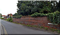
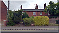
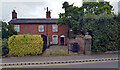
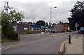
100 photos from this area
Area Information
Key information about the NR20 4DW including its size, population, and administrative classification.
- Area Type
- Postcode
- Area Size
- 7.8 hectares
- Population
- 2348
- Population Density
- 223 people/km²
House Prices in NR20 4DW
47
Properties
£209,233
Average Sold Price
£58,550
Lowest Price
£365,000
Highest Price
Showing 47 properties
| Address | Type | Beds | Baths | Last Sale Price | Last Sale Date | |
|---|---|---|---|---|---|---|
| 13 Swanton Drive, Dereham, NR20 4DW | Bungalow | 3 | 1 | £327,000 | Aug 2025 | |
| 34 Swanton Drive, Dereham, NR20 4DW | Detached | 4 | 2 | £340,000 | Aug 2025 | |
| 36 Swanton Drive, Dereham, NR20 4DW | Bungalow | 2 | 1 | £285,000 | Dec 2024 | |
| 17 Swanton Drive, Dereham, NR20 4DW | house | - | - | £286,000 | Jan 2024 | |
| 35 Swanton Drive, Dereham, NR20 4DW | Bungalow | 2 | 1 | £326,000 | Nov 2023 | |
| 23 Swanton Drive, Dereham, NR20 4DW | Bungalow | 3 | 1 | £365,000 | Nov 2022 | |
| 9 Swanton Drive, Dereham, NR20 4DW | Retail | 3 | 1 | £315,000 | Sep 2022 | |
| 19 Swanton Drive, Dereham, NR20 4DW | Bungalow | - | - | £185,000 | May 2021 | |
| 46 Swanton Drive, Dereham, NR20 4DW | Bungalow | 2 | 1 | £225,000 | Jan 2021 | |
| 20 Swanton Drive, Dereham, NR20 4DW | Bungalow | - | - | £230,000 | Dec 2020 |
Page 1 of 5
Energy Efficiency in NR20 4DW
Amenities
Schools
| Rank | School | Type | Entry gender | Ages |
|---|
Explore more schools in this area
Go to Schools tabDemographics
Household Size
Two person
most common
Accommodation Type
Houses
most common
Tenure
75
majority
Ethnic Group
White
most common
Religion
N/A
most common
Household Composition
N/A
most common
Age
47
median
Adults (30-64 years)
most common
Household Deprivation
N/A
with no deprivation
NS-SEC
35
in Lower managerial occupations
Explore more demographic insights in this area
Go to Demographics tabPlanning
Planning Constraints
- Flood RiskPremium
- Ramsar Wetland SitesPremium
- Area of Outstanding Natural BeautyPremium
- Protected Nature ReservePremium
- Protected WoodlandPremium