Area Overview for NR19 2ET
Photos of NR19 2ET
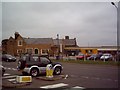
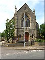
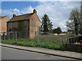
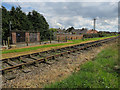
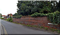
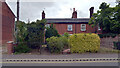
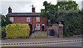
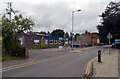
100 photos from this area
Area Information
Key information about the NR19 2ET including its size, population, and administrative classification.
- Area Type
- Postcode
- Area Size
- 2.6 hectares
- Population
- 1175
- Population Density
- 1336 people/km²
House Prices in NR19 2ET
27
Properties
£144,568
Average Sold Price
£37,500
Lowest Price
£347,500
Highest Price
Showing 27 properties
| Address | Type | Beds | Baths | Last Sale Price | Last Sale Date | |
|---|---|---|---|---|---|---|
| 24 Cemetery Road, Dereham, NR19 2ET | Terraced | 3 | 1 | £347,500 | May 2024 | |
| Stonemasons Cottage, 18 Cemetery Road, Dereham, NR19 2ET | Terraced | 3 | 1 | £230,000 | Jun 2021 | |
| 14 Cemetery Road, Dereham, NR19 2ET | house | - | - | £195,000 | Feb 2021 | |
| 12 Cemetery Road, Dereham, NR19 2ET | Semi-detached | 4 | 2 | £270,000 | Aug 2020 | |
| 16 Cemetery Road, Dereham, NR19 2ET | Semi-detached | 3 | 1 | £245,000 | Jan 2020 | |
| 20 Cemetery Road, Dereham, NR19 2ET | Terraced | 3 | - | £156,000 | Jul 2014 | |
| 46 Cemetery Road, Dereham, NR19 2ET | Terraced | 3 | 2 | £185,000 | Oct 2013 | |
| The Old School House, 1 Cemetery Road, Dereham, NR19 2ET | Detached | - | - | £178,000 | Oct 2006 | |
| 40 Cemetery Road, Dereham, NR19 2ET | Terraced | - | - | £148,000 | Apr 2003 | |
| 2 Cemetery Road, Dereham, NR19 2ET | Detached | - | - | £118,000 | Mar 2000 |
Page 1 of 3
Energy Efficiency in NR19 2ET
Amenities
Schools
| Rank | School | Type | Entry gender | Ages |
|---|
Explore more schools in this area
Go to Schools tabDemographics
Household Size
Two person
most common
Accommodation Type
Houses
most common
Tenure
75
majority
Ethnic Group
White
most common
Religion
N/A
most common
Household Composition
N/A
most common
Age
47
median
Adults (30-64 years)
most common
Household Deprivation
N/A
with no deprivation
NS-SEC
30
in Lower managerial occupations
Explore more demographic insights in this area
Go to Demographics tabPlanning
Planning Constraints
- Flood RiskPremium
- Ramsar Wetland SitesPremium
- Area of Outstanding Natural BeautyPremium
- Protected Nature ReservePremium
- Protected WoodlandPremium