Area Overview for NR13 6TS
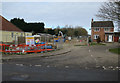
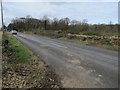
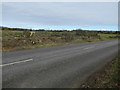
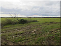
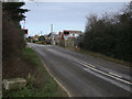
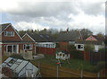
Photos of NR13 6TS

Area Information
NR13 6TS is a specific postcode covering a small residential cluster in England. The land spans exactly 3.2 hectares, making it a compact area for living in this location. With a population of 1441 people, the density stands at 270 people per square kilometre. This figure indicates a suburban environment rather than a dense urban centre. Living in NR13 6TS means dealing with a settled community where space is relatively abundant for the number of residents. The area functions as a quiet residential extension to wider Norwich suburbs. Homebuyers looking for NR13 6TS find a neighbourhood defined by its manageable scale and limited footprint. Daily life here centres on local quiet rather than the pace of a major town core. The specific nature of the postcode suggests a contained zone of housing rather than a sprawling village. Prospective buyers should understand they are entering a defined, smaller community within the broader Norfolk county. The combination of low density and specific boundaries creates a distinct character for homes in NR13 6TS. You can expect a lived-in feel where the residential purpose dominates the landscape. This area offers a straightforward introduction to rural-adjacent living without the isolation of remote countryside.
- Area Type
- Postcode
- Area Size
- 3.2 hectares
- Population
- 1441
- Population Density
- 270 people/km²
Homes in NR13 6TS exist within a market defined by significant resident investment and tenure stability. You will find that 90 per cent of properties are owned outright or with a mortgage, leaving only a small slice for the rental sector. This statistic confirms the area is primarily an owner-occupied zone. Houses form the sole predominant accommodation type within this 3.2-hectare boundary. The high ownership rate of 90 per cent suggests developers do not frequently turn over stock here. Buying a home involves entering a community where most neighbours have established roots over many years. This lack of rental pressure often leads to lower transaction speeds and fewer forced sales on the market. Property values tend to remain consistent because the supply is tightly controlled by existing homeowners. Potential buyers should expect to compete with a standing army of owners who view their homes as permanent assets. The market does not exhibit the volatility seen in high-rental districts of Norwich. Instead, prices likely reflect long-term appreciation driven by capital investment rather than speculative buying. Those interested in NR13 6TS should prepare to negotiate with individuals who intend to stay for decades. The nature of the housing stock means renovation projects often respect the established character of the built environment. Selling a property here may take longer if buyers seek the high yield of rental districts. However, you benefit from a community that values property maintenance and neighbourly relations.
House Prices in NR13 6TS
Showing 11 properties
| Address | Type | Beds | Baths | Last Sale Price | Last Sale Date | |
|---|---|---|---|---|---|---|
| 1 Fenton Close, Rackheath, NR13 6TS | Bungalow | - | - | - | - | |
| 20 Fenton Close, Rackheath, NR13 6TS | Flat | - | - | - | - | |
| 4 Fenton Close, Rackheath, NR13 6TS | house | - | - | - | - | |
| 14 Fenton Close, Rackheath, NR13 6TS | Flat | - | - | - | - | |
| 18 Fenton Close, Rackheath, NR13 6TS | Flat | - | - | - | - | |
| 8 Fenton Close, Rackheath, NR13 6TS | Flat | - | - | - | - | |
| 2 Fenton Close, Rackheath, NR13 6TS | Semi-detached | - | - | - | - | |
| 16 Fenton Close, Rackheath, NR13 6TS | Flat | - | - | - | - | |
| 6 Fenton Close, Rackheath, NR13 6TS | Flat | - | - | - | - | |
| 10 Fenton Close, Rackheath, NR13 6TS | Flat | - | - | - | - |
Energy Efficiency in NR13 6TS
Daily life in NR13 6TS relies on accessible amenities within practical reach of the residential cluster. You can reach Salhouse Railway Station, Brundall Gardens Railway Station, and Brundall Railway Station by car or active travel. These rail hubs provide essential links to Norwich and the wider network. For shopping and groceries, Makro Norwich, Tesco Norwich, and Lidl Poppy serve the immediate needs of households. You will find large-format retail options nearby that cater to weekly stocking runs. Wroxham remains the nearest metro facility, offering a transport node for further exploration. Norwich International Airport sits nearby, granting you quick access to domestic and international travel. These five retail outlets and transport points within proximity define your lifestyle convenience. You do not need to travel far for essential supplies or scheduled transit. The clustering of supermarkets like Tesco and Lidl suggests a focus on practical value. Commuters requiring rail access have three stations to choose from depending on their schedule. Living in NR13 6TS grants you a blend of rural quiet and urban reach. You can manage large purchases at Makro or weekly food at Lidl without leaving the county. The specific locations of these amenities create a predictable routine for residents. Your morning commute depends on the frequency of services from Brundall or Salhouse. Even for air travel, the airport remains within a reasonable distance for regional trips.
Amenities
Schools
| Rank | School | Type | Entry gender | Ages |
|---|
Explore more schools in this area
Go to Schools tabDemographics
The community profile in NR13 6TS reflects a mature and stable population. The median age here is 47 years, which places the area firmly within the adult demographic range. Most residents belong to the 30-64 years age bracket, indicating a workforce-focused household structure. Nearly 90 per cent of people own their homes, revealing a market dominated by owner-occupiers rather than tenants. This high ownership rate typically suggests long-term stability within the neighbourhood. Houses comprise the primary accommodation type found throughout the area. The predominant ethnic group is White, mirroring the broader national demographic trends in rural England. You are unlikely to experience the rapid demographic shifts common in developing urban regeneration zones. The population composition points towards families and established couples seeking permanence. Livelihoods in this age group often balance career progression with retirement planning. The demographic data paints a picture of consistency rather than transient living patterns. For those considering NR13 6TS, the environment supports a demographic accustomed to settled life. No other major ethnic groups or age clusters dominate the statistics to a similar degree. The social fabric appears built on shared tenure and similar life stages. This demographic reality stabilises the character of the area against external pressures.
Household Size
Accommodation Type
Tenure
Ethnic Group
Religion
Household Composition
Age
Household Deprivation
NS-SEC
Explore more demographic insights in this area
Go to Demographics tabPlanning
Planning Constraints
- Flood RiskPremium
- Ramsar Wetland SitesPremium
- Area of Outstanding Natural BeautyPremium
- Protected Nature ReservePremium
- Protected WoodlandPremium