Area Overview for NR13 6TU
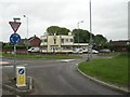
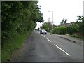
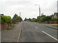
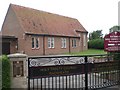
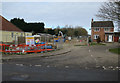
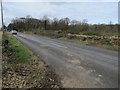
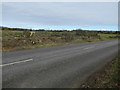
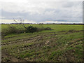
Photos of NR13 6TU

Area Information
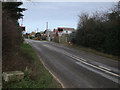
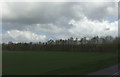
Living in NR13 6TU offers a settled residential experience within a compact neighbourhood. This postcode area covers just 3.0 hectares, housing a population of 2,147 people. The footprint is small, creating an intimate environment where streets are close together. You will find this location situated in the broader Norwich region, linking local residents to wider city amenities. The cluster functions as a dedicated housing zone rather than a sprawling town centre. Daily life here revolves around proximity, with most walks leading to essential services within a few hundred metres. You avoid the congestion of major traffic hubs while maintaining steady access to the wider city network. The layout suggests a community focused on stability, where long-term residents form the backbone of the local scene. You are not in a chaotic urban fringe but in a defined residential pocket. This distinction matters if you seek a quiet address without the isolation of rural living. The area balances privacy with connectivity, ensuring that daily errands do not require extensive travel. Your morning routine benefits from a density that supports local interaction without sacrificing green space or peace.
- Area Type
- Postcode
- Area Size
- 3.0 hectares
- Population
- 2147
- Population Density
- 286 people/km²
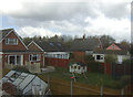
The property market in NR13 6TU is defined by stability and long-term commitment. With 78 per cent of residents owning their homes, this is distinctly an owner-occupied area rather than a rental market. This high ownership rate implies that most properties have been updated by owners over time rather than through speculative short-term letting. Houses make up the primary accommodation type, ensuring a consistent housing stock for buyers looking for single-family dwellings. You will find a market geared towards purchasing a future home rather than securing a temporary address. This dynamic affects pricing and availability, as sellers often list with the intention of retirement or upgrading rather than moving at a moment's notice. For buyers, this environment offers a chance to acquire a home with a clear sense of community over it. The lack of high-volume rental listings means competition focuses on specific family-sized properties. Extra care is needed to secure a view because the turnover rate is naturally lower.
House Prices in NR13 6TU
Showing 13 properties
| Address | Type | Beds | Baths | Last Sale Price | Last Sale Date | |
|---|---|---|---|---|---|---|
| 2 Warden Way, Rackheath, NR13 6TU | house | - | - | - | - | |
| 15 Warden Way, Rackheath, NR13 6TU | house | - | - | - | - | |
| 8 Warden Way, Rackheath, NR13 6TU | house | - | - | - | - | |
| 6 Warden Way, Rackheath, NR13 6TU | house | - | - | - | - | |
| 4 Warden Way, Rackheath, NR13 6TU | house | - | - | - | - | |
| 10 Warden Way, Rackheath, NR13 6TU | house | - | - | - | - | |
| 9 Warden Way, Rackheath, NR13 6TU | house | - | - | - | - | |
| 13 Warden Way, Rackheath, NR13 6TU | house | - | - | - | - | |
| 7 Warden Way, Rackheath, NR13 6TU | house | - | - | - | - | |
| 5 Warden Way, Rackheath, NR13 6TU | house | - | - | - | - |
Energy Efficiency in NR13 6TU
Your daily lifestyle in NR13 6TU benefits from several key amenities within practical reach. You have access to five retail options including Tesco Norwich, Lidl Sprowston, and Makro Norwich. These supermarkets provide all the necessities for keeping a household stocked without needing extensive travel. Five railway stations serve the area, offering flexible choices for your daily commute or leisure trips. Salhouse and Brundall Gardens stations act as local stops, while Norwich Railway Station handles long-distance connections. If you require air travel, Norwich International Airport is available as a nearby option. You can also reach Wroxham Metro for further logistical support. These facilities create a convenient ecosystem where work, shopping, and travel intersect. You do not need to leave the region for basic tasks. The cluster of amenities supports a self-sufficient routine. Driving times to these venues are short, preserving your evenings for family time rather than commuting.
Amenities
Schools
Education near NR13 6TU is anchored by one specific institution supported in the data. You will find Rackheath Primary School serving the local primary education needs. This school holds an outstanding Ofsted rating, marking it as the highest possible grade for educational quality. The presence of a single primary option in the immediate vicinity suggests a tight-knit school community. Families with young children will rely heavily on this facility for their early education plans. The outstanding designation provides assurance regarding academic standards and school leadership. For parents considering homes in NR13 6TU, this rating is a significant factor. It implies that children living near these houses will have access to top-tier primary teaching without needing to travel far. Secondary education options are not listed in the provided data, so residents must plan for transfers into different catchment zones later. The current setup suits families with young children who prioritize proximity and high-rated feeding schools.
| Rank | School | Type | Entry gender | Ages |
|---|
Explore more schools in this area
Go to Schools tabDemographics
The community in NR13 6TU reflects a mature and established demographic. The median age stands at 47 years, confirming that adults between 30 and 64 years old form the most common age range. This profile points to households led by families in their peak earning years or empty nesters with significant savings. Home ownership is high, reaching 78 per cent of all households. This figure indicates a strong preference for buying rather than renting, suggesting stability within the local population. Houses dominate the accommodation landscape, meaning you will see detached or semi-detached property rather than apartment blocks. The predominant ethnic group is White, aligning with the broader national average for this region. These statistics paint a picture of traditional family units. You will likely encounter neighbours who have lived here for decades. The low rate of transient population means local schools and community centres operate with consistency. A homeowner in this postcode faces less uncertainty than in areas with high rental turnover.
Household Size
Accommodation Type
Tenure
Ethnic Group
Religion
Household Composition
Age
Household Deprivation
NS-SEC
Explore more demographic insights in this area
Go to Demographics tabPlanning
Planning Constraints
- Flood RiskPremium
- Ramsar Wetland SitesPremium
- Area of Outstanding Natural BeautyPremium
- Protected Nature ReservePremium
- Protected WoodlandPremium