Area Overview for NR13 6RF
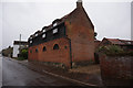
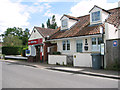
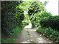
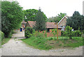
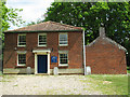
Photos of NR13 6RF
Area Information
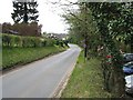
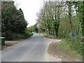
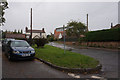
NR13 6RF is a compact residential cluster covering 1.3 hectares within the Norfolk postcode district. This small area houses 1,577 residents across a tightly knit community. The neighbourhood size suggests a quiet, low-density environment rather than a busy urban centre. Living in NR13 6RF means navigating a space where every local street is part of a larger, cohesive village structure. The population density stands at 177 people per square kilometre, which is relatively low compared to larger towns. This figure indicates ample green space between properties and a lack of high-rise development. The area is situated in England, offering a typical English suburban experience without the congestion of city life. You can expect a pace of life that prioritises local knowledge and neighbourly recognition. Daily routines involve shorter commutes to nearby facilities because amenities are within practical reach. The small footprint of the development ensures that residents maintain close proximity to their local services. This postcode represents a specific, defined slice of suburban life where the boundaries are clear and the community identity is strong. For those seeking a home in this area, the limited scale offers a manageable and predictable living environment.
- Area Type
- Postcode
- Area Size
- 1.3 hectares
- Population
- 1577
- Population Density
- 177 people/km²
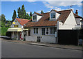
The property market in NR13 6RF operates primarily as an owner-occupied sector. With 84% of homes owned by residents, this postcode is not a hub for rental speculation or transient tenants. The accommodation type is exclusively houses, meaning you will not find apartments or flats for sale or rent in this specific cluster. This housing stock offers the security and space associated with detached or semi-detached homes rather than shared flats. For buyers looking at properties in NR13 6RF, the market reflects stability and permanence. The small area size of 1.3 hectares restricts the volume of new developments, keeping the character of the area intact. This scarcity often correlates with steady demand for the existing housing stock. When viewing homes in NR13 6RF, expect traditional building styles suited to the local landscape. The high ownership rate implies that sellers are often motivated by long-term life changes rather than short-term capital gains. This market dynamic reduces volatility for serious homebuyers who wish to settle down. The absence of flats simplifies the search process, as buyers do not need to balance requirements for different housing configurations.
House Prices in NR13 6RF
Showing 11 properties
| Address | Type | Beds | Baths | Last Sale Price | Last Sale Date | |
|---|---|---|---|---|---|---|
| 7 Thieves Lane, Salhouse, NR13 6RF | Terraced | 4 | 2 | £375,000 | May 2023 | |
| 15 Thieves Lane, Salhouse, NR13 6RF | Semi-detached | - | - | £53,500 | Sep 2002 | |
| 3 Thieves Lane, Salhouse, NR13 6RF | Retail | 4 | 2 | - | - | |
| Unit A, 7 Thieves Lane, Salhouse, NR13 6RF | Terraced | - | - | - | - | |
| 11 Thieves Lane, Salhouse, NR13 6RF | Semi-detached | - | - | - | - | |
| 9 Thieves Lane, Salhouse, NR13 6RF | Semi-detached | - | - | - | - | |
| 5 Thieves Lane, Salhouse, NR13 6RF | house | - | - | - | - | |
| 17 Thieves Lane, Salhouse, NR13 6RF | house | - | - | - | - | |
| 21 Thieves Lane, Salhouse, NR13 6RF | Semi-detached | - | - | - | - | |
| 19 Thieves Lane, Salhouse, NR13 6RF | Bungalow | - | - | - | - |
Energy Efficiency in NR13 6RF
Residents of NR13 6RF enjoy access to a range of amenities within practical reach. Rail travel is available through five nearby stations, including Salhouse Railway Station, Hoveton & Wroxham Railway Station, and Brundall Gardens Railway Station. These stations facilitate regional travel and leisure trips. There is also one metro stop at Wroxham, providing further transport links for those needing advanced connectivity. For daily shopping, five retail options are nearby, including Makro Norwich, Lidl Poppy, and Lidl Sprowston. Access to these large supermarkets means you can stock homes in NR13 6RF efficiently without long drives. Norwich International Airport is one of the accessible air links, offering regional and international flights. This combination of rail, metro, retail, and air travel ensures that living in NR13 6RF does not require isolation from wider opportunities. You can run local errands quickly while retaining the option to travel further afield. The presence of multiple retail outlets supports a self-sufficient lifestyle without relying on driving to distant high streets. Quality groceries and household essentials are just moments away.
Amenities
Schools
Education facilities near NR13 6RF cater primarily to young children. Salhouse CofE Primary School serves the local primary education needs. The school holds a satisfactory Ofsted rating as of its latest inspection. This is the only primary school listed within the immediate vicinity of the postcode. The mix of school types in this area is currently limited, focusing on early education stages rather than secondary options. Families with school-age children will rely on this specific provision for their younger offspring. The satisfactory rating indicates that the school meets the required standards for British education. You should verify current admission criteria and catchment areas directly with the school administration. The absence of secondary schools listed in the data means older students likely travel further for their education. This common pattern exists in many village and rural areas across Norfolk. Living in NR13 6RF requires planning around the transport needs of school run days. The singular presence of Salhouse CofE Primary School defines the educational landscape for this small cluster. Families value the stability provided by a single, established local institution.
| Rank | School | Type | Entry gender | Ages |
|---|
Explore more schools in this area
Go to Schools tabDemographics
The community profile of NR13 6RF reflects a settled adult population. The median age for residents is 47 years, and the most common age range falls between 30 and 64 years. This demographic data points to a neighbourhood dominated by working-age households rather than children or the elderly. You are more likely to meet professionals or established families here than young students or retirees. Home ownership is exceptionally high, with 84% of residents owning their property outright. This statistic confirms that NR13 6RF is a stable, owner-occupied area where people have long-term stakes in their local environment. The predominant accommodation type consists of houses, which aligns with the preference for family living or established home ownership. The area lacks the high-rise apartments or flats common in city centres. Ethnically, the predominant group is White, indicating a homogenous community history. These facts suggest a tranquil setting where long-standing residents form the backbone of local businesses and social groups. The age profile supports quieter streets compared to areas with a higher concentration of teenagers or younger singles. Housing stability here fosters strong community ties and consistent local investment.
Household Size
Accommodation Type
Tenure
Ethnic Group
Religion
Household Composition
Age
Household Deprivation
NS-SEC
Explore more demographic insights in this area
Go to Demographics tabPlanning
Planning Constraints
- Flood RiskPremium
- Ramsar Wetland SitesPremium
- Area of Outstanding Natural BeautyPremium
- Protected Nature ReservePremium
- Protected WoodlandPremium