Area Overview for NR13 6RL
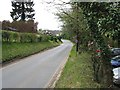
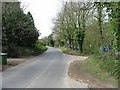
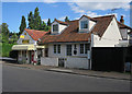
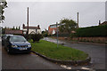
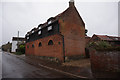
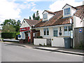
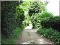
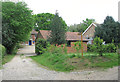
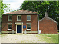
Photos of NR13 6RL
Area Information
NR13 6RL occupies a small residential cluster with a precise footprint of 6628 square metres. This postcode serves a defined population of 1577 people, creating a close‑knit environment where residents move with purpose and familiarity. The area balances intimate scale with practical accessibility to broader Norwich services. You find yourself in a neighbourhood where daily life revolves around proximity to rail links, retail hubs, and natural corridors. The setting suits those who value clear boundaries between home and community rather than sprawling urban density. Here, the built environment supports straightforward routines without overwhelming complexity. Local streets function as quiet thoroughfares, facilitating slow movement and neighbourly interaction. The area's size ensures you can walk to key destinations while maintaining a sense of residential separation. This locality offers stability without isolation, positioning you well for both family life and ease of access. You receive the benefits of a recognised postcode area without the anonymity of larger developments.
- Area Type
- Postcode
- Area Size
- 6628 m²
- Population
- 1577
- Population Density
- 177 people/km²
The property market in NR13 6RL centres on house ownership with 84 percent of residents holding their homes. Houses dominate the accommodation landscape, offering traditional British residential structures typical of this postcode. This concentration indicates a primarily owner‑occupied area rather than a rental market. You purchase with the expectation of forming a long‑term stake in the property and neighbourhood. The high ownership percentage reduces transient residents, fostering consistent community participation. Buying here means joining an established group of homeowners who value property maintenance and local governance. The housing stock reflects sustained investment from previous generations moving up the property ladder. This stability benefits both current and future residents through consistent neighbourhood standards. You avoid the volatility common in high‑turnover rental sectors. The market supports buyers seeking secure tenure in a well‑defined residential zone.
House Prices in NR13 6RL
Showing 7 properties
| Address | Type | Beds | Baths | Last Sale Price | Last Sale Date | |
|---|---|---|---|---|---|---|
| 3 Redell Close, Salhouse, NR13 6RL | house | - | - | £275,000 | Oct 2016 | |
| 5 Redell Close, Salhouse, NR13 6RL | Detached | 3 | - | £249,950 | Oct 2013 | |
| 1 Redell Close, Salhouse, NR13 6RL | Bungalow | 2 | 1 | £197,000 | Feb 2007 | |
| 6 Redell Close, Salhouse, NR13 6RL | Detached | - | - | £165,000 | Apr 2003 | |
| 4 Redell Close, Salhouse, NR13 6RL | Detached | - | - | - | - | |
| 2 Redell Close, Salhouse, NR13 6RL | Bungalow | - | - | - | - | |
| 7 Redell Close, Salhouse, NR13 6RL | Terraced | - | - | - | - |
Energy Efficiency in NR13 6RL
Living in NR13 6RL provides practical access to nearby amenities including Salhouse Railway Station, Hoveton & Wroxham Railway Station, Brundall Gardens Railway Station, and Wroxham for metro services. Retail options within practical reach include Makro Norwich, Lidl Poppy, and Lidl Sprowston for everyday shopping. Norwich International Airport sits nearby for travel requirements. These facilities form a functional network supporting routine errands and occasional journeys. You access supermarkets instantly while retaining railway connections to wider regions. Dining opportunities and leisure choices extend naturally through these named venues. The area's location positions you close to essential services without requiring extensive commutes. Daily life incorporates spontaneous visits to local stores and scheduled trips to nearby stations. This amenity distribution balances independence with network access.
Amenities
Schools
Families residing in NR13 6RL have access to Salhouse CofE Primary School, a primary institution with a satisfactory Ofsted rating. This school serves young learners within the immediate locality. The presence of a single named primary school indicates focused provision for early education needs. You find educational support aligned with local community values and religious traditions. The satisfactory rating confirms the school meets regulatory standards for delivery and outcomes. Limited school data reflects the small, specialised nature of this sole primary provision. Parents may consider transport arrangements to reach this singular institution for their children's education. The school's designation as Church of England funded influences cultural and spiritual approaches to schooling. You benefit from proximity to a recognised educational facility without complex catchment navigation.
| Rank | School | Type | Entry gender | Ages |
|---|
Explore more schools in this area
Go to Schools tabDemographics
The community in NR13 6RL reflects established residential patterns with a median age of 47 years. Adults between 30 and 64 years represent the most common age range, indicating a population focused on maturity and stability. Eighty‑four percent of residents own their homes, demonstrating high equity levels and long‑term settlement. Houses form the predominant accommodation type, establishing a consistent architectural character across the neighbourhood. The predominant ethnic group is White, aligning with the broader demographic trends of rural Norfolk. These figures depict a settled community where generational ties likely strengthen social cohesion. The high home ownership rate suggests residents prioritise stability over temporary arrangements. You encounter neighbours who have invested deeply in their local environment over extended periods. This demographic profile supports quiet, predictable living conditions for those seeking permanence. The area appeals to individuals and families favouring established routines and neighbouring familiarity.
Household Size
Accommodation Type
Tenure
Ethnic Group
Religion
Household Composition
Age
Household Deprivation
NS-SEC
Explore more demographic insights in this area
Go to Demographics tabPlanning
Planning Constraints
- Flood RiskPremium
- Ramsar Wetland SitesPremium
- Area of Outstanding Natural BeautyPremium
- Protected Nature ReservePremium
- Protected WoodlandPremium