Area Overview for NR13 6EY
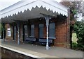
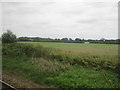
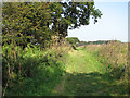
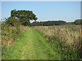
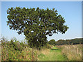
Photos of NR13 6EY

Area Information
Living in NR13 6EY means inhabiting a specific residential cluster defined by a postcode covering an area of 20.9 hectares. This small footprint accommodates a population of 1,577 residents, resulting in a density of 177 people per square kilometre. The environment is characterised by houses situated within this compact zone, offering a defined sense of locality rather than a sprawling suburb. Daily life revolves around this central cluster, where every street is part of the immediate community network. You are situated close enough to feel connected yet far enough to enjoy quiet surroundings typical of a low-density postcode. The residential nature of NR13 6EY ensures homes face mainly other dwellings rather than heavy industrial activity. Prospective buyers should view this as a settled neighbourhood where the built environment is contained within clear boundaries. The area functions as a self-contained unit within the wider Broads region, providing a stable base for those seeking a home in a defined geographical pocket without the noise or congestion of larger town centres.
- Area Type
- Postcode
- Area Size
- 20.9 hectares
- Population
- 1577
- Population Density
- 177 people/km²
The property market in NR13 6EY is distinctly characterised by owner-occupation. With 84 per cent of homes owned by residents, the area functions as a settled market rather than a transient rental hub. All accommodation within the 20.9-hectare boundary comprises houses, reflecting a preference for detached or semi-detached living over flats or apartments. This stock profile appeals to buyers seeking traditional family homes or private gardens. You will find a concentration of existing stock where long-term owners have remained within the postcode. The high proportion of owner-occupiers suggests value is placed on stability and the maintenance of private property. New development is less likely given the constraints of a small residential cluster, meaning supply relies heavily on existing listings. Buyers looking for rental properties will find very few options compared to those searching for homes for purchase. The market dynamics indicate that resale values depend on the condition of individual houses rather than a high-volume rental yield model. Understanding this ownership split helps you gauge the neighbourhood's primary intent as a place to put down roots rather than a stopover.
House Prices in NR13 6EY
Showing 3 properties
| Address | Type | Beds | Baths | Last Sale Price | Last Sale Date | |
|---|---|---|---|---|---|---|
| Redwing Farm, Howletts Loke, Salhouse, NR13 6EY | Detached | - | - | £395,000 | Oct 2003 | |
| Annexe, Hagg Wood House, Howletts Loke, Salhouse, NR13 6EY | Flat | - | - | - | - | |
| Hagg Wood House, Howletts Loke, Salhouse, NR13 6EY | Detached | - | - | - | - |
Energy Efficiency in NR13 6EY
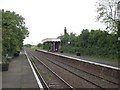
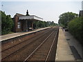
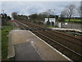
Daily life in NR13 6EY benefits from a wide range of amenities within driving distance. Five retail locations serve shopping needs, including Lidl Sprowston, the East of England Co-operative Co, and Tesco Norwich. These supermarkets provide essential groceries and household goods without requiring a long trip into the city centre. For rail travel, you have access to Salhouse Railway Station, Hoveton & Wroxham Railway Station, and Brundall Gardens Railway Station among the five available stations. One metro station is located at Wroxham. Travel to the coast or airport is streamlined by the presence of one airport, Norwich International Airport, nearby. The area size of 20.9 hectares means local facilities are a short drive away, preserving the character of home while offering convenience. You do not need to rely on NR13 6EY for weekly shop or leisure activities. The proximity to Sprowston and Broads villages ensures that culture, dining, and entertainment remain accessible. This balance allows you to enjoy the quiet life while maintaining easy access to the wider county's services.
Amenities
Schools
Families living in NR13 6EY have access to Salhouse CofE Primary School, which sits just on the doorstep. This institution serves young children in the primary age range and holds a satisfactory Ofsted rating. The specific designation of Church of England indicates the school maintains its religious character while delivering education to the local catchment. Because there are no secondary schools or other primary institutions listed in the immediate vicinity for this postcode, parents must look beyond NR13 6EY for older children's education. You may need to travel to neighbouring villages or towns like Hoveton or Wroxham for comprehensive schooling needs depending on distance and transport links. The presence of one primary school with a satisfactory rating provides a baseline of educational provision, though options for specialist or high-performing secondary education require further investigation outside the immediate area. For families with secure school places already, this location offers convenience for younger children without the commutes associated with more distant settlements.
| Rank | School | Type | Entry gender | Ages |
|---|
Explore more schools in this area
Go to Schools tabDemographics
The community in NR13 6EY reflects a mature demographic profile dominated by adults between 30 and 64 years of age. The median age stands at 47, indicating a resident base that has likely settled in the area for a significant period. Home ownership is the primary tenure model, with 84 per cent of residents owning their property outright or with a mortgage. Only a small minority rent within this postcode. The accommodation stock consists entirely of houses, aligning with the preferences of the established adult population. White residents make up the predominant ethnic group, creating a culturally homogenous neighbourhood. This stability suggests a quiet street life where long-term neighbours interact regularly. The high ownership rate of 84 per cent signals that families and individuals prioritise security and permanence. You are unlikely to encounter frequent turnover of tenants, which often contributes to a stronger sense of local identity. The age distribution supports a community focused on family life, career stability, or retirement living within a consistent environment.
Household Size
Accommodation Type
Tenure
Ethnic Group
Religion
Household Composition
Age
Household Deprivation
NS-SEC
Explore more demographic insights in this area
Go to Demographics tabPlanning
Planning Constraints
- Flood RiskPremium
- Ramsar Wetland SitesPremium
- Area of Outstanding Natural BeautyPremium
- Protected Nature ReservePremium
- Protected WoodlandPremium