Area Overview for NR13 3SB
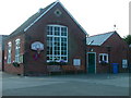
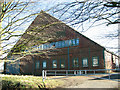
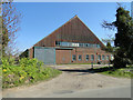
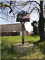
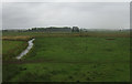
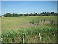
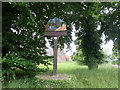
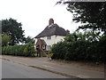
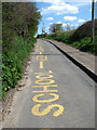
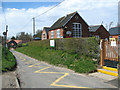
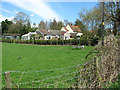
Photos of NR13 3SB
Area Information
Living in NR13 3SB means residing in a specific postcode covering a small residential cluster spanning 47.7 hectares. This area is situated in England with a population of 1,176 residents, creating a quiet domestic environment. The density stands at 54 people per square kilometre, which ensures plenty of space while maintaining a sense of community. You are part of a neighbourhood where houses dominate the landscape rather than high-rise blocks or apartments. The demographic profile shows adults between 30 and 64 years represent the most common age range, indicating a mature and stable population. With a median age of 47, the area attracts buyers seeking a settled lifestyle away from city centres. This small footprint supports a lower-key existence compared to larger towns. The mix of adult residents suggests a focus on long-term living rather than transient accommodation. You will find a community defined by home ownership rather than private renting. The population characteristics point towards families and individuals who have put down roots in the region. Daily life here revolves around proximity to local services rather than constant urban stimulation.
- Area Type
- Postcode
- Area Size
- 47.7 hectares
- Population
- 1176
- Population Density
- 54 people/km²
The property market in NR13 3SB is characterised by a dominance of houses suitable for owner-occupiers. With 78 per cent of the population owning their homes, this is not a zone driven by private landlords or buy-to-let investments. The prevailing accommodation type is houses, which aligns with the low population density of 54 people per square kilometre. This market structure means you are likely to find single-family dwellings rather than flats or terraced housing in high supply. Buyers looking at this postcode can expect a residential environment where property values may reflect the scarcity of space within the 47.7 hectares available. The high ownership rate indicates that homes here are often passed down or retained for decades. You will find fewer sales turnover rates compared to rental-heavy districts. This stability benefits owners but may limit rental options for those seeking to move frequently. The lack of rental inventory suggests that purchasing is the only viable route for many intending residents. The market operates on the principles of a suburban or rural residential zone where ownership is the norm.
House Prices in NR13 3SB
Showing 2 properties
| Address | Type | Beds | Baths | Last Sale Price | Last Sale Date | |
|---|---|---|---|---|---|---|
| Barn End, Grimmer Lane, Cantley, NR13 3SB | Detached | - | - | - | - | |
| The Bungalow, Grimmer Lane, Cantley, NR13 3SB | Detached | - | - | - | - |
Energy Efficiency in NR13 3SB
Residents of NR13 3SB have access to several amenities within practical reach, though options remain limited by size. Five rail stations operate nearby, including Cantley Railway Station, Buckenham Railway Station, and Lingwood Railway Station. These transport links connect you to broader networks despite the rural feel of the settlement. For daily shopping needs, you can visit Spar, Co-op Loddon, and Co-op 49-53, which provide essential groceries and household items. Reedham Ferry North serves as the sole notable ferry facility in the surrounding area. This small selection of services means you will plan your trips to larger towns for specialist shopping or leisure activities. The presence of multiple railway stations adds convenience for commuters who value flexibility. However, the scarcity of large retail parks or cinemas means your routine revolves around local convenience stores. You will find that errands are simple but regular visits to towns may be necessary for a full range of goods.
Amenities
Schools
Cantley Primary School stands as the nearest educational institution for residents of NR13 3SB. It operates as a primary school and holds a Good rating from Ofsted. This single facility serves the needs of younger children in the vicinity, given the age profile of the area. The presence of a good-rated primary school supports families with school-aged children, even though secondary options are not listed within this specific dataset. You must look beyond this immediate cluster for secondary education, as the data does not provide details on other institutions. The Good rating from Ofsted indicates that the school meets required standards for teaching and student welfare. The proximity to Cantley Primary School adds value to the housing stock in NR13 3SB. Families relocating to this postcode will rely on this specific school for their early education years. The absence of other named schools in the provided information suggests a dependence on the nearest listed option for primary needs.
| Rank | School | Type | Entry gender | Ages |
|---|
Explore more schools in this area
Go to Schools tabDemographics
The community in NR13 3SB is defined by a mature demographic structure where adults aged 30 to 64 years form the majority. The median age of 47 years confirms this trend of an established population. Home ownership stands at 78 per cent, which is a significant indicator of financial stability and long-term settlement. This high rate of ownership suggests that most households have purchased rather than rented their homes. Houses remain the primary accommodation type, consistent with the area's layout and planning constraints. The predominant ethnic group is White, reflecting the traditional character of the local settlement. These figures describe a neighbourhood where residents are likely to be there for the long haul. The concentration of owner-occupiers often leads to greater investment in properties and community cohesion. You will encounter a population that values privacy and space, typical of areas dominated by houses. The age profile implies that schools catering to younger children and teenagers serve this specific cluster. The demographic data paints a picture of a stable, non-transient community where neighbours often know each other over decades.
Household Size
Accommodation Type
Tenure
Ethnic Group
Religion
Household Composition
Age
Household Deprivation
NS-SEC
Explore more demographic insights in this area
Go to Demographics tabPlanning
Planning Constraints
- Flood RiskPremium
- Ramsar Wetland SitesPremium
- Area of Outstanding Natural BeautyPremium
- Protected Nature ReservePremium
- Protected WoodlandPremium