Area Overview for NR12 8YB
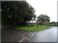
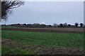
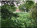
Photos of NR12 8YB


Area Information
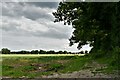
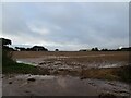
The postcode sector NR12 8YB represents a compact residential cluster covering just 3.7 hectares in Norwich. With a resident population of 2,061 people, this small area maintains a low density of 71 people per square kilometre. You will find mostly houses rather than high-rise blocks or terraced rows. The setting suggests a spread-out neighbourhood where most residents walk to immediate neighbours. Daily life here revolves around the quiet rhythm of a village-style community catching up with the wider Norwich region. This cluster offers a low-key environment for those seeking space without isolation. Understanding living in NR12 8YB requires recognising its specific scale. It is not a vast district but a defined pocket of homes. You move between properties with significantly closer proximity than in typical suburban sprawl. The small footprint means infrastructure is tailored to local needs rather than major thoroughfares. If you visit the area, you will notice a sense of established routine. The housing mix consists of family homes, reflecting the community's long-term presence. Residents appreciate the lack of congestion and the manageable distances between locations. This postal zone functions as a self-contained part of a larger rural fringe surrounding Norwich.
- Area Type
- Postcode
- Area Size
- 3.7 hectares
- Population
- 2061
- Population Density
- 71 people/km²
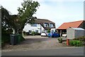
The property market in NR12 8YB functions as a predominantly owner-occupied zone. With 78% home ownership, the area consists mainly of established households rather than a transient rental sector. The accommodation type is exclusively houses, meaning you will not find flats or converted buildings for sale here. This housing stock suits buyers seeking standalone properties with private gardens and space. The low density of 71 people per square kilometre confirms a sprawling layout rather than a walk-up street. Owners in this postcode have a strong foothold in the local property scene. You compete primarily with other owner-occupiers when selling or buying homes in NR12 8YB. The market dynamics reflect stability driven by long-term residents who choose to stay. Rental demand exists but represents only about one-quarter of the total market. If you are looking for a quick turnover, this area may not suit investors seeking high yield from short-term tenants. However, the prevalence of houses provides security for families who have built their lives here. The housing inventory consists of standard family dwellings rather than luxury developments. Buyers should expect deals centred on practicality and established market value.
House Prices in NR12 8YB
Showing 1 properties
| Address | Type | Beds | Baths | Last Sale Price | Last Sale Date | |
|---|---|---|---|---|---|---|
| Accommodation At Acadamy Of Robotics Limited, Raf Neatishead, Birds Lane, Neatishead, NR12 8YB | Flat | - | - | - | - |
Energy Efficiency in NR12 8YB
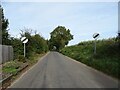
Residents of NR12 8YB enjoy access to several local amenities within practical reach. Recent shoppers utilise Morrisons Daily and Tesco Norwich for their weekly grocery requirements. These retail outlets provide essential food and household goods close to the cluster. Commuters rely on rail transport connecting them to the wider region. Hoveton & Wroxham Railway Station, Salhouse Railway Station, and Worstead Railway Station form the key transport nodes. You take trains here to reach Norwich or other coastal towns. Travelers often pass through the nearby town of Wroxham for broader services. This metro hub offers additional shopping, dining, and leisure options for those needing more than the basics. The area maintains a quiet character with these suburban services acting as the main focus. You do not need a car for all errands, though public routes rely on these specific stations. The proximity to retail keeps daily life manageable without hours spent in traffic. Residents appreciate the balance between rural living and shop access. Hoveton & Wroxham Railway Station provides a direct line for those working in the city. Salhouse Railway Station offers seasonal and regional connections.
Amenities
Schools
Families living in NR12 8YB have access to two specific primary schools. Horning Community Primary School holds a 'good' Ofsted rating and serves the local community. Neatishead Church of England Primary School carries a higher 'outstanding' Ofsted rating. Both institutions operate as primary education providers for children in the zone. You will not find secondary schools listed in the immediate vicinity of this postcode. The absence of secondary options implies that older students travel further for high school education. The mix of school targets offers parents a choice between the two established local institutions. One school meets standard expectations while the other achieves the highest rating currently assigned by inspectors. Living in NR12 8YB places you within distance of these educational resources. You send local children to either Horning Community Primary School or Neatishead Church of England Primary School. The ratings assure parents of acceptable educational standards in this rural setting. Neither school is rated as requiring improvement or failing. The presence of a 'good' school provides a safety net if the ‘outstanding’ option is full.
| Rank | School | Type | Entry gender | Ages |
|---|
Explore more schools in this area
Go to Schools tabDemographics
The community within NR12 8YB reflects a mature cross-section of society. The median age stands at 47 years, indicating that adults dominate the demographic landscape. Most residents fall into the 30 to 64 year age bracket, suggesting stable families and working professionals are common. Home ownership is high, with 78% of households owning their properties outright or with mortgage. This figure points to a quarter of the area retaining tenanted accommodation, while the outstanding majority live in owner-occupied homes. The accommodation type data confirms that houses prevail over flat-led urban developments. This pattern aligns with the low population density of 71 people per square kilometre. You will encounter a traditional suburban layout rather than modern apartment blocks. The population data shows a strong ethnic majority among the white demographic. These statistics suggest a consistent neighbourhood evolving slowly over time. The high ownership rate typically stabilises property values and reduces tenant turnover. Families with children and retirees likely make up a significant portion of the street. You do not find the rapid demographic shifts seen in Regeneration zones.
Household Size
Accommodation Type
Tenure
Ethnic Group
Religion
Household Composition
Age
Household Deprivation
NS-SEC
Explore more demographic insights in this area
Go to Demographics tabPlanning
Planning Constraints
- Flood RiskPremium
- Ramsar Wetland SitesPremium
- Area of Outstanding Natural BeautyPremium
- Protected Nature ReservePremium
- Protected WoodlandPremium