Area Overview for NR12 8XS
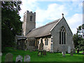
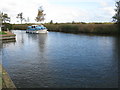
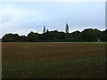
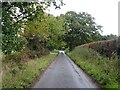
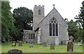
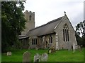
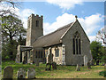
Photos of NR12 8XS
Area Information
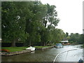
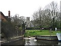
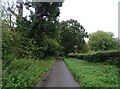
Living in NR12 8XS means residing within a specific postcode cluster that covers 84.9 hectares. This small residential setting accommodates a population of 2061 people, creating a setting with low population density of just 71 people per square kilometre. You will find yourself in an environment defined by space rather than urban sprawl. The daily rhythm here reflects the quiet nature of a rural cluster rather than a busy town centre. While the area functions as a defined boundary for administrative purposes, your actual home lies within this manageable footprint of land and houses. Residents enjoy a sense of seclusion without being cut off from essential services. The area serves as a practical example of English rural living where natural surroundings dominate the local landscape. You are part of a community where every neighbour can potentially be known, given the limited number of households. This location stands apart from larger market towns due to its focused residential nature. The character of NR12 8XS is shaped by its role as a contained housing district. Prospective buyers should view this as a distinct pocket of accommodation within the broader Norfolk region.
- Area Type
- Postcode
- Area Size
- 84.9 hectares
- Population
- 2061
- Population Density
- 71 people/km²
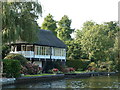
The property market in NR12 8XS is defined by a strong owner-occupier culture, where 78% of homes are privately owned. This high ownership rate indicates that the area rarely sees a significant portion of rental properties circulating on the market. The accommodation type is exclusively houses, meaning you will not find flats or terraced housing within this specific postcode cluster. This confirms NR12 8XS as a dedicated residential zone designed for families or individuals seeking detached or semi-detached living. Buyers looking in this area should expect to compete with existing owners who have a strong financial incentive to keep the property. The market consists of established rather than speculative housing stock. Your search for homes in NR12 8XS will focus on traditional house designs rather than modern apartments or conversion projects. The high ownership percentage also suggests that local estate agents may hold fewer active listings compared to high-rental zones. When viewing properties, you are looking at homes that have remained in the same family structure for an average duration.
House Prices in NR12 8XS
Showing 11 properties
| Address | Type | Beds | Baths | Last Sale Price | Last Sale Date | |
|---|---|---|---|---|---|---|
| Shoals Cottage, The Shoal, Irstead, NR12 8XS | Detached | 5 | 3 | £1,037,000 | Jul 2018 | |
| Orsteada, The Shoal, Irstead, NR12 8XS | Detached | - | - | £890,000 | Jul 2004 | |
| Irstead Cottage, The Shoal, Irstead, NR12 8XS | house | - | - | £230,000 | Jan 2001 | |
| Honeysuckle Cottage, The Shoal, Irstead, NR12 8XS | Detached | 4 | 1 | - | - | |
| Riverside, The Shoal, Irstead, NR12 8XS | Detached | 3 | 1 | - | - | |
| Ice House, The Shoal, Irstead, NR12 8XS | house | 3 | - | - | - | |
| Deek Side, The Shoal, Irstead, NR12 8XS | Detached | - | - | - | - | |
| Shoals Piece, The Shoal, Irstead, NR12 8XS | Detached | - | - | - | - | |
| Fir Tree Cottage, The Shoal, Irstead, NR12 8XS | Bungalow | - | - | - | - | |
| Little Fen, The Shoal, Irstead, NR12 8XS | Detached | - | - | - | - |
Energy Efficiency in NR12 8XS
The lifestyle for residents of NR12 8XS relies heavily on nearby amenities rather than facilities located immediately on the doorstep. You have four retail choices within practical reach, including Morrisons Daily, Tesco Norwich, and East of England Co-operative Co. These supermarkets provide essential grocery shopping and daily necessities without requiring long journeys. Beyond shopping, the area is near Wroxham, a notable metro hub that likely offers broader cultural or leisure activities. Rail connectivity is supported by three stations nearby: Hoveton & Wroxham Railway Station, Worstead Railway Station, and Salhouse Railway Station. This rail access allows you to travel to Norwich or other major cities independently. Your daily life blends rural quietude with access to established UK retail brands and transport nodes. The presence of these specific retailers and stations means you are not isolated from modern conveniences. Residents can manage their weekly shop and commute needs using these specific transport links.
Amenities
Schools
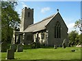
Families living in NR12 8XS have access to two primary schools located in the immediate vicinity. Horning Community Primary School is rated as 'good' by Ofsted and serves the local catchment. Neatishead Church of England Primary School holds an 'outstanding' rating from Ofsted, offering a high standard of education nearby. This mix of school types provides parents with reputable educational options without needing to travel great distances. Children in the area will attend either these established institutions or similar primary venues. The presence of an outstanding-rated school is a significant advantage for parents prioritising educational quality. You do not need to look further for primary education, as both Horning Community Primary School and Neatishead Church of England Primary School are well-regarded. The availability of both 'good' and 'outstanding' ratings suggests a competitive environment for local children. There are no secondary schools listed in the immediate data, so older children may need to travel to larger town centres for higher education.
| Rank | School | Type | Entry gender | Ages |
|---|
Explore more schools in this area
Go to Schools tabDemographics
The community in NR12 8XS reflects a settled demographic profile with a median age of 47 years. Most residents fall into the 30-64 years age range, indicating a population established in their prime working and family-raising years. Home ownership is the dominant tenure, with 78% of properties owned by their current occupants. This high figure suggests the area attracts buyers looking for stability and long-term roots rather than short-term renters. Almost the entire housing stock consists of houses, reinforcing the suburban or semi-rural character of the neighbourhood. The predominant ethnic group reported in the area is White, mirroring broader national trends in rural England. You will find a community where established families make up the bulk of the population. The low diversity in ethnicity aligns with the area's historical development as a housing zone. Residents here have likely put down roots for many years, creating a stable social fabric. The age structure means the area caters well to adults seeking a quiet environment away from the youngest children or the very elderly.
Household Size
Accommodation Type
Tenure
Ethnic Group
Religion
Household Composition
Age
Household Deprivation
NS-SEC
Explore more demographic insights in this area
Go to Demographics tabPlanning
Planning Constraints
- Flood RiskPremium
- Ramsar Wetland SitesPremium
- Area of Outstanding Natural BeautyPremium
- Protected Nature ReservePremium
- Protected WoodlandPremium