Area Overview for NR12 8XR
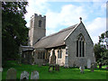
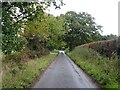
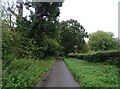
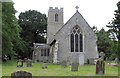
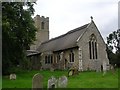
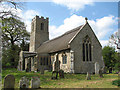
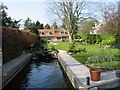
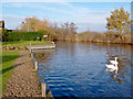
Photos of NR12 8XR
Area Information
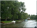
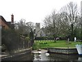
NR12 8XR is a specific postcode area covering a small residential cluster within rural Norfolk. The estate spans 74.3 hectares and is home to a population of 2,061 people. You will find that the community is spread out, resulting in a population density of just 71 people per square kilometre. This low density creates a quiet, spacious environment typical of the Norfolk countryside. The area operates as a distinct residential pocket that blends proximity to urban services with the tranquillity of open space. When you consider living in NR12 8XR, you acquire a foothold in a region defined by its rural character rather than high-density urban living. The neighbourhood functions as a contained community where residents benefit from broad green spaces and a lack of congestion. Daily life here revolves around local amenities that are within practical reach, allowing you to maintain a self-sufficient routine without long commutes to the nearest town centre. The setting is ideal for those seeking a slower pace of life while retaining access to necessary conveniences.
- Area Type
- Postcode
- Area Size
- 74.3 hectares
- Population
- 2061
- Population Density
- 71 people/km²
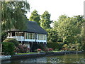
The housing stock in NR12 8XR is characterised by a dominant presence of Houses, reflecting the rural nature of this specific postcode area. With 78% of residents owning their homes, the market here is overwhelmingly owner-occupied rather than a rental sector. This high proportion of ownership means the local fabric is stable, with few tenants moving in and out of these 74.3 hectares annually. When you look at homes in NR12 8XR, you are looking at properties where owners have likely invested in maintenance and improvements over many years. The market does not feature high-rise apartments or urban flats; instead, the focus is entirely on detached or semi-detached residences suited to country living. This environment appeals to buyers who want certainty and permanence in their investment. The scarcity of rental properties suggests that demand for ownership exceeds the supply of tenanted accommodation. Consequently, the sale of a property here often involves securing a permanent home in a low-density setting. You should note that the ownership figure of 78% is exceptionally high for the UK, underscoring the area's appeal to those seeking to settle down permanently.
House Prices in NR12 8XR
Showing 11 properties
| Address | Type | Beds | Baths | Last Sale Price | Last Sale Date | |
|---|---|---|---|---|---|---|
| Southview, Shoals Road, Irstead, NR12 8XR | Detached | 4 | 4 | £315,000 | Jun 2005 | |
| Broadland House, Shoals Road, Irstead, NR12 8XR | Detached | - | - | £547,925 | Jan 2004 | |
| Herons Carr, Shoals Road, Irstead, NR12 8XR | house | - | - | £252,500 | Jun 1998 | |
| Meadow Cottage, Shoals Road, Irstead, NR12 8XR | Detached | 3 | 1 | - | - | |
| Irstead Hall, Shoals Road, Irstead, NR12 8XR | house | - | - | - | - | |
| Falgate Cottage, Irstead Hall Farm, Shoals Road, Irstead, NR12 8XR | Bungalow | - | - | - | - | |
| The Little House, Shoals Road, Irstead, NR12 8XR | Detached | - | - | - | - | |
| Wren Corner, Shoals Road, Irstead, NR12 8XR | Bungalow | - | - | - | - | |
| Irstead Lodge, Shoals Road, Irstead, NR12 8XR | Detached | - | - | - | - | |
| Poppy Field Barn, Shoals Road, Irstead, NR12 8XR | Semi-detached | - | - | - | - |
Energy Efficiency in NR12 8XR
Daily life in NR12 8XR is supported by a range of amenities within a practical distance. You will find four key retail locations serving the community's shopping needs. These include Morrisons Daily, Tesco Norwich, and the East of England Co-operative Co, ensuring you do not have to travel far for groceries and essentials. Beyond retail, the area benefits from transport links to Wroxham, a notable local hub likely offering leisure and commercial opportunities. For rail travel, the network connects you to Hoveton and Wroxham Railway Station, Worstead Railway Station, and Salhouse Railway Station, giving you flexibility in how you reach further destinations. The layout of these amenities encourages a car-free routine for local errands while retaining connectivity for longer trips. Shopping at a Co-operative or Tesco is a matter of minutes, fitting seamlessly into a rural lifestyle. The presence of a dedicated railway station in Wroxham, listed as a metro category location, suggests a central node for local activity. Your lifestyle here will be defined by convenience and the ability to blend country living with accessible services without the clutter of a busy high street.
Amenities
Schools
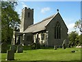
Families considering NR12 8XR have access to two highly rated primary schools within the immediate vicinity. Horning Community Primary School holds a Ofsted rating of good, providing a solid educational foundation for young children. Neatishead Church of England Primary School stands out with an outstanding Ofsted rating, offering a top-tier primary education option. Both institutions serve the rural community effectively and are small enough to offer close teacher-student relationships. The absence of secondary schools in the immediate data for this specific cluster means that high school education requires travel to larger towns. For families, this typically means a short bus journey or an active commute to nearby secondary centres. The presence of an outstanding-rated primary school is a significant asset for residents with younger children. You can rest assured that the starting point for your child's education in NR12 8XR is of a very high standard. The mix of a 'good' and an 'outstanding' primary option ensures parents have some choice without needing to move to a different zone to find quality education.
| Rank | School | Type | Entry gender | Ages |
|---|
Explore more schools in this area
Go to Schools tabDemographics
The people residing in NR12 8XR form a community with a distinctly mature profile. The median age is 47 years, confirming that Adults between 30 and 64 years represent the most common age range. This demographic suggests an area settled by families and established households rather than students or young professionals. You will find that 78% of residents have achieved home ownership, indicating a very strong sense of local community and stability. The predominant accommodation type consists of Houses, which aligns perfectly with the area's rural nature and the prevailing age of the population. While the data reflects a predominantly White ethnic group, the high ownership rate means residents are likely deeply invested in their local surroundings. The age profile means you are buying into an established neighbourhood where neighbours have likely lived there for decades. This stability often translates into safer streets and well-cared-for properties. For a buyer listening to your needs, the demographic picture shows a quiet, settled community where long-term living is the norm.
Household Size
Accommodation Type
Tenure
Ethnic Group
Religion
Household Composition
Age
Household Deprivation
NS-SEC
Explore more demographic insights in this area
Go to Demographics tabPlanning
Planning Constraints
- Flood RiskPremium
- Ramsar Wetland SitesPremium
- Area of Outstanding Natural BeautyPremium
- Protected Nature ReservePremium
- Protected WoodlandPremium