Area Overview for NR12 8UD
Photos of NR12 8UD
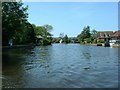
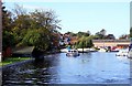
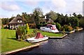
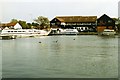
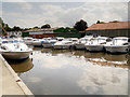
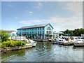
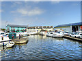

79 photos from this area
Area Information
Key information about the NR12 8UD including its size, population, and administrative classification.
- Area Type
- Postcode
- Area Size
- 3.2 hectares
- Population
- 2298
- Population Density
- 154 people/km²
House Prices in NR12 8UD
11
Properties
£306,375
Average Sold Price
£165,000
Lowest Price
£550,000
Highest Price
Showing 11 properties
| Address | Type | Beds | Baths | Last Sale Price | Last Sale Date | |
|---|---|---|---|---|---|---|
| The Beehive, Riverside Road, Hoveton, NR12 8UD | Bungalow | 3 | 2 | £550,000 | Feb 2024 | |
| 3, Bure Cottages, Riverside Road, Hoveton, NR12 8UD | Terraced | 4 | 2 | £265,500 | Apr 2015 | |
| 4, Bure Cottages, Riverside Road, Hoveton, NR12 8UD | Semi-detached | 4 | 3 | £245,000 | Dec 2011 | |
| Willow Marsh, Riverside Road, Hoveton, NR12 8UD | house | - | - | £165,000 | Mar 1998 | |
| 2, Mirabilis, Bure Cottages, Riverside Road, Hoveton, NR12 8UD | Semi-detached | 4 | 2 | - | - | |
| 5, Bure Cottages, Riverside Road, Hoveton, NR12 8UD | Terraced | 7 | - | - | - | |
| Coot, Riverside Road, Hoveton, NR12 8UD | hotel | - | - | - | - | |
| Honeypot, Riverside Road, Hoveton, NR12 8UD | Bungalow | - | - | - | - | |
| 1, Bosuns Cottage, Bure Cottages, Riverside Road, Hoveton, NR12 8UD | house | - | - | - | - | |
| Saltash, Riverside Road, Hoveton, NR12 8UD | Detached | - | - | - | - |
Page 1 of 2
Energy Efficiency in NR12 8UD
Amenities
Schools
| Rank | School | Type | Entry gender | Ages |
|---|
Explore more schools in this area
Go to Schools tabDemographics
Household Size
Two person
most common
Accommodation Type
Houses
most common
Tenure
74
majority
Ethnic Group
White
most common
Religion
N/A
most common
Household Composition
N/A
most common
Age
47
median
Elderly (65+ years)
most common
Household Deprivation
N/A
with no deprivation
NS-SEC
29
in Lower managerial occupations
Explore more demographic insights in this area
Go to Demographics tabPlanning
Planning Constraints
- Flood RiskPremium
- Ramsar Wetland SitesPremium
- Area of Outstanding Natural BeautyPremium
- Protected Nature ReservePremium
- Protected WoodlandPremium