Area Overview for NR12 8TL
Photos of NR12 8TL
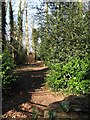
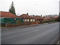
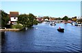
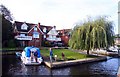

79 photos from this area
Area Information
Key information about the NR12 8TL including its size, population, and administrative classification.
- Area Type
- Postcode
- Area Size
- 2.7 hectares
- Population
- 1832
- Population Density
- 188 people/km²
House Prices in NR12 8TL
17
Properties
£620,000
Average Sold Price
£370,000
Lowest Price
£1,225,000
Highest Price
Showing 17 properties
| Address | Type | Beds | Baths | Last Sale Price | Last Sale Date | |
|---|---|---|---|---|---|---|
| 2 Hartwell Road, Wroxham, NR12 8TL | house | - | - | £370,000 | Dec 2020 | |
| Redwoods, 3 Hartwell Road, Wroxham, NR12 8TL | Detached | - | - | £460,000 | Oct 2020 | |
| Hartwell House, 17 Hartwell Road, Wroxham, NR12 8TL | Bungalow | 5 | - | £1,225,000 | Feb 2019 | |
| Broadland Villa, 7 Hartwell Road, Wroxham, NR12 8TL | Detached | - | - | £425,000 | Apr 2004 | |
| Court House, 4 Hartwell Road, Wroxham, NR12 8TL | Detached | 4 | - | - | - | |
| Cramond Lodge, 6 Hartwell Road, Wroxham, NR12 8TL | Detached | 4 | 1 | - | - | |
| Tyndale, 1 Hartwell Road, Wroxham, NR12 8TL | Detached | 4 | 2 | - | - | |
| Barton House, 19 Hartwell Road, Wroxham, NR12 8TL | Detached | - | - | - | - | |
| Annexe, Hartwell House, 17 Hartwell Road, Wroxham, NR12 8TL | Flat | - | - | - | - | |
| Ashford House, 8 Hartwell Road, Wroxham, NR12 8TL | house | - | - | - | - |
Page 1 of 2
Energy Efficiency in NR12 8TL
Amenities
Schools
| Rank | School | Type | Entry gender | Ages |
|---|
Explore more schools in this area
Go to Schools tabDemographics
Household Size
Two person
most common
Accommodation Type
Houses
most common
Tenure
79
majority
Ethnic Group
White
most common
Religion
N/A
most common
Household Composition
N/A
most common
Age
47
median
Adults (30-64 years)
most common
Household Deprivation
N/A
with no deprivation
NS-SEC
35
in Lower managerial occupations
Explore more demographic insights in this area
Go to Demographics tabPlanning
Planning Constraints
- Flood RiskPremium
- Ramsar Wetland SitesPremium
- Area of Outstanding Natural BeautyPremium
- Protected Nature ReservePremium
- Protected WoodlandPremium