Area Overview for NR12 8RX
Photos of NR12 8RX
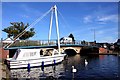
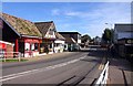
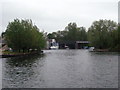
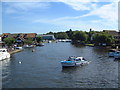
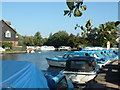
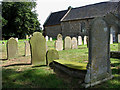
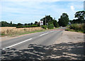
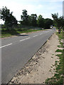
100 photos from this area
Area Information
Key information about the NR12 8RX including its size, population, and administrative classification.
- Area Type
- Postcode
- Area Size
- 7.8 hectares
- Population
- 1832
- Population Density
- 188 people/km²
House Prices in NR12 8RX
24
Properties
£245,735
Average Sold Price
£64,000
Lowest Price
£475,000
Highest Price
Showing 24 properties
| Address | Type | Beds | Baths | Last Sale Price | Last Sale Date | |
|---|---|---|---|---|---|---|
| Demaur, 65 Norwich Road, Wroxham, NR12 8RX | Bungalow | 3 | 2 | £350,000 | Jun 2025 | |
| 70 Norwich Road, Wroxham, NR12 8RX | Bungalow | - | - | £475,000 | Feb 2022 | |
| 72 Norwich Road, Wroxham, NR12 8RX | Detached | 4 | - | £420,000 | Dec 2019 | |
| 68 Norwich Road, Wroxham, NR12 8RX | Bungalow | 3 | 1 | £272,500 | Sep 2019 | |
| 60 Norwich Road, Wroxham, NR12 8RX | Bungalow | - | - | £280,000 | Aug 2018 | |
| 56 Norwich Road, Wroxham, NR12 8RX | Bungalow | 2 | - | £245,000 | Apr 2018 | |
| 52 Norwich Road, Wroxham, NR12 8RX | Bungalow | - | - | £330,000 | Apr 2017 | |
| Pightles Way, 78 Norwich Road, Wroxham, NR12 8RX | Detached | 4 | 3 | £220,000 | Mar 2017 | |
| 54 Norwich Road, Wroxham, NR12 8RX | Bungalow | 2 | - | £223,000 | Dec 2016 | |
| 62 Norwich Road, Wroxham, NR12 8RX | Bungalow | 4 | 2 | £305,000 | Mar 2016 |
Page 1 of 3
Energy Efficiency in NR12 8RX
Amenities
Schools
| Rank | School | Type | Entry gender | Ages |
|---|
Explore more schools in this area
Go to Schools tabDemographics
Household Size
Two person
most common
Accommodation Type
Houses
most common
Tenure
79
majority
Ethnic Group
White
most common
Religion
N/A
most common
Household Composition
N/A
most common
Age
47
median
Adults (30-64 years)
most common
Household Deprivation
N/A
with no deprivation
NS-SEC
35
in Lower managerial occupations
Explore more demographic insights in this area
Go to Demographics tabPlanning
Planning Constraints
- Flood RiskPremium
- Ramsar Wetland SitesPremium
- Area of Outstanding Natural BeautyPremium
- Protected Nature ReservePremium
- Protected WoodlandPremium