Area Overview for NR12 8RS
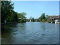
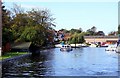
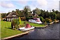
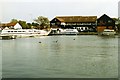
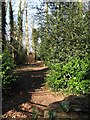
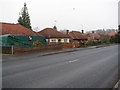
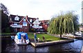
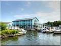
Photos of NR12 8RS


Area Information
Living in NR12 8RS offers a quiet residential experience within a compact cluster measuring just 1.9 hectares. This small neighbourhood accommodates a population of 1,832 people, creating an intimate setting where every street is familiar to the others. The area functions as a settled community rather than a sprawling suburban development, catering primarily to those seeking a low-key lifestyle away from the hustle of larger towns. Daily life here revolves around proximity to essential services rather than long commuting distances to the cluster itself. The high density of ownership and the specific layout suggest a stable environment where neighbours know one another well. Residents enjoy a peaceful atmosphere defined by its limited footprint and distinct separation from major urban centres. While the area lacks the scale of a major town centre, its character provides a sanctuary for homeowners who value privacy and established surroundings. The postcode represents a specific slice of rural Norfolk life, balancing accessibility with tranquility. Families in NR12 8RS benefit from being situated in a recognised residential zone that maintains its identity despite being part of the broader Manby and Gunton parish.
- Area Type
- Postcode
- Area Size
- 1.9 hectares
- Population
- 1832
- Population Density
- 188 people/km²
The property market in NR12 8RS is characterised by stable ownership rather than a transient rental sector. With 79% of the population owning their homes, you will find that properties in this postcode are predominantly privately owned. This high rate of home ownership transforms the local housing stock into a mix of long-term family residences passed down through generations or purchased for settlement. The accommodation type is exclusively houses, meaning you will not encounter purpose-built flats or convertibled buildings within these specific boundaries. This exclusivity appeals to buyers seeking traditional living arrangements with gardens and separate living spaces. The small area size of 1.9 hectares limits the supply of new build homes, meaning all available stock likely consists of existing properties requiring appreciation in value or renovation. For buyers looking at homes in NR12 8RS, the inventory reflects a mature market where properties are carefully tended by current owners. This demographic reality also influences resale values, as the area attracts buyers looking for permanence rather than short-term lets. The combination of high ownership and single housing types suggests a predictable market environment for investors or owner-occupiers alike.
House Prices in NR12 8RS
Showing 16 properties
| Address | Type | Beds | Baths | Last Sale Price | Last Sale Date | |
|---|---|---|---|---|---|---|
| 4 Grange Walk, Wroxham, NR12 8RS | Bungalow | 4 | - | £437,500 | Jul 2020 | |
| Victoria Croft, 24 Grange Walk, Wroxham, NR12 8RS | Bungalow | 4 | 4 | £190,000 | Jul 2019 | |
| Crosstrees, 20 Grange Walk, Wroxham, NR12 8RS | Bungalow | 3 | - | £285,000 | Nov 2016 | |
| Grange Dell, 22 Grange Walk, Wroxham, NR12 8RS | Bungalow | - | - | £275,000 | Apr 2013 | |
| 10 Grange Walk, Wroxham, NR12 8RS | house | - | - | £550,000 | Dec 2011 | |
| Midway, 12 Grange Walk, Wroxham, NR12 8RS | Chalet | 4 | 2 | £285,000 | Mar 2011 | |
| The Drift, 18 Grange Walk, Wroxham, NR12 8RS | Detached | - | - | £235,000 | Nov 2002 | |
| Fairwinds, 8 Grange Walk, Wroxham, NR12 8RS | Bungalow | 4 | 2 | - | - | |
| The Bungalow, 16 Grange Walk, Wroxham, NR12 8RS | Bungalow | 3 | 3 | - | - | |
| High Oaks, 6 Grange Walk, Wroxham, NR12 8RS | Bungalow | 3 | 2 | - | - |
Energy Efficiency in NR12 8RS
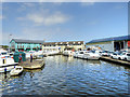
Residents of NR12 8RS enjoy convenient access to a range of amenities within practical reach, ensuring daily needs are met without extensive travel. You can shop at the East of England Co-operative Co, Lidl Sprowston, and Tesco Norwich, which provides a solid selection of groceries and daily essentials nearby. Five retail points in total offer enough variety for routine household shopping without needing a lengthy commute. For those who prefer alternative transport, four rail stations including Hoveton & Wroxham Railway Station, Salhouse Railway Station, and Worstead Railway Station connect the area to wider networks. A single metro stop in Wroxham offers additional public transport options close by. Norwich International Airport is also reachable, facilitating travel for work or leisure. These amenities create a functional suburb where essential services are clustered within a short drive or train journey. The presence of Lidl and Tesco suggests a practical, value-focused retail environment rather than high-end luxury shopping. This mix of transport hubs and supermarkets supports a lifestyle that balances the quiet of rural living with the convenience of having services nearby. Families can run errands efficiently while maintaining the relaxed pace of life defined by the area's small size.
Amenities
Schools
Families considering schools near NR12 8RS have access to the Rudolf Steiner School, a notable independent institution located in close proximity. This is the only specific school identified within the immediate data set for the area. The independent status of the Rudolf Steiner School offers an alternative educational model focused on holistic development rather than the standard state curriculum. This mix of school types provides options for parents seeking non-traditional education pathways, although state schools are not listed in the available records for this specific cluster. The presence of an independent school indicates that the surrounding parish likely supports a broader range of educational facilities beyond the immediate postcode boundary. Families must look beyond NR12 8RS for comprehensive state primary or secondary options, as the nearest data point highlights only the Rudolf Steiner School. The independence of this institution suggests higher tuition fees but potentially more flexible educational philosophies. When planning for children, you should verify transport links and catchment areas, as the school's location relative to the 1.9-hectare cluster may require travel for many local families.
| Rank | School | Type | Entry gender | Ages |
|---|
Explore more schools in this area
Go to Schools tabDemographics
The community in NR12 8RS is dominated by adults between the ages of 30 and 64, reflecting a mature demographic profile. The median age of 47 indicates that this area attracts families with grown children or established professionals rather than young students or empty nesters. A remarkable 79% of residents own their homes outright or with a mortgage, pointing to a deeply rooted community where people have made a long-term commitment to the neighbourhood. The housing stock consists almost entirely of houses, with no flats or conversion buildings recorded within these bounds. This housing type aligns perfectly with the demographic, supporting family life and extended households. The predominant ethnic group is White, consistent with the broader rural profile of East Anglia. With 1,832 residents spread across 1.9 hectares, the population density reaches 188 people per square kilometre. While this figure seems moderate, it feels more intimate due to the lack of high-rise living. The stability shown by high home ownership rates suggests that this area includes households that have stayed through market cycles, creating a reliable and consistent social fabric for anyone considering buying a home here.
Household Size
Accommodation Type
Tenure
Ethnic Group
Religion
Household Composition
Age
Household Deprivation
NS-SEC
Explore more demographic insights in this area
Go to Demographics tabPlanning
Planning Constraints
- Flood RiskPremium
- Ramsar Wetland SitesPremium
- Area of Outstanding Natural BeautyPremium
- Protected Nature ReservePremium
- Protected WoodlandPremium