Area Overview for NR12 8DG
Photos of NR12 8DG


Area Information
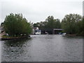
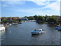
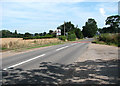
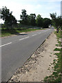
NR12 8DG represents a specific residential cluster within Norfolk with a defined character shaped by its size and population. The area covers 1.6 hectares and is home to 2298 people. You will find that living in NR12 8DG offers a compact environment, which fosters a close-knit community feel despite the small land area. The density of 154 people per square kilometre indicates a moderate spread of dwellings without the congestion of high-density urban zones. This postcode identifies a settlement designed for residents who value proximity to neighbours without sacrificing space. Daily life here revolves around the practicalities of a established residential zone rather than a vibrant nightlife or commercial hub. The area functions as a quiet domestic space where locally based individuals manage their daily routines with ease. Because the location is so specific, you cannot find a wide variety of tall buildings or large shopping centres within the immediate boundaries. Instead, the experience of living in NR12 8DG is defined by access to the immediate surroundings and the wider networks of transport and services that connect it to the rest of the region. This postcode covers a small residential cluster that prioritises housing stability over competitive commercial development.
- Area Type
- Postcode
- Area Size
- 1.6 hectares
- Population
- 2298
- Population Density
- 154 people/km²
The property market in NR12 8DG is characterised by a strong bias towards owner-occupiers. Seven out of every ten households in this postcode own their homes outright or have a mortgage, while only a minority rent. This statistic signifies that the area benefits from high levels of stability and long-term residency. The accommodation type is almost exclusively houses, which aligns with the demographic trend of older residents and those seeking permanent family bases. You will not find a significant proportion of purpose-built rental units or temporary accommodation in this small 1.6 hectare cluster. For prospective buyers, the high home ownership rate of 74% indicates that asking prices often reflect significant investment by previous owners who have maintained the properties through their tenure. The lack of rental market data suggests that the housing stock is predominantly designed for permanent living rather than short-term lets. When seeking homes in NR12 8DG, you are entering a market where properties have likely been lived in for many years by the same families. This creates a neighbourhood where residents know each other and where property values may be influenced by the established nature of the stock rather than speculative development.
House Prices in NR12 8DG
Showing 15 properties
| Address | Type | Beds | Baths | Last Sale Price | Last Sale Date | |
|---|---|---|---|---|---|---|
| 9 Stalham Road, Hoveton, NR12 8DG | house | 5 | 2 | £570,000 | Sep 2025 | |
| The Moorings, 7 Stalham Road, Hoveton, NR12 8DG | Bungalow | 3 | 2 | £450,000 | Oct 2023 | |
| 5 Stalham Road, Hoveton, NR12 8DG | Retail | 5 | 2 | £465,000 | Apr 2022 | |
| 22 Stalham Road, Hoveton, NR12 8DG | Bungalow | 3 | 2 | £350,000 | Aug 2017 | |
| Wayside Cottage, 11A Stalham Road, Hoveton, NR12 8DG | Bungalow | 2 | - | £315,000 | Aug 2016 | |
| Woodthorpe, 24 Stalham Road, Hoveton, NR12 8DG | Bungalow | - | - | £248,000 | Oct 2012 | |
| 18 Stalham Road, Hoveton, NR12 8DG | Detached | 3 | 1 | £173,500 | Oct 2006 | |
| 14 Stalham Road, Hoveton, NR12 8DG | Detached | - | - | £235,000 | Apr 2005 | |
| Cairnsmore, 13A Stalham Road, Hoveton, NR12 8DG | Detached | - | - | £265,000 | Jan 2004 | |
| St Cecilia, 26 Stalham Road, Hoveton, NR12 8DG | Bungalow | - | - | £245,000 | Dec 2002 |
Energy Efficiency in NR12 8DG
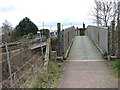
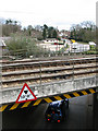
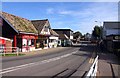
The lifestyle in NR12 8DG is defined by convenience to local amenities while maintaining a residential focus. Within practical reach, you have access to four railway stations including Hoveton & Wroxham Railway Station, Salhouse Railway Station, and Worstead Railway Station. These rail links provide vital connections to Norwich and beyond without requiring you to own a car for every journey. There is also one metro-style railway station at Wroxham, further enhancing public transport options for this specific postcode. For daily shopping needs, five retail centres are nearby. Notable options include the East of England Co-operative Co, Lidl Sprowston, and Tesco Norwich. These supermarkets ensure you can stock up on groceries and household essentials without traveling excessive distances. While there is no mention of major leisure complexes or cinemas within the small 1.6 hectare area, the proximity to reliable retail and rail infrastructure supports a self-sufficient local character. Living in NR12 8DG means enjoying the quiet of a residential cluster while having reliable access to established high-street retailers and railway stations for regional travel. This balance makes the area suitable for those who value public transport and regular shopping trips over immediate access to nightlife or entertainment venues.
Amenities
Schools
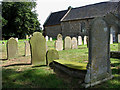
Families considering schools near NR12 8DG have access to several educational institutions in the immediate vicinity. The nearest primary education option is St John's Community Primary School and Nursery, which holds a good Ofsted rating. This school provides both primary education and nursery facilities, offering a comprehensive base for young children within the local area. Another listed primary institution is Broadland High School, which serves the early years of compulsory education for pupils in the wider catchment. For secondary education, the area looks towards Broadland High Ormiston Academy. This academy provides senior schooling and represents the main local option for older students. The presence of these specific schools indicates that you can draw on established local education providers without needing to travel far for your children's schooling. The mix of a primary school with a good rating and an academy for secondary education provides a complete local pathway for families residing in NR12 8DG. Residents do not need to rely heavily on boarding schools or institutions located in distant market towns, as the necessary facilities for primary and secondary education are listed as available nearby options.
| Rank | School | Type | Entry gender | Ages |
|---|
Explore more schools in this area
Go to Schools tabDemographics
The community within NR12 8DG displays a distinct age profile skewed towards older residents. The median age stands at 47 years, and the most common age range comprises elderly people aged 65 years and over. These figures indicate that the area attracts retirees or older families who have sought a comfortable later life in Norfolk. With 74% home ownership, the vast majority of households have purchased their properties rather than renting. This high level of ownership suggests long-term residents who are settled in their homes and invested in the local stability of the neighbourhood. The predominant ethnicity in NR12 8DG is White, reflecting a homogenous demographic typical of many rural and semi-rural English settlements. The accommodation type is overwhelmingly houses, meaning you will find detached or semi-detached residential buildings rather than flats or maisonettes. This housing stock supports family life and independent living arrangements suited to older demographics. The low population density of 154 people per square kilometre contributes to a quieter atmosphere compared to bustling town centres. When considering homes in NR12 8DG, you are looking at an area defined by stable, owner-occupied households living in substantial houses rather than high-rise apartments.
Household Size
Accommodation Type
Tenure
Ethnic Group
Religion
Household Composition
Age
Household Deprivation
NS-SEC
Explore more demographic insights in this area
Go to Demographics tabPlanning
Planning Constraints
- Flood RiskPremium
- Ramsar Wetland SitesPremium
- Area of Outstanding Natural BeautyPremium
- Protected Nature ReservePremium
- Protected WoodlandPremium