Area Overview for NR12 8DP
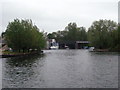
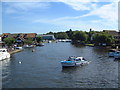
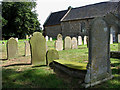
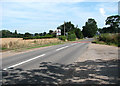
Photos of NR12 8DP


Area Information
Living in NR12 8DP offers a quiet residential experience defined by its compact scale and established character. This specific postcode covers just 7.3 hectares, creating an intimate, clustered neighbourhood rather than a sprawling district. You will find a population of 2,298 people spread across this small footprint, resulting in a density of 154 people per square kilometre. This suggests a close-knit environment where neighbours likely know one another, as the population is not densely packed but rather spread across established housing clusters. The area represents a residential enclave within the broader Norwich postcode region, offering a sense of privacy without complete isolation from nearby services. Daily life here is governed by the rhythms of a mature community, where the convenience of local amenities balances with the benefit of limited traffic compared to larger urban centres. Whether you seek a tranquil home or a village feel, this postcode delivers a focused living space that prioritises domestic stability over high-energy urban spectacle.
- Area Type
- Postcode
- Area Size
- 7.3 hectares
- Population
- 2298
- Population Density
- 154 people/km²
Homes in NR12 8DP are characterised by a market dominated by owner-occupiers rather than investors or private landlords. With 74% of households owning their homes, you will find a neighbourhood where residents have a vested long-term interest in the local estate and its upkeep. The primary accommodation type comprises houses, which aligns with the area's high home ownership percentage and mature demographic. This housing stock likely consists of detached, semi-detached, or terraced properties built over several decades, catering to families and retirees alike. Given the small area size of just 7.3 hectares, new developments are limited, meaning the supply of fresh housing is consistent with the available space. Buyers looking at this postcode should expect a market driven by existing stock rather than new builds. The high ownership rate implies that sellers in this area are often motivated by life changes such as retirement moves rather than quick financial turnovers. Consequently, property values here likely reflect steady, organic growth tied to local demand and the limited supply of land available for expansion.
House Prices in NR12 8DP
Showing 50 properties
| Address | Type | Beds | Baths | Last Sale Price | Last Sale Date | |
|---|---|---|---|---|---|---|
| 25 Waveney Drive, Hoveton, NR12 8DP | Bungalow | 4 | - | £540,000 | Nov 2025 | |
| 24 Waveney Drive, Hoveton, NR12 8DP | Bungalow | - | - | £575,000 | Aug 2025 | |
| 23 Waveney Drive, Hoveton, NR12 8DP | Bungalow | 3 | 2 | £472,500 | Aug 2025 | |
| 26 Waveney Drive, Hoveton, NR12 8DP | Bungalow | 3 | 2 | £670,000 | Mar 2025 | |
| 37 Waveney Drive, Hoveton, NR12 8DP | Bungalow | 4 | 2 | £400,000 | Mar 2025 | |
| 6 Waveney Drive, Hoveton, NR12 8DP | Bungalow | 3 | 1 | £390,000 | Apr 2023 | |
| 34 Waveney Drive, Hoveton, NR12 8DP | Bungalow | 3 | 1 | £425,000 | Jan 2023 | |
| 13 Waveney Drive, Hoveton, NR12 8DP | Retail | 4 | 2 | £550,000 | Sep 2022 | |
| 28 Waveney Drive, Hoveton, NR12 8DP | Semi-detached | 4 | - | £460,000 | Aug 2022 | |
| 12 Waveney Drive, Hoveton, NR12 8DP | Bungalow | 3 | - | £350,000 | Sep 2021 |
Energy Efficiency in NR12 8DP
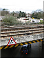
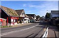
Residents in NR12 8DP enjoy convenient access to a range of transport and retail hubs without needing to travel far into the city centre. Within practical reach, you can find three railway stations including Hoveton & Wroxham Railway Station, Salhouse Railway Station, and Worstead Railway Station, facilitating easy rail connections for commuting or weekend trips. Retail options include East of England Co-operative Co, Lidl Sprowston, and Tesco Norwich, ensuring you have access to groceries and essential shopping needs without a long drive. The nearest metro area is Wroxham, located just one unit away in the dataset indices, offering wider leisure and dining possibilities. This concentration of transport links and supermarkets means that daily errands are manageable by car or potentially by foot depending on the specific location within the postcode. The amenities listed provide a self-contained lifestyle where major shopping and local transit needs are met without significant travel time.
Amenities
Schools
For families considering NR12 8DP, several educational institutions operate within practical reach, offering a mix of primary and secondary education options. You have access to St John's Community Primary School and Nursery, which holds a 'good' Ofsted rating, suggesting a reliable standard of education for younger children. Nearby, you will find Broadland High School and Broadland High Ormiston Academy, both providing secondary education for older students. While Specifics regarding the Ofsted ratings for Broadland High School and Broadland High Ormiston Academy are not included in the provided data, their presence indicates a robust educational infrastructure supporting the local community. The combination of a highly-rated primary school with academy-sponsored high schools provides a comprehensive pathway for children growing up in the neighbourhood. This mix of school types ensures that regardless of your specific educational philosophy preferences, there are established institutions readily available to serve the needs of local children.
| Rank | School | Type | Entry gender | Ages |
|---|
Explore more schools in this area
Go to Schools tabDemographics
The community within NR12 8DP reflects a settled, mature population with distinct characteristics regarding age and housing stability. The median age is 47 years, indicating that the majority of residents are mid-life adults rather than young families or retirees. Indeed, the most common age group falls into the elderly category, with the highest concentration of residents being those aged 65 years and older. This demographic profile points towards a suburb historically favoured by those looking to downsize or who have lived there since their working years. Home ownership stands at a very high rate of 74%, confirming that this is overwhelmingly an owner-occupied area rather than a letting market. Almost three-quarters of households own their property outright or with a mortgage, which suggests long-term stability and financial investment in the neighbourhood. The majority of accommodation consists of houses, fitting the profile of a traditional family or retirement suburb. Predominantly, the ethnic makeup is White, aligning with typical patterns in many Norfolk rural and semi-rural satellite towns.
Household Size
Accommodation Type
Tenure
Ethnic Group
Religion
Household Composition
Age
Household Deprivation
NS-SEC
Explore more demographic insights in this area
Go to Demographics tabPlanning
Planning Constraints
- Flood RiskPremium
- Ramsar Wetland SitesPremium
- Area of Outstanding Natural BeautyPremium
- Protected Nature ReservePremium
- Protected WoodlandPremium