Area Overview for NR12 8DB
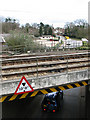
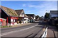
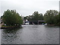
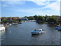
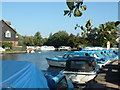
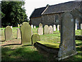
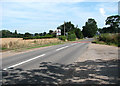
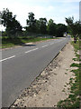
Photos of NR12 8DB

Area Information
Living in NR12 8DB offers a quiet residential experience characterised by low population density. This postcode covers a specific residential cluster comprising approximately 4,658 square metres, which supports a population of 2,298 people. Consequently, the area maintains a density of 154 people per square kilometre, creating a distinctively calm environment compared to larger urban centres. You will find that daily life here is defined by proximity and space rather than bustling high streets or crowded public squares. The setting functions as a settled neighbourhood where residents value privacy and a close-knit community feel. As a small residential area, NR12 8DB does not operate like a major town; instead, it serves as a peaceful location for those seeking a slower pace. The limited physical footprint means that green spaces and quiet streets permeate the entire locality. For someone considering homes in NR12 8DB, the primary appeal lies in this manageable scale and the absence of overcrowding. You can expect a neighbourhood where the built environment is compact, allowing for easy access to local features without the noise and congestion often found in more densely populated zones. This makes it an attractive option for buyers who prioritise tranquility over extensive urban infrastructure.
- Area Type
- Postcode
- Area Size
- 4658 m²
- Population
- 2298
- Population Density
- 154 people/km²
The property market in NR12 8DB is defined by a predominance of owner-occupation and traditional housing stock. With 74% of residents owning their homes, this area functions largely as a market for existing homeowners rather than a hub for private landlords or first-time buyer investments. This high ownership rate implies that the housing stock consists mainly of long-term residents who have likely lived there for years. The accommodation type is exclusively houses, meaning you will not find apartment blocks or terraced rows typical of younger, denser urban developments. This structural reality limits development potential within the current footprint of the postcode and reinforces the character of a permanent, established residential zone. For buyers looking at homes in NR12 8DB, the opportunity often involves purchasing from owners looking to downsize or move elsewhere, rather than navigating a competitive bidding war for new builds. The small area size of 4,658 square metres further constrains the supply of available properties, which can influence local pricing and availability. While the market does not feature the volatility of rental-heavy zones, the lack of rental stock means fewer options for investors looking for short-term lets. Your search here will focus on the existing, mixed inventory of houses that cater to families or couples with no plans to move frequently. This market structure offers stability but requires patience to find a property that suits specific spatial requirements.
House Prices in NR12 8DB
No properties found in this postcode.
Energy Efficiency in NR12 8DB
Your daily lifestyle in NR12 8DB relies heavily on practical amenities located within a short travel radius. Convenient retail options include the East of England Co-operative Co and the Lidl Sprowston, both situated nearby for essential grocery shopping. For those requiring larger supermarkets, the Tesco Norwich is accessible within practical reach, providing a broader range of products and household goods. Transport links are managed through four railway stations in the vicinity, including Hoveton & Wroxham Railway Station, Salhouse Railway Station, and Worstead Railway Station. These stations provide rail connectivity for commuters and travellers. Additionally, Wroxham serves as a notable metro link point, offering another route for public transport access. While NR12 8DB itself is a quiet residential cluster, these nearby facilities ensure that your needs for food and transport are met without leaving the immediate region. The combination of cooperative and discount retailers alongside larger chains caters to a wide range of shopping preferences. Rail access allows you to connect with wider networks without needing a private vehicle for every journey. Living in NR12 8DB means balancing the quiet of your home with the convenience of these established amenities within reach.
Amenities
Schools
Families seeking education options near NR12 8DB have access to a specific mix of academic institutions. The area is primarily supported by St John's Community Primary School and Nursery, which holds a good Ofsted rating. This establishment offers both primary education and nursery care, providing a continuous educational thread for younger children. In addition to the rated institution, there are other local educational facilities including Broadland High School and Broadland High Ormiston Academy. Broadland High School functions as a primary school, offering an additional layer of local primary education for younger age groups. Broadland High Ormiston Academy operates as an academy, which typically grants it greater freedom in curriculum and management compared to maintained schools. This arrangement gives parents several choices within the immediate vicinity, though the distribution suggests a focus on primary education rather than a broad spectrum of secondary options within walking distance. The presence of these schools supports families who wish their children to remain close to home. While St John's holds a formal good rating, the other institutions provide essential community education services. Prospective buyers must note that the proximity to these specific schools is a key asset for those prioritising local education in their housing decision.
| Rank | School | Type | Entry gender | Ages |
|---|
Explore more schools in this area
Go to Schools tabDemographics
The community within NR12 8DB has a clear demographic profile shaped by an older population. The median age stands at 47, with the elderly group aged 65 and over representing the most common age range. This statistical reality indicates a neighbourhood where life is often centred around retirement or the later stages of career and family life. Social dynamics in NR12 8DB are likely to reflect the needs of this older demographic, such as convenient access to medical services and a preference for quieter surroundings. Home ownership is a defining feature of the community, with 74% of residents owning their properties. This high level of ownership suggests a stable population with deep local roots and long-term commitment to the neighbourhood. The area consists predominantly of houses, which aligns with the preference for spacious living environments typical of older households. Ethnic diversity is currently low, as the predominant ethnic group is White. This homogeneity contributes to a uniform cultural character within NR12 8DB. Understanding these figures helps you appreciate that the area is not a young, rapidly growing hub but a mature settlement. The combination of an older population and high home ownership rates creates a stabilising effect on property values and local infrastructure needs.
Household Size
Accommodation Type
Tenure
Ethnic Group
Religion
Household Composition
Age
Household Deprivation
NS-SEC
Explore more demographic insights in this area
Go to Demographics tabPlanning
Planning Constraints
- Flood RiskPremium
- Ramsar Wetland SitesPremium
- Area of Outstanding Natural BeautyPremium
- Protected Nature ReservePremium
- Protected WoodlandPremium