Area Overview for NR12 8BH
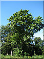
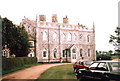
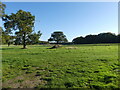
Photos of NR12 8BH

Area Information
The neighbourhood defined by postcode NR12 8BH spans 55.8 hectares and accommodates a population of 2,298 residents. Living in NR12 8BH offers a compact residential experience with a density of 154 people per square kilometre. This small footprint ensures that daily life remains intimate and manageable. The low population density creates a quiet environment where neighbours know each other well. You will find the settlement functions as a self-contained cluster rather than a sprawling town. Homes here are arranged to prioritise resident comfort over high-traffic commercialzones. The area is designed for people who value proximity to green space without isolation. Daily errands take minimal effort because the footprint is so limited.
- Area Type
- Postcode
- Area Size
- 55.8 hectares
- Population
- 2298
- Population Density
- 154 people/km²
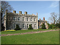
The housing stock in NR12 8BH is dominated by traditional British family homes. Every property in this postcode falls under the category of houses. This exclusion of flats or multi-unit complexes defines the architectural character of the area. You will find a consistent roofline and garden space across the neighbourhood. The market is overwhelmingly owner-occupied rather than rental-focused. A staggering 74% of residents hold their property deeds. This statistic indicates a mature market where families stay for generations. You will rarely encounter speculators flipping properties for quick profit. Instead, you will meet sellers who have lived here for decades.
House Prices in NR12 8BH
Showing 1 properties
| Address | Type | Beds | Baths | Last Sale Price | Last Sale Date | |
|---|---|---|---|---|---|---|
| Keepers Cottage, Beeston Park, The Street, Neatishead, NR12 8BH | Detached | - | - | - | - |
Energy Efficiency in NR12 8BH
Daily life in NR12 8BH involves short trips to key amenities. You can reach the town of Wroxham within practical distance. This nearby town serves as a minor metropolitan hub for regional needs. For rail commuters, there are three stations close to you. These include Hoveton & Wroxham Railway Station, Worstead Railway Station, and Salhouse Railway Station. Train travel connects you to Norwich and London efficiently. Retail options include Tesco Norwich and Morrisons Daily. These supermarkets open the door to fresh food and household essentials. You do not need to travel far for groceries. The layout supports a drive-to lifestyle without overwhelming commutes. Your day-to-day convenience relies on these nearby transport links and shops.
Amenities
Schools
Families moving to NR12 8BH rely on surrounding educational institutions. The nearest primary school is St John's Community Primary School and Nursery. Carers will find this site holds a Good rating from Ofsted. Another option for younger children is Broadland High School. As children grow, they can matriculate to Broadland High Ormiston Academy. This academy serves as a key secondary education provider nearby. The mix of primary and academy organisations ensures continuity of care. You can choose schools that match your pedagogical preferences. These institutions serve the wider region surrounding the NR12 8BH cluster. They provide a standard of education that parents trust.
| Rank | School | Type | Entry gender | Ages |
|---|
Explore more schools in this area
Go to Schools tabDemographics
The community in NR12 8BH is defined by an older demographic profile. The median age for residents here is 47 years. Most commonly, the population consists of elderly individuals aged 65 years and over. This age structure influences the vibe of the neighbourhood and the services required. It is a quiet place suitable for retirement or later-life living. You will find that 74% of the residents own their homes outright. This high rate of ownership suggests stability and a lack of high-turnover rentals. The accommodation types in NR12 8BH are exclusively houses. There are no flats or converted apartment blocks within this postcode area. The predominant ethnic group is White, reflecting a long-established community makeup. These demographics create a cohesive society where shared values and life stages align. You will encounter a stable voting bloc and neighbours who have put down deep roots.
Household Size
Accommodation Type
Tenure
Ethnic Group
Religion
Household Composition
Age
Household Deprivation
NS-SEC
Explore more demographic insights in this area
Go to Demographics tabPlanning
Planning Constraints
- Flood RiskPremium
- Ramsar Wetland SitesPremium
- Area of Outstanding Natural BeautyPremium
- Protected Nature ReservePremium
- Protected WoodlandPremium