Area Overview for NR12 8AW
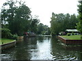
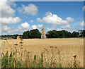
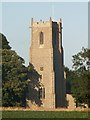
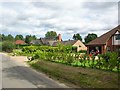
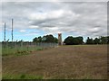
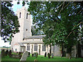
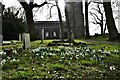
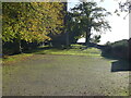
Photos of NR12 8AW
Area Information
Living in NR12 8AW offers a quiet residential experience within a small cluster covering approximately 71 people per square kilometre. The area serves over 2,000 residents, creating a distinctly village-like atmosphere where neighbours know one another. Daily life here is defined by proximity rather than urban density, allowing you to enjoy a slower pace without total isolation. You are situated in a setting where the built environment gives way quickly to open space, meaning your view often extends beyond your immediate garden. This postcode represents a specific residential pocket rather than a sprawling town, which limits immediate access to major city centres but enhances the sense of privacy you might seek. Your days in this location likely involve walking to local facilities or driving short distances to access larger amenities like Wroxham, which sits nearby as your nearest metro point. The low population density ensures that noise levels remain minimal, making it an ideal location if you value silence. You are not competing with high-rise towers or crowded streets, but instead sharing your neighbourhood with roughly 2,006 fellow residents. This scale provides a manageable community feel where local events and news travel quickly. Whether you are pulling into a driveway or stepping onto a plot of land, the context of NR12 8AW is one of contained domesticity, far removed from the rush of larger urban hubs.
- Area Type
- Postcode
- Area Size
- Not available
- Population
- 2061
- Population Density
- 71 people/km²
The property market in NR12 8AW is heavily skewed towards owner-occupation, with 78% of homes owned by their current residents. This statistic paints a clear picture for you as a potential buyer: the local housing stock is not a transient rental market but a settled portfolio of family homes. Every house in this postcode likely has been tended by an owner for some time, resulting in a community well-maintained by personal investment rather than corporate standards. The accommodation type is exclusively houses, so you will not find apartment blocks, shared ownership flats, or maisonettes for sale here. When you consider buying a home in NR12 8AW, you are entering a market where sellers are often living in the property they intend to sell. This creates a distinct dynamic where negotiations might differ from larger cities because buyers are competing against people who wish to stay. The low number of properties available, combined with a small total population of 2,061, means inventory is scarce. If you decide to move here, you may need to be flexible on timing or look in the immediate postcodes surrounding NR12 8AW to find what you require. The high ownership rate also indicates that the area is less likely to see rapid turnover or speculative flipping, providing a degree of stability in property values.
House Prices in NR12 8AW
No properties found in this postcode.
Energy Efficiency in NR12 8AW
Your lifestyle in NR12 8AW benefits from a selection of practical amenities reachable without excessive travel. Supermarket access is covered by two notable retailers: Tesco Norwich and Morrisons Daily. These stores provide the essential food shopping and daily convenience goods you expect in any modern household. While a full leisure complex is absent, Wroxham sits nearby as your nearest metro location, offering a broader range of cultural, dining, and entertainment options if you are willing to drive a short distance. You do not need to travel far to secure your essentials, as the local retail count of two major chains ensures your weekly shop is never far away. The area itself does not list parks or specific leisure centres within the immediate data, meaning your green space comes from the surrounding countryside typical of this density. Your social and retail life revolves around these two supermarkets and the rail hubs that give you access to Hoveton and Wroxham, Worstead, and Salhouse stations. For you, living in NR12 8AW means a self-sufficient home life with a quick drive to the wider world. You can find everything you need for daily living within your postcode or a brief journey to the nearest town centre. The character of your daily life is defined by this balance: complete convenience locally, but freedom to explore further afield quickly.
Amenities
Schools
For families considering NR12 8AW, the local education provision is supported by two primary schools with strong official ratings. The Horning Community Primary School operates nearby with an Ofsted rating of good, indicating a solid foundation for children's learning. Additionally, you have the Neatishead Church of England Primary School in your neighbourhood, which holds an outstanding Ofsted rating. This external recognition places it in the highest performance category, suggesting high standards in teaching and student care. Having two options of this caliber means you do not need to travel far to secure a good education for your children. Both institutions are primary schools, meaning they cater to children from age four up to the start of secondary education. You are likely to find a mix of denominational and community schooling options within reach of NR12 8AW, offering you choice regarding your child's upbringing without the need for daily long-distance travel. The presence of an outstanding-rated school significantly boosts the desirability of the area for parents who prioritise educational excellence. You can expect a structured learning environment close to home, reducing commute times for your children between school and safety.
| Rank | School | Type | Entry gender | Ages |
|---|
Explore more schools in this area
Go to Schools tabDemographics
The community within NR12 8AW is dominated by adults aged between 30 and 64 years, pointing towards families and established professionals rather than students or the elderly. The median age sits at 47 years, confirming that this area attracts households at the midpoint of their adult life. Consequently, you will find most neighbours have likely settled here for a significant period, resulting in a stable and long-term population. Home ownership is firmly entrenched, with 78% of residents owning their property outright or with a mortgage. This high figure suggests that many families have remained in their homes through various life stages, building deep roots in the locality. Almost all residents live in houses, meaning the terrace or flat living common in cities is absent from your daily surroundings. The predominant ethnic group is White, reflecting the traditional demographic makeup of the region. You are living in an area where housing is tailored to family living rather than investor rentals or luxury apartments. This demographic profile often correlates with lower deprivation, as owner-occupiers tend to maintain their properties well and participate in local governance. The absence of a younger under-30 cohort means the area might lack the vibrancy of a student hub, but it offers a quieter, more settled environment. For you, the resident, this means a predictable community where local shops and schools serve consistent, long-term needs rather than fluctuating student demands.
Household Size
Accommodation Type
Tenure
Ethnic Group
Religion
Household Composition
Age
Household Deprivation
NS-SEC
Explore more demographic insights in this area
Go to Demographics tabPlanning
Planning Constraints
- Flood RiskPremium
- Ramsar Wetland SitesPremium
- Area of Outstanding Natural BeautyPremium
- Protected Nature ReservePremium
- Protected WoodlandPremium