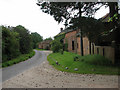
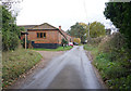
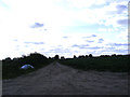
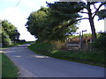
Area Overview for NR10 4QG
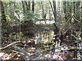
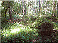
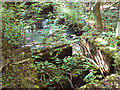
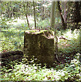
Photos of NR10 4QG
Area Information
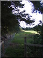
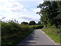
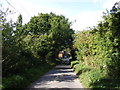
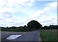
NR10 4QG sits within a defined postcode area that covers a specific residential cluster of 30.4 hectares. You will find a population of 1,259 people living here, which creates a quiet and intimate community atmosphere. With a density of 29 people per square kilometre, the streets are spread out rather than crowded. This layout suits anyone who values space and a slower pace of life over urban convenience. The area is situated in England, offering a stable environment for those seeking a calmer alternative to city centres. Living in NR10 4QG means you are part of a small, cohesive neighbourhood where residents likely know one another. The compact nature of this residential cluster ensures that daily commutes and local journeys are straightforward. You do not face the noise or congestion typical of larger towns. Instead, you enjoy a setting where the focus remains on the home and the immediate surroundings. This small scale defines the character of daily life here, providing a sense of stability for families and individuals alike.
- Area Type
- Postcode
- Area Size
- 30.4 hectares
- Population
- 1259
- Population Density
- 29 people/km²
The housing market in NR10 4QG is dominated by owner-occupiers. With 75% of homes owned outright or with a mortgage, this area is not a hub for student rentals or short-term lets. Instead, it appeals to people looking to put down roots in a specific postcode. The primary accommodation type found here is houses, consistent with the rural and semi-rural feel of the local landscape. You will mostly encounter detached or semi-detached properties rather than the flats common in larger cities. Smaller homes dominate the stock compared to the houses found in denser urban centres. This means property values here track closely with local market movements and rental demand families. Buying a home in NR10 4QG often means joining an established community of long-term residents. The low density of 29 people per square kilometre ensures that larger properties have space around them. There is minimal competition from large blocks of social housing or private rental schemes. This creates a predictable market environment where buyers are often neighbours or people working in the area.
House Prices in NR10 4QG
Showing 2 properties
| Address | Type | Beds | Baths | Last Sale Price | Last Sale Date | |
|---|---|---|---|---|---|---|
| 9, Mole Cottage, Barn Hill, Green Lane, Haveringland, NR10 4QG | Semi-detached | - | - | - | - | |
| 8, Barn Hill, Green Lane, Haveringland, NR10 4QG | Semi-detached | - | - | - | - |
Energy Efficiency in NR10 4QG
Daily life in NR10 4QG revolves around a few key amenities within practical reach. You have access to three major supermarkets, including East of England Co-operative, Lidl Taverham, and Tesco Thorpe Mariott. These options ensure you can buy groceries without travelling far. There are five retail outlets nearby, offering essential goods and basic convenience. For transport links, a railway station in Aylsham is just one metro stop away. This provides a straightforward link to Norwich and other larger centres. Norwich International Airport is also available for travel needs. While the local amenities are modest, they cover the essential requirements of shopping and travel. You will find a quiet, functional lifestyle rather than a vibrant high street experience. The small number of commercial sites reflects the residential nature of the area. This setup works well for those who prefer their shopping trips to be quick and efficient. You do not need a car for basic needs, though owning one is likely given the rural setting.
Amenities
Schools
| Rank | School | Type | Entry gender | Ages |
|---|
Explore more schools in this area
Go to Schools tabDemographics
The community in NR10 4QG is defined by a settled demographic profile. The median age is 47 years, indicating that adults between the ages of 30 and 64 make up the most common age range. You are therefore likely to see more grown-ups raising families or enjoying retirement than children or very young adults. This age structure suggests a neighbourhood favoured by those who have established their careers or lives. Home ownership is high, standing at 75%. The vast majority of houses are owner-occupied rather than rented, which often translates to greater stability for both residents and the local market. The predominant ethnic group is White, reflecting the traditional character of many parts of Norfolk. Most people live in detached or semi-detached houses rather than flats or terraced homes. This accommodation type supports the family-oriented nature of the community. There is no high deprivation data recorded, which aligns with the strong home ownership rates and stable population. You can expect a quiet, established environment rather than a rapidly changing or struggling area.
Household Size
Accommodation Type
Tenure
Ethnic Group
Religion
Household Composition
Age
Household Deprivation
NS-SEC
Explore more demographic insights in this area
Go to Demographics tabPlanning
Planning Constraints
- Flood RiskPremium
- Ramsar Wetland SitesPremium
- Area of Outstanding Natural BeautyPremium
- Protected Nature ReservePremium
- Protected WoodlandPremium