Area Overview for NR10 5NW
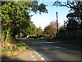
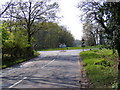
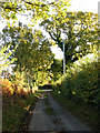
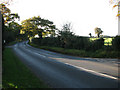
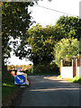
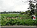
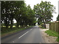
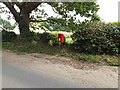
Photos of NR10 5NW


Area Information
NR10 5NW represents a specific postcode area covering a small residential cluster just outside Norwich. This locality spans 39.6 hectares and currently accommodates a population of 1,259 people. The low density of 29 people per square kilometre defines a quiet, unconfined setting where homes sit further apart than in dense urban centres. Living in NR10 5NW means embracing a neighbourhood character shaped by significant open space rather than continuous development. Although the area contains only 125 residents per hectare, it remains part of the broader Norfolk county structure. You will find that daily life here centres on locality rather than the immediate immediate built-up fringe. The small scale ensures that you notice individual properties and local landmarks rather than a monolithic streetscape. This residential cluster offers a distinct alternative to the larger towns neighbouring it. The scale suggests a place where residents know their immediate surroundings intimately. You are not navigating a crowded metropolis but stepping into a defined, manageable environment. The area's distinct identity comes from its constrained size and its role as a functional residential zone. Every square metre serves the purpose of housing the existing community without adding new density. This setup provides a clear picture of life in this specific part of Norfolk.
- Area Type
- Postcode
- Area Size
- 39.6 hectares
- Population
- 1259
- Population Density
- 29 people/km²
The housing market in NR10 5NW is dominated by homeownership rather than the rental sector. With 75 per cent of residents owning their homes, the area functions as an established residential zone for owned properties. The accommodation type is consistently Houses, indicating a stock focused on detached or semi-detached single-family dwellings. This data points to a market where buyers have historically sought ownership over tenanted arrangements. You are unlikely to encounter a high volume of flats or purpose-built apartment blocks when searching for homes in NR10 5NW. The property landscape reflects a traditional suburban or semi-rural model suited to individual family units. Low population density supports the prevalence of larger estates rather than compact row houses. This means that if you are looking to purchase a house here, you face a competitive landscape among other owners rather than a speculative rental market. The 75 per cent ownership figure also suggests that selling may require patience, as fewer residents are looking to move quickly. Estates in this postcode cluster tend to stay with families for generational periods. Consequently, the market here rewards buyers who value stability and physical space over potential rapid turnover. Homes in NR10 5NW cater to those who already own homes, maintaining a consistent character across the 39.6 hectares.
House Prices in NR10 5NW
Showing 6 properties
| Address | Type | Beds | Baths | Last Sale Price | Last Sale Date | |
|---|---|---|---|---|---|---|
| Greenacre Farmhouse, 36 Holt Road, Felthorpe, NR10 5NW | Detached | 4 | 1 | £430,500 | Aug 2017 | |
| Valley Farm, Holt Road, Felthorpe, NR10 5NW | house | 5 | 3 | - | - | |
| Hedgehog Barn, Valley Farm, Holt Road, Felthorpe, NR10 5NW | Retail | 3 | 3 | - | - | |
| Dairy Barn, Valley Farm, Holt Road, Felthorpe, NR10 5NW | Bungalow | - | - | - | - | |
| Cornfields, Valley Farm, Holt Road, Felthorpe, NR10 5NW | house | - | - | - | - | |
| Owl Barn, Valley Farm, Holt Road, Felthorpe, NR10 5NW | Bungalow | - | - | - | - |
Energy Efficiency in NR10 5NW
Residents of NR10 5NW enjoy access to essential retail and transport hubs within practical reach. Your nearest supermarket options include the East of England Co-operative Co, Tesco Thorpe Mariott, and Lidl Taverham. These five major retailers provide all necessary grocery and household needs without requiring a long journey into Norwich city centre. There is one metro station available at Aylsham, offering rail connections for regional travel. For air travel, Norwich International Airport sits nearby, connecting the locality to national and international destinations within a reasonable drive. This amenity mix supports both daily errands and occasional adventures outside the immediate vicinity. Living in NR10 5NW means you do not need a car for every task, though a vehicle remains necessary for airport trips or visiting larger town centres. The spread of supermarkets ensures that price comparison is easy and shopping trips are convenient. You can walk or drive to one of these stores depending on your specific location within the postcode cluster. The presence of these specific venues provides a reliable backbone for household logistics. Unlike urban centres, you do not find endless dining or entertainment options within the immediate neighbourhood boundaries. Instead, your lifestyle revolves around these key accessible points alongside your local home environment.
Amenities
Schools
| Rank | School | Type | Entry gender | Ages |
|---|
Explore more schools in this area
Go to Schools tabDemographics
The community within NR10 5NW reflects a mature and settled population profile. The median age stands at 47 years, indicating that adults between 30 and 64 years form the most common age range. You will find that the majority of residents are established adults rather than young families or students. This demographic skew influences the pace of local life and the types of services prioritised by households. Home ownership rates are exceptionally high at 75 per cent, meaning three out of four residents own their properties outright or with a mortgage. This level of ownership creates a stable, non-transient population with long-term roots in the neighbourhood. The accommodation type is overwhelmingly Houses, with no data suggesting a prevalence of flats or terraced blocks. The predominant ethnic group is White, reflecting the established local character of the region. There is little evidence of rapid demographic shifts or high-rise construction within this residential cluster. You can expect a community where long-term residents know each other across generations. The high ownership rate suggests that many families have stayed in NR10 5NW for extended periods. This stability contributes to a predictable social structure within the 39.6 hectares. The age profile further implies that weekdays may see more retired adults or young professionals living locally. The lack of student housing or high-density rental sectors distinguishes this area from nearby urban centres.
Household Size
Accommodation Type
Tenure
Ethnic Group
Religion
Household Composition
Age
Household Deprivation
NS-SEC
Explore more demographic insights in this area
Go to Demographics tabPlanning
Planning Constraints
- Flood RiskPremium
- Ramsar Wetland SitesPremium
- Area of Outstanding Natural BeautyPremium
- Protected Nature ReservePremium
- Protected WoodlandPremium