Area Overview for NR10 4BH
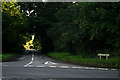
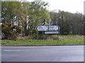
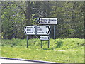
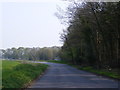
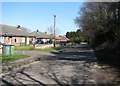
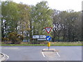
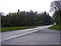
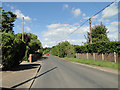
Photos of NR10 4BH
Area Information
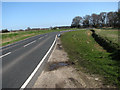
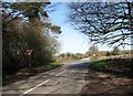
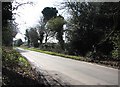
Living in NR10 4BH means residing within a compact residential cluster of 3.2 hectares that supports a population of 2320 people. This specific postcode area maintains a moderate density of 235 people per square kilometre, creating a neighbourhood that feels intimate without being crowded. You will find yourself surrounded by a settled community where daily life revolves around the practical needs of a predominantly adult population. The area functions as a quiet extension of the wider Norwich region, offering a peaceful environment suitable for those seeking stability rather than high-energy urbanisation. Residents here enjoy a residential landscape free from major planning constraints. There is no AONB coverage, no protected woodland, and no Ramsar wetland sites affecting development potential in this zone. Flood risk remains low, providing peace of mind regarding long-term safety. The small scale of the postcode ensures that neighbours are always nearby, fostering a sense of local familiarity. When you consider buying homes in NR10 4BH, you are choosing a location defined by its manageable size and its integration into a larger housing market that prioritises established, owner-occupied dwellings over transient rental economies.
- Area Type
- Postcode
- Area Size
- 3.2 hectares
- Population
- 2320
- Population Density
- 235 people/km²
The property market in NR10 4BH is distinctly characterised by a legacy of owner-occupied housing. With 73% of households owning their homes, the area skews heavily against the rental sector. This high level of ownership means that when properties come up for sale, they often remain on the market longer as owners carefully time their moves. The predominance of houses as the main accommodation type further distinguishes this postcode from urban centres where flats are common. For you looking to buy, this market offers limited inventory due to the reluctance of long-term homeowners to move. The housing stock consists primarily of houses found in small residential clusters typical of the 3.2-hectare footprint of this area. While the high ownership rate provides stability and community continuity, it also means prices may be reflective of high demand within a specific supply constraint. If you are comparing NR10 4BH to other locations, note that this is not a dynamic investment market populated by landlords. Instead, it is a settled area where homes pass between families who view property as a permanent home rather than a short-term asset.
House Prices in NR10 4BH
No properties found in this postcode.
Energy Efficiency in NR10 4BH
Daily life in NR10 4BH benefits from a practical array of amenities located within practical reach. Residents have access to five notable retail venues, including the East of England Co-operative Co, Tesco Thorpe Mariott, and Lidl Taverham. These specific supermarkets provide comprehensive shopping needs from fresh produce to household essentials without requiring long journeys into town centres. For those requiring faster travel arrangements, Norwich International Airport is a key facility nearby, offering straightforward links to other parts of the country. Public transport reliance is enhanced by the presence of Aylsham as a nearby metro station, providing regional rail connections. This accessibility allows residents to commute to Norwich or other hubs while maintaining a suburban base in NR10 4BH. The combination of local supermarkets and transport links creates a convenient lifestyle where errands and commutes are manageable. You will find that the essence of living here relies on reaching these specific named locations like the Tesco Thorpe Mariott and Aylsham station quickly and efficiently.
Amenities
Schools
Families living in NR10 4BH have several educational options immediately nearby, both designated as primary institutions. Horsford Church of England Junior School serves as a local option for younger pupils. Another prominent option is Horsford CofE VA Primary School, which holds a "good" rating from Ofsted. This Ofsted rating signals a standard of education that meets the requirements set by the Department for Education. The mix of schools includes multiple primary institutions but no secondary schools listed within the immediate proximity data. This configuration suggests that once children complete their primary education at venues like Horsford CofE VA Primary School, they will typically travel to secondary schools located in the broader Norwich borough. For parents focusing on living in NR10 4BH, the presence of a school with a "good" rating provides reassurance regarding the quality of early education. You should factor in commute times to secondary education when viewing homes, as these facilities are notably absent from the immediate school list provided for this specific postcode.
| Rank | School | Type | Entry gender | Ages |
|---|
Explore more schools in this area
Go to Schools tabDemographics
The community profile of NR10 4BH is defined by a mature population with a median age of 47 years. The vast majority of residents fall within the 30 to 64 years age range, indicating a neighbourhood where adults have likely established their careers and families long ago. This demographic reality aligns with a striking figure for home ownership; 73% of households own their property outright or with a mortgage. Such a high ownership rate suggests deep community roots and long-term commitment to the locality. Houses dominate the accommodation types in this post code, reflecting the preference of this age group for detached or semi-detached living over flats or high-rise accommodation. The predominant ethnic group is White, which mirrors the broader national trends seen in parts of East Anglia. This homogeneity contributes to a stable social fabric where long-standing families have shaped the character of the streets. You should expect a quiet, family-oriented atmosphere where social interactions are often neighbourly and grounded in shared local responsibilities rather than transient social networks.
Household Size
Accommodation Type
Tenure
Ethnic Group
Religion
Household Composition
Age
Household Deprivation
NS-SEC
Explore more demographic insights in this area
Go to Demographics tabPlanning
Planning Constraints
- Flood RiskPremium
- Ramsar Wetland SitesPremium
- Area of Outstanding Natural BeautyPremium
- Protected Nature ReservePremium
- Protected WoodlandPremium