Area Overview for NR10 4DQ
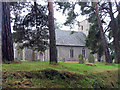
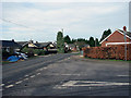
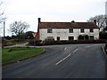
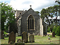
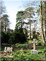
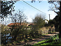
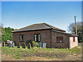
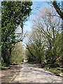
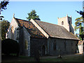
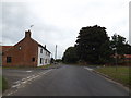
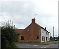
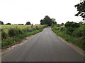
Photos of NR10 4DQ
Area Information
Living in NR10 4DQ means settling into a defined residential cluster covering an area of 16.0 hectares with a population of 2,320 people. This postcode represents a specific geographic pocket within a broader neighbourhood, offering a sense of space that is uncommon in larger urban settlements. The environment is characterised by its nature as a small, concentrated community rather than a sprawling townscape. You will find yourself in an area where the population density is moderate, creating a setting that balances quiet countryside living with practical access to essential services. The area accommodates roughly 2,000 residents across its footprint, ensuring a manageable scale for neighbourhood life without the anonymity of a major city centre. This specific postcode serves as the central reference point for a community where daily interactions are shaped by its compact size and close-knit structure. For those considering homes in NR10 4DQ, the physical boundaries provide a clear identity and a distinct sense of place within the local landscape. The community within NR10 4DQ displays a clear demographic profile focused on established residents. The median age stands at 47 years, indicating that the neighbourhood is dominated by adults aged between 30 and 64 years. This age distribution suggests a population of settled families and older professionals rather than a transient student or young workforce. Household stability is evident, with 73% of all residents owning their homes outright or with a mortgage. This high ownership rate contrasts significantly with areas where renting is the norm, pointing to a community invested in long-term local roots. The accommodation type is exclusively houses, meaning you will not find flats or apartments in this specific cluster. Ethnic diversity is lowest, as White residents form the predominant group, reflecting the typical character of established villages and rural settlements in this region. These figures collectively paint a picture of a mature, stable community where residents are likely to value tradition, permanence, and local participation. The property market in NR10 4DQ is defined by its status as a predominantly owner-occupied locality with 73% home ownership. This high figure indicates that the majority of housing stock is intended for permanent residents rather than short-term rentals or institutions. The accommodation type is strictly houses, confirming that the search for flats or apartments in this postcode will yield no results at the current time. Buyers looking at homes in NR10 4DQ should expect to view detached or semi-detached properties typical of a rural or semi-rural setting. The small area size of 16.0 hectares limits the volume of available inventory, suggesting a market where properties are often held by families who have lived there for generations. This concentration of owner-occupied housing implies a stable local economy where buyers are weighed against sellers, and price fluctuations may be slower than in volatile rental markets. Understanding this structure helps you navigate expectations regarding leaseholds, shared ownership schemes, or new builds, none of which feature prominently in the specific data for this cluster. Educational provision for children living in NR10 4DQ relies on two specific primary schools located in the immediate vicinity. Horsford Church of England Junior School serves as a local option for younger pupils, offering a faith-based education within the primary phase of schooling. Further specificity is available at Horsford CofE VA Primary School, which holds an Ofsted rating of 'good'. This rating provides a verified standard of quality for parents selecting homes in NR10 4DQ who require primary education for their children. The availability of two within a small postcode suggests a locally focused cluster of education rather than a broad range of secondary options directly within the cluster. Families must look beyond these primary institutions for secondary education, but the presence of two reputable primaries indicates a supportive local infrastructure. These schools are the main references for any family considering the practicalities of living in this postcode, ensuring that primary schooling is accessible without needing to travel far from the house. Digital connectivity for residents of NR10 4DQ is robust, supporting both modern work habits and daily communication needs. The fixed broadband quality score reaches 92 out of 100, classifying the connection as excellent. This high performance ensures that working from home is feasible without significant lag or disruption, a critical factor for remote professionals. Mobile network quality follows closely with a score of 81 out of 100, indicating a good to very good standard for signal reliability across the postcode. Residents can expect dependable coverage for smartphones and tablets, facilitating constant communication and seamless integration with digital services. While no railway station sits directly within the 16.0 hectare cluster, the presence of Aylsham as a metro transport hub within practical reach connects you to wider networks. The combination of excellent home internet and good mobile signals means that life in NR10 4DQ is not isolated from the digital economy, making it a viable option for those seeking a rural or semi-rural lifestyle without sacrificing high-speed connectivity. Your daily lifestyle in NR10 4DQ benefits from practical access to essential retail and transport hubs within a short drive. Local shopping needs are met by several prominent names, including East of England Co-operative Co, Tesco Thorpe Mariott, and Lidl Taverham. These five retail venues provide a complete range of groceries and household essentials, ensuring you do not need to travel far for basics. For those requiring faster connections to other regions, Norwich International Airport serves as the nearest major airport, offering flight possibilities for business or leisure travel. Transport links are further supported by the rail network, with Aylsham acting as the closest metropolitan hub for train services. While the immediate area of 16.0 hectares may lack extensive leisure parks or large commercial centres, the proximity to these established amenities creates a convenient routine. Your weekends can be spent exploring nearby towns or combining local errands with a quick trip to the airport, blending the convenience of suburbia with the accessibility of a transport corridor. Safety and environmental data for NR10 4DQ present a reassuring picture of a low-risk living environment. The area passes all major safety and planning constraint assessments, indicating a clean slate regarding hazards. Crime risk assessment places the neighbourhood in the 'pass' category with a score of 84 out of 100, where a higher score denotes better safety. This figure confirms that the area has below-average crime rates compared to broader benchmarks, making it a secure location for raising a family. Natural flood risk is negligible, with a score of 0 out of 100, meaning there is no measurable risk of flooding from water sources. Furthermore, planning constraints related to nature conservation show no restrictions; the score is 0 for Ramsar wetland sites, Areas of Outstanding Natural Beauty, protected nature reserves, and protected woodland. This zero-risk profile across environmental categories means you can develop or maintain a garden without worrying about protected species or conservation zones. The combination of low crime and zero environmental risk creates a secure foundation for permanent residence. Who typically lives in NR10 4DQ and what is the community feel like?The community is dominated by adults aged 30 to 64 years with a median age of 47. Stability is high, as 73% of residents own their homes. The area hosts 2,320 people across 16.0 hectares, fostering a close-knit, mature atmosphere typical of established neighbourhoods where families and long-term residents form the core of the population. What schools are available near NR10 4DQ for my children?There are two primary schools in the immediate vicinity. Horsford Church of England Junior School and Horsford CofE VA Primary School both serve the local community. The latter holds an Ofsted rating of 'good', providing a verified standard of education for primary-aged children in the cluster. How is digital connectivity for working from home in this postcode?Digital infrastructure is excellent. The fixed broadband score is 92 out of 100, ensuring high-speed internet suitable for remote work. Mobile coverage scores 81 out of 100, offering reliable connectivity for personal devices. These figures confirm that the rural setting does not compromise access to modern communication networks. Is the area safe from crime and environmental hazards?Risk assessments are overwhelmingly positive. The crime risk score is 84 out of 100, indicating below-average crime rates. Flood risk, Ramsar site status, and woodland designations all show a score of 0, meaning there are no flood threats or protected nature constraints affecting the land within the area. What amenities and transport links are within practical reach of NR10 4DQ?Residents have access to five key retail outlets including Tesco Thorpe Mariott and Lidl Taverham. Transport options include Norwich International Airport and Aylsham station, which serves as the nearest metro hub. These amenities and links provide a balance of local convenience and wider regional mobility for commuters and travellers.
- Area Type
- Postcode
- Area Size
- 16.0 hectares
- Population
- 2320
- Population Density
- 235 people/km²
The property market in NR10 4DQ is defined by its status as a predominantly owner-occupied locality with 73% home ownership. This high figure indicates that the majority of housing stock is intended for permanent residents rather than short-term rentals or institutions. The accommodation type is strictly houses, confirming that the search for flats or apartments in this postcode will yield no results at the current time. Buyers looking at homes in NR10 4DQ should expect to view detached or semi-detached properties typical of a rural or semi-rural setting. The small area size of 16.0 hectares limits the volume of available inventory, suggesting a market where properties are often held by families who have lived there for generations. This concentration of owner-occupied housing implies a stable local economy where buyers are weighed against sellers, and price fluctuations may be slower than in volatile rental markets. Understanding this structure helps you navigate expectations regarding leaseholds, shared ownership schemes, or new builds, none of which feature prominently in the specific data for this cluster. Educational provision for children living in NR10 4DQ relies on two specific primary schools located in the immediate vicinity. Horsford Church of England Junior School serves as a local option for younger pupils, offering a faith-based education within the primary phase of schooling. Further specificity is available at Horsford CofE VA Primary School, which holds an Ofsted rating of 'good'. This rating provides a verified standard of quality for parents selecting homes in NR10 4DQ who require primary education for their children. The availability of two within a small postcode suggests a locally focused cluster of education rather than a broad range of secondary options directly within the cluster. Families must look beyond these primary institutions for secondary education, but the presence of two reputable primaries indicates a supportive local infrastructure. These schools are the main references for any family considering the practicalities of living in this postcode, ensuring that primary schooling is accessible without needing to travel far from the house. Digital connectivity for residents of NR10 4DQ is robust, supporting both modern work habits and daily communication needs. The fixed broadband quality score reaches 92 out of 100, classifying the connection as excellent. This high performance ensures that working from home is feasible without significant lag or disruption, a critical factor for remote professionals. Mobile network quality follows closely with a score of 81 out of 100, indicating a good to very good standard for signal reliability across the postcode. Residents can expect dependable coverage for smartphones and tablets, facilitating constant communication and seamless integration with digital services. While no railway station sits directly within the 16.0 hectare cluster, the presence of Aylsham as a metro transport hub within practical reach connects you to wider networks. The combination of excellent home internet and good mobile signals means that life in NR10 4DQ is not isolated from the digital economy, making it a viable option for those seeking a rural or semi-rural lifestyle without sacrificing high-speed connectivity. Your daily lifestyle in NR10 4DQ benefits from practical access to essential retail and transport hubs within a short drive. Local shopping needs are met by several prominent names, including East of England Co-operative Co, Tesco Thorpe Mariott, and Lidl Taverham. These five retail venues provide a complete range of groceries and household essentials, ensuring you do not need to travel far for basics. For those requiring faster connections to other regions, Norwich International Airport serves as the nearest major airport, offering flight possibilities for business or leisure travel. Transport links are further supported by the rail network, with Aylsham acting as the closest metropolitan hub for train services. While the immediate area of 16.0 hectares may lack extensive leisure parks or large commercial centres, the proximity to these established amenities creates a convenient routine. Your weekends can be spent exploring nearby towns or combining local errands with a quick trip to the airport, blending the convenience of suburbia with the accessibility of a transport corridor. Safety and environmental data for NR10 4DQ present a reassuring picture of a low-risk living environment. The area passes all major safety and planning constraint assessments, indicating a clean slate regarding hazards. Crime risk assessment places the neighbourhood in the 'pass' category with a score of 84 out of 100, where a higher score denotes better safety. This figure confirms that the area has below-average crime rates compared to broader benchmarks, making it a secure location for raising a family. Natural flood risk is negligible, with a score of 0 out of 100, meaning there is no measurable risk of flooding from water sources. Furthermore, planning constraints related to nature conservation show no restrictions; the score is 0 for Ramsar wetland sites, Areas of Outstanding Natural Beauty, protected nature reserves, and protected woodland. This zero-risk profile across environmental categories means you can develop or maintain a garden without worrying about protected species or conservation zones. The combination of low crime and zero environmental risk creates a secure foundation for permanent residence. Who typically lives in NR10 4DQ and what is the community feel like?The community is dominated by adults aged 30 to 64 years with a median age of 47. Stability is high, as 73% of residents own their homes. The area hosts 2,320 people across 16.0 hectares, fostering a close-knit, mature atmosphere typical of established neighbourhoods where families and long-term residents form the core of the population. What schools are available near NR10 4DQ for my children?There are two primary schools in the immediate vicinity. Horsford Church of England Junior School and Horsford CofE VA Primary School both serve the local community. The latter holds an Ofsted rating of 'good', providing a verified standard of education for primary-aged children in the cluster. How is digital connectivity for working from home in this postcode?Digital infrastructure is excellent. The fixed broadband score is 92 out of 100, ensuring high-speed internet suitable for remote work. Mobile coverage scores 81 out of 100, offering reliable connectivity for personal devices. These figures confirm that the rural setting does not compromise access to modern communication networks. Is the area safe from crime and environmental hazards?Risk assessments are overwhelmingly positive. The crime risk score is 84 out of 100, indicating below-average crime rates. Flood risk, Ramsar site status, and woodland designations all show a score of 0, meaning there are no flood threats or protected nature constraints affecting the land within the area. What amenities and transport links are within practical reach of NR10 4DQ?Residents have access to five key retail outlets including Tesco Thorpe Mariott and Lidl Taverham. Transport options include Norwich International Airport and Aylsham station, which serves as the nearest metro hub. These amenities and links provide a balance of local convenience and wider regional mobility for commuters and travellers.
House Prices in NR10 4DQ
Showing 38 properties
| Address | Type | Beds | Baths | Last Sale Price | Last Sale Date | |
|---|---|---|---|---|---|---|
| Felthorpe Post Office, 46 The Street, Felthorpe, NR10 4DQ | Bungalow | 2 | 1 | £410,000 | Jun 2025 | |
| Dondoro, 72 The Street, Felthorpe, NR10 4DQ | Chalet | 3 | 1 | £325,000 | Apr 2025 | |
| Lodge View, 90 The Street, Felthorpe, NR10 4DQ | Terraced | 3 | 1 | £230,000 | Apr 2025 | |
| Ashlea, 94 The Street, Felthorpe, NR10 4DQ | house | - | - | £238,833 | Aug 2021 | |
| 50 The Street, Felthorpe, NR10 4DQ | Semi-detached | 3 | 1 | £227,000 | Feb 2021 | |
| The Loophole, 88 The Street, Felthorpe, NR10 4DQ | Terraced | 3 | 1 | £220,000 | Mar 2020 | |
| Greenacres, 64 The Street, Felthorpe, NR10 4DQ | hospital_care_home | - | - | £178,462 | Oct 2018 | |
| Highbanks, 38 The Street, Felthorpe, NR10 4DQ | Bungalow | 3 | 1 | £285,000 | Aug 2018 | |
| East Haddon, 30 The Street, Felthorpe, NR10 4DQ | Semi-detached | 4 | 1 | £279,500 | Nov 2016 | |
| Theadale, 62 The Street, Felthorpe, NR10 4DQ | Bungalow | 2 | 1 | £205,000 | Mar 2016 |
Energy Efficiency in NR10 4DQ
Your daily lifestyle in NR10 4DQ benefits from practical access to essential retail and transport hubs within a short drive. Local shopping needs are met by several prominent names, including East of England Co-operative Co, Tesco Thorpe Mariott, and Lidl Taverham. These five retail venues provide a complete range of groceries and household essentials, ensuring you do not need to travel far for basics. For those requiring faster connections to other regions, Norwich International Airport serves as the nearest major airport, offering flight possibilities for business or leisure travel. Transport links are further supported by the rail network, with Aylsham acting as the closest metropolitan hub for train services. While the immediate area of 16.0 hectares may lack extensive leisure parks or large commercial centres, the proximity to these established amenities creates a convenient routine. Your weekends can be spent exploring nearby towns or combining local errands with a quick trip to the airport, blending the convenience of suburbia with the accessibility of a transport corridor. Safety and environmental data for NR10 4DQ present a reassuring picture of a low-risk living environment. The area passes all major safety and planning constraint assessments, indicating a clean slate regarding hazards. Crime risk assessment places the neighbourhood in the 'pass' category with a score of 84 out of 100, where a higher score denotes better safety. This figure confirms that the area has below-average crime rates compared to broader benchmarks, making it a secure location for raising a family. Natural flood risk is negligible, with a score of 0 out of 100, meaning there is no measurable risk of flooding from water sources. Furthermore, planning constraints related to nature conservation show no restrictions; the score is 0 for Ramsar wetland sites, Areas of Outstanding Natural Beauty, protected nature reserves, and protected woodland. This zero-risk profile across environmental categories means you can develop or maintain a garden without worrying about protected species or conservation zones. The combination of low crime and zero environmental risk creates a secure foundation for permanent residence. Who typically lives in NR10 4DQ and what is the community feel like?The community is dominated by adults aged 30 to 64 years with a median age of 47. Stability is high, as 73% of residents own their homes. The area hosts 2,320 people across 16.0 hectares, fostering a close-knit, mature atmosphere typical of established neighbourhoods where families and long-term residents form the core of the population. What schools are available near NR10 4DQ for my children?There are two primary schools in the immediate vicinity. Horsford Church of England Junior School and Horsford CofE VA Primary School both serve the local community. The latter holds an Ofsted rating of 'good', providing a verified standard of education for primary-aged children in the cluster. How is digital connectivity for working from home in this postcode?Digital infrastructure is excellent. The fixed broadband score is 92 out of 100, ensuring high-speed internet suitable for remote work. Mobile coverage scores 81 out of 100, offering reliable connectivity for personal devices. These figures confirm that the rural setting does not compromise access to modern communication networks. Is the area safe from crime and environmental hazards?Risk assessments are overwhelmingly positive. The crime risk score is 84 out of 100, indicating below-average crime rates. Flood risk, Ramsar site status, and woodland designations all show a score of 0, meaning there are no flood threats or protected nature constraints affecting the land within the area. What amenities and transport links are within practical reach of NR10 4DQ?Residents have access to five key retail outlets including Tesco Thorpe Mariott and Lidl Taverham. Transport options include Norwich International Airport and Aylsham station, which serves as the nearest metro hub. These amenities and links provide a balance of local convenience and wider regional mobility for commuters and travellers.
Amenities
Schools
Educational provision for children living in NR10 4DQ relies on two specific primary schools located in the immediate vicinity. Horsford Church of England Junior School serves as a local option for younger pupils, offering a faith-based education within the primary phase of schooling. Further specificity is available at Horsford CofE VA Primary School, which holds an Ofsted rating of 'good'. This rating provides a verified standard of quality for parents selecting homes in NR10 4DQ who require primary education for their children. The availability of two within a small postcode suggests a locally focused cluster of education rather than a broad range of secondary options directly within the cluster. Families must look beyond these primary institutions for secondary education, but the presence of two reputable primaries indicates a supportive local infrastructure. These schools are the main references for any family considering the practicalities of living in this postcode, ensuring that primary schooling is accessible without needing to travel far from the house. Digital connectivity for residents of NR10 4DQ is robust, supporting both modern work habits and daily communication needs. The fixed broadband quality score reaches 92 out of 100, classifying the connection as excellent. This high performance ensures that working from home is feasible without significant lag or disruption, a critical factor for remote professionals. Mobile network quality follows closely with a score of 81 out of 100, indicating a good to very good standard for signal reliability across the postcode. Residents can expect dependable coverage for smartphones and tablets, facilitating constant communication and seamless integration with digital services. While no railway station sits directly within the 16.0 hectare cluster, the presence of Aylsham as a metro transport hub within practical reach connects you to wider networks. The combination of excellent home internet and good mobile signals means that life in NR10 4DQ is not isolated from the digital economy, making it a viable option for those seeking a rural or semi-rural lifestyle without sacrificing high-speed connectivity. Your daily lifestyle in NR10 4DQ benefits from practical access to essential retail and transport hubs within a short drive. Local shopping needs are met by several prominent names, including East of England Co-operative Co, Tesco Thorpe Mariott, and Lidl Taverham. These five retail venues provide a complete range of groceries and household essentials, ensuring you do not need to travel far for basics. For those requiring faster connections to other regions, Norwich International Airport serves as the nearest major airport, offering flight possibilities for business or leisure travel. Transport links are further supported by the rail network, with Aylsham acting as the closest metropolitan hub for train services. While the immediate area of 16.0 hectares may lack extensive leisure parks or large commercial centres, the proximity to these established amenities creates a convenient routine. Your weekends can be spent exploring nearby towns or combining local errands with a quick trip to the airport, blending the convenience of suburbia with the accessibility of a transport corridor. Safety and environmental data for NR10 4DQ present a reassuring picture of a low-risk living environment. The area passes all major safety and planning constraint assessments, indicating a clean slate regarding hazards. Crime risk assessment places the neighbourhood in the 'pass' category with a score of 84 out of 100, where a higher score denotes better safety. This figure confirms that the area has below-average crime rates compared to broader benchmarks, making it a secure location for raising a family. Natural flood risk is negligible, with a score of 0 out of 100, meaning there is no measurable risk of flooding from water sources. Furthermore, planning constraints related to nature conservation show no restrictions; the score is 0 for Ramsar wetland sites, Areas of Outstanding Natural Beauty, protected nature reserves, and protected woodland. This zero-risk profile across environmental categories means you can develop or maintain a garden without worrying about protected species or conservation zones. The combination of low crime and zero environmental risk creates a secure foundation for permanent residence. Who typically lives in NR10 4DQ and what is the community feel like?The community is dominated by adults aged 30 to 64 years with a median age of 47. Stability is high, as 73% of residents own their homes. The area hosts 2,320 people across 16.0 hectares, fostering a close-knit, mature atmosphere typical of established neighbourhoods where families and long-term residents form the core of the population. What schools are available near NR10 4DQ for my children?There are two primary schools in the immediate vicinity. Horsford Church of England Junior School and Horsford CofE VA Primary School both serve the local community. The latter holds an Ofsted rating of 'good', providing a verified standard of education for primary-aged children in the cluster. How is digital connectivity for working from home in this postcode?Digital infrastructure is excellent. The fixed broadband score is 92 out of 100, ensuring high-speed internet suitable for remote work. Mobile coverage scores 81 out of 100, offering reliable connectivity for personal devices. These figures confirm that the rural setting does not compromise access to modern communication networks. Is the area safe from crime and environmental hazards?Risk assessments are overwhelmingly positive. The crime risk score is 84 out of 100, indicating below-average crime rates. Flood risk, Ramsar site status, and woodland designations all show a score of 0, meaning there are no flood threats or protected nature constraints affecting the land within the area. What amenities and transport links are within practical reach of NR10 4DQ?Residents have access to five key retail outlets including Tesco Thorpe Mariott and Lidl Taverham. Transport options include Norwich International Airport and Aylsham station, which serves as the nearest metro hub. These amenities and links provide a balance of local convenience and wider regional mobility for commuters and travellers.
| Rank | School | Type | Entry gender | Ages |
|---|
Explore more schools in this area
Go to Schools tabDemographics
The community within NR10 4DQ displays a clear demographic profile focused on established residents. The median age stands at 47 years, indicating that the neighbourhood is dominated by adults aged between 30 and 64 years. This age distribution suggests a population of settled families and older professionals rather than a transient student or young workforce. Household stability is evident, with 73% of all residents owning their homes outright or with a mortgage. This high ownership rate contrasts significantly with areas where renting is the norm, pointing to a community invested in long-term local roots. The accommodation type is exclusively houses, meaning you will not find flats or apartments in this specific cluster. Ethnic diversity is lowest, as White residents form the predominant group, reflecting the typical character of established villages and rural settlements in this region. These figures collectively paint a picture of a mature, stable community where residents are likely to value tradition, permanence, and local participation. The property market in NR10 4DQ is defined by its status as a predominantly owner-occupied locality with 73% home ownership. This high figure indicates that the majority of housing stock is intended for permanent residents rather than short-term rentals or institutions. The accommodation type is strictly houses, confirming that the search for flats or apartments in this postcode will yield no results at the current time. Buyers looking at homes in NR10 4DQ should expect to view detached or semi-detached properties typical of a rural or semi-rural setting. The small area size of 16.0 hectares limits the volume of available inventory, suggesting a market where properties are often held by families who have lived there for generations. This concentration of owner-occupied housing implies a stable local economy where buyers are weighed against sellers, and price fluctuations may be slower than in volatile rental markets. Understanding this structure helps you navigate expectations regarding leaseholds, shared ownership schemes, or new builds, none of which feature prominently in the specific data for this cluster. Educational provision for children living in NR10 4DQ relies on two specific primary schools located in the immediate vicinity. Horsford Church of England Junior School serves as a local option for younger pupils, offering a faith-based education within the primary phase of schooling. Further specificity is available at Horsford CofE VA Primary School, which holds an Ofsted rating of 'good'. This rating provides a verified standard of quality for parents selecting homes in NR10 4DQ who require primary education for their children. The availability of two within a small postcode suggests a locally focused cluster of education rather than a broad range of secondary options directly within the cluster. Families must look beyond these primary institutions for secondary education, but the presence of two reputable primaries indicates a supportive local infrastructure. These schools are the main references for any family considering the practicalities of living in this postcode, ensuring that primary schooling is accessible without needing to travel far from the house. Digital connectivity for residents of NR10 4DQ is robust, supporting both modern work habits and daily communication needs. The fixed broadband quality score reaches 92 out of 100, classifying the connection as excellent. This high performance ensures that working from home is feasible without significant lag or disruption, a critical factor for remote professionals. Mobile network quality follows closely with a score of 81 out of 100, indicating a good to very good standard for signal reliability across the postcode. Residents can expect dependable coverage for smartphones and tablets, facilitating constant communication and seamless integration with digital services. While no railway station sits directly within the 16.0 hectare cluster, the presence of Aylsham as a metro transport hub within practical reach connects you to wider networks. The combination of excellent home internet and good mobile signals means that life in NR10 4DQ is not isolated from the digital economy, making it a viable option for those seeking a rural or semi-rural lifestyle without sacrificing high-speed connectivity. Your daily lifestyle in NR10 4DQ benefits from practical access to essential retail and transport hubs within a short drive. Local shopping needs are met by several prominent names, including East of England Co-operative Co, Tesco Thorpe Mariott, and Lidl Taverham. These five retail venues provide a complete range of groceries and household essentials, ensuring you do not need to travel far for basics. For those requiring faster connections to other regions, Norwich International Airport serves as the nearest major airport, offering flight possibilities for business or leisure travel. Transport links are further supported by the rail network, with Aylsham acting as the closest metropolitan hub for train services. While the immediate area of 16.0 hectares may lack extensive leisure parks or large commercial centres, the proximity to these established amenities creates a convenient routine. Your weekends can be spent exploring nearby towns or combining local errands with a quick trip to the airport, blending the convenience of suburbia with the accessibility of a transport corridor. Safety and environmental data for NR10 4DQ present a reassuring picture of a low-risk living environment. The area passes all major safety and planning constraint assessments, indicating a clean slate regarding hazards. Crime risk assessment places the neighbourhood in the 'pass' category with a score of 84 out of 100, where a higher score denotes better safety. This figure confirms that the area has below-average crime rates compared to broader benchmarks, making it a secure location for raising a family. Natural flood risk is negligible, with a score of 0 out of 100, meaning there is no measurable risk of flooding from water sources. Furthermore, planning constraints related to nature conservation show no restrictions; the score is 0 for Ramsar wetland sites, Areas of Outstanding Natural Beauty, protected nature reserves, and protected woodland. This zero-risk profile across environmental categories means you can develop or maintain a garden without worrying about protected species or conservation zones. The combination of low crime and zero environmental risk creates a secure foundation for permanent residence. Who typically lives in NR10 4DQ and what is the community feel like?The community is dominated by adults aged 30 to 64 years with a median age of 47. Stability is high, as 73% of residents own their homes. The area hosts 2,320 people across 16.0 hectares, fostering a close-knit, mature atmosphere typical of established neighbourhoods where families and long-term residents form the core of the population. What schools are available near NR10 4DQ for my children?There are two primary schools in the immediate vicinity. Horsford Church of England Junior School and Horsford CofE VA Primary School both serve the local community. The latter holds an Ofsted rating of 'good', providing a verified standard of education for primary-aged children in the cluster. How is digital connectivity for working from home in this postcode?Digital infrastructure is excellent. The fixed broadband score is 92 out of 100, ensuring high-speed internet suitable for remote work. Mobile coverage scores 81 out of 100, offering reliable connectivity for personal devices. These figures confirm that the rural setting does not compromise access to modern communication networks. Is the area safe from crime and environmental hazards?Risk assessments are overwhelmingly positive. The crime risk score is 84 out of 100, indicating below-average crime rates. Flood risk, Ramsar site status, and woodland designations all show a score of 0, meaning there are no flood threats or protected nature constraints affecting the land within the area. What amenities and transport links are within practical reach of NR10 4DQ?Residents have access to five key retail outlets including Tesco Thorpe Mariott and Lidl Taverham. Transport options include Norwich International Airport and Aylsham station, which serves as the nearest metro hub. These amenities and links provide a balance of local convenience and wider regional mobility for commuters and travellers.
Household Size
Accommodation Type
Tenure
Ethnic Group
Religion
Household Composition
Age
Household Deprivation
NS-SEC
Explore more demographic insights in this area
Go to Demographics tabPlanning
Planning Constraints
- Flood RiskPremium
- Ramsar Wetland SitesPremium
- Area of Outstanding Natural BeautyPremium
- Protected Nature ReservePremium
- Protected WoodlandPremium