Area Overview for NR10 3JH
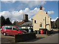
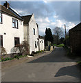
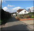
Photos of NR10 3JH


Area Information
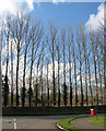
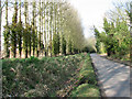
Living in NR10 3JH offers the stable environment of a specific residential cluster rather than the sprawling energy of a large town centre. This postcode covers an area of 17.9 hectares, creating a compact neighbourhood where residents interact frequently due to the limited physical space. With a population of 1,792, you will find a community that feels personal yet retains a degree of privacy typical of this density level. The environment is calm, defined by its small scale rather than grand infrastructure projects. Life here revolves around the immediate surroundings, with everything within a short drive or walk of the nearest stations and shops. You are living in a defined pocket of England where the pace of life matches the population count. There is no clutter of dense urban development; instead, the layout encourages a slower, more measured daily routine. This area appeals to those who prefer a settled existence over the volatility of rapidly changing city hubs. The homogeneity of the location ensures that remoteness from major hubs is balanced by the intimacy of a small village feel. You gain a clear sense of the local landscape without the overwhelming noise of larger metropolitan zones.
- Area Type
- Postcode
- Area Size
- 17.9 hectares
- Population
- 1792
- Population Density
- 245 people/km²
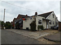
The housing market in this postcode is characterised by a predominantly owner-occupied stock, resulting in a long-term settled community. With 72% of homes owned outright or via mortgage, the area feels like a sanctuary for those seeking to put down permanent roots rather than a transient rental hub. You will primarily find houses rather than flats, catering to preferences for single-family units with private gardens. This accommodation type suits the demographic profile of adults aged 30 to 64 who prioritise space and autonomy. The low ratio of rented properties suggests that prices here may be stable and driven by local demand rather than speculative investment. Buyers looking at homes in this area should expect typical suburban or semi-rural architectural styles common to this region. Single households or couples dominate the scene, with fewer young sharers due to the legacy of the local housing stock. The absence of large housing estates means you will navigate a more established, consistent market where property values reflect the enduring nature of the structures you will purchase.
House Prices in NR10 3JH
Showing 20 properties
| Address | Type | Beds | Baths | Last Sale Price | Last Sale Date | |
|---|---|---|---|---|---|---|
| Caravan, 8A West Lane, Horsham St Faith, NR10 3JH | Detached | - | - | £785,000 | Sep 2023 | |
| Old Paddock Barn, 7 West Lane, Horsham St Faith, NR10 3JH | house | - | - | £850,000 | Feb 2022 | |
| The Gables, 16 West Lane, Horsham St Faith, NR10 3JH | Bungalow | 3 | 1 | £325,000 | Aug 2021 | |
| Rosebank, 10 West Lane, Horsham St Faith, NR10 3JH | Chalet | 2 | 1 | £5,000 | Aug 2019 | |
| Roermond, 12 West Lane, Horsham St Faith, NR10 3JH | house | - | - | £5,000 | Aug 2019 | |
| 9 West Lane, Horsham St Faith, NR10 3JH | Detached | 4 | 3 | £500,000 | Jul 2012 | |
| Silver Dawn, 22 West Lane, Horsham St Faith, NR10 3JH | Semi-detached | - | - | £150,000 | Jul 2008 | |
| Maybury, 24 West Lane, Horsham St Faith, NR10 3JH | Bungalow | - | - | £135,000 | May 2004 | |
| Rose View, 18 West Lane, Horsham St Faith, NR10 3JH | Semi-detached | - | - | £49,000 | Oct 1996 | |
| The Kennels, 8 West Lane, Horsham St Faith, NR10 3JH | Detached | 6 | 3 | - | - |
Energy Efficiency in NR10 3JH
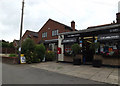
Your daily life in NR10 3JH is supported by a pragmatic network of nearby amenities that balance convenience with a relaxed routine. You have three rail stations to choose from: Norwich Railway Station, Salhouse Railway Station, and Hoveton & Wroxham Railway Station. These connections provide access to broader reading and leisure options without requiring a long car journey. For shopping, five retail outlets are within practical reach, including a large branch of Tesco Norwich and multiple Co-operative stores. These venues offer the essentials of daily life, from groceries to household necessities, keeping transport costs low. Norwich International Airport sits nearby, providing occasional flight options for residents wishing to travel frequently. A metro stop in Wroxham adds to the transport matrix, especially for weekend commuters heading towards Windsor or Epping in London direction. While you will not find a bustling high street for entertainment, the named amenities ensure that routine errands remain efficient. You live at a distance that preserves your peace of mind while keeping daily services accessible.
Amenities
Schools
Families considering schools near NR10 3JH have one primary option within the immediate vicinity. St Faiths CofE Primary School stands as the nearest educational establishment to this residential cluster. This school holds a good Ofsted rating, indicating that it meets expected standards for education and care. As a primary institution, it serves only the younger demographic of the neighbourhood's children, who make up a small fraction of the resident population given the median age of 47. There are no secondary schools listed for this specific postcode, meaning older children from NR10 3JH must commute further for their secondary education. The presence of a good-rated primary school provides a reliable foundation for young families living in the houses surrounding this area. While the lack of secondary options is a structural constraint for the 10 to 16-year-old demographic, primary parents benefit from a reputable local institution that keeps younger siblings close to home.
| Rank | School | Type | Entry gender | Ages |
|---|
Explore more schools in this area
Go to Schools tabDemographics
The people calling this home skews noticeably older than the national average, reflecting a mature community focused on established stability. The median age sits at 47 years, placing the heart of the neighbourhood firmly within the adult demographic between 30 and 64 years old. You will encounter a population that values long-term residency, supported by a high home ownership rate of 72%. This figure indicates that the vast majority of residents have settled permanently rather than moving frequently. Almost no one lives in flats, meaning the housing stock consists almost entirely of detached or semi-detached houses suited to families or empty nesters. The ethnic composition is predominantly White, mirroring the traditional character of many rural outlying areas. With 245 people per square kilometre, the population density remains moderate. This balance allows for a close-knit social structure without the congestion of high-density urban living. Older residents often dominate social interactions, and the neighbourhood benefits from a generation that has likely contributed significantly to local institutions over decades.
Household Size
Accommodation Type
Tenure
Ethnic Group
Religion
Household Composition
Age
Household Deprivation
NS-SEC
Explore more demographic insights in this area
Go to Demographics tabPlanning
Planning Constraints
- Flood RiskPremium
- Ramsar Wetland SitesPremium
- Area of Outstanding Natural BeautyPremium
- Protected Nature ReservePremium
- Protected WoodlandPremium