Area Overview for MK43 7SE
Photos of MK43 7SE
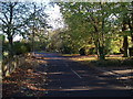

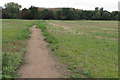
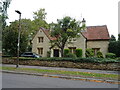
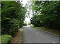
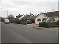
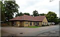
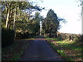
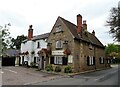
12 photos from this area
Area Information
Key information about the MK43 7SE including its size, population, and administrative classification.
- Area Type
- Postcode
- Area Size
- 6653 m²
- Population
- 2510
- Population Density
- 423 people/km²
House Prices in MK43 7SE
14
Properties
£243,371
Average Sold Price
£89,950
Lowest Price
£402,500
Highest Price
Showing 14 properties
| Address | Type | Beds | Baths | Last Sale Price | Last Sale Date | |
|---|---|---|---|---|---|---|
| 4 Grenidge Way, Oakley, MK43 7SE | Semi-detached | 3 | 1 | £402,500 | Sep 2023 | |
| 14 Grenidge Way, Oakley, MK43 7SE | Retail | 3 | 1 | £346,500 | Dec 2022 | |
| 8 Grenidge Way, Oakley, MK43 7SE | house | 3 | - | £363,000 | Sep 2022 | |
| 12 Grenidge Way, Oakley, MK43 7SE | Semi-detached | 3 | 1 | £260,000 | May 2021 | |
| 28 Grenidge Way, Oakley, MK43 7SE | Semi-detached | 3 | 1 | £292,500 | May 2018 | |
| 20 Grenidge Way, Oakley, MK43 7SE | Semi-detached | 3 | 2 | £257,000 | Apr 2017 | |
| 22 Grenidge Way, Oakley, MK43 7SE | Bungalow | 3 | 1 | £230,000 | Dec 2015 | |
| 26 Grenidge Way, Oakley, MK43 7SE | Semi-detached | 3 | - | £165,000 | Feb 2013 | |
| 18 Grenidge Way, Oakley, MK43 7SE | house | 3 | - | £183,500 | Nov 2010 | |
| 24 Grenidge Way, Oakley, MK43 7SE | Bungalow | - | - | £177,500 | Oct 2004 |
Page 1 of 2
Energy Efficiency in MK43 7SE
Amenities
Schools
| Rank | School | Type | Entry gender | Ages |
|---|
Explore more schools in this area
Go to Schools tabDemographics
Household Size
Family (3-5 people)
most common
Accommodation Type
Houses
most common
Tenure
83
majority
Ethnic Group
White
most common
Religion
N/A
most common
Household Composition
N/A
most common
Age
47
median
Adults (30-64 years)
most common
Household Deprivation
N/A
with no deprivation
NS-SEC
47
in Lower managerial occupations
Explore more demographic insights in this area
Go to Demographics tabPlanning
Planning Constraints
- Flood RiskPremium
- Ramsar Wetland SitesPremium
- Area of Outstanding Natural BeautyPremium
- Protected Nature ReservePremium
- Protected WoodlandPremium