Area Overview for MK43 7RL
Photos of MK43 7RL
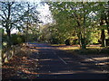

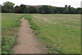
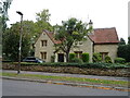
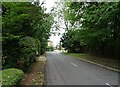
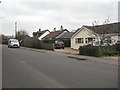
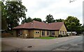
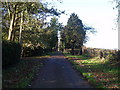
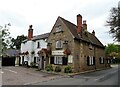

12 photos from this area
Area Information
Key information about the MK43 7RL including its size, population, and administrative classification.
- Area Type
- Postcode
- Area Size
- 9776 m²
- Population
- 2510
- Population Density
- 423 people/km²
House Prices in MK43 7RL
20
Properties
£266,455
Average Sold Price
£155,000
Lowest Price
£395,000
Highest Price
Showing 20 properties
| Address | Type | Beds | Baths | Last Sale Price | Last Sale Date | |
|---|---|---|---|---|---|---|
| 21 Dewlands, Oakley, MK43 7RL | house | 3 | 1 | £395,000 | Jun 2024 | |
| 22 Dewlands, Oakley, MK43 7RL | house | - | - | £315,000 | Dec 2019 | |
| 20 Dewlands, Oakley, MK43 7RL | house | - | - | £385,000 | Jan 2019 | |
| 16 Dewlands, Oakley, MK43 7RL | Detached | 4 | 1 | £365,000 | Aug 2018 | |
| 4 Dewlands, Oakley, MK43 7RL | Detached | 4 | 1 | £240,000 | Nov 2016 | |
| 10 Dewlands, Oakley, MK43 7RL | Semi-detached | 4 | - | £248,000 | Aug 2014 | |
| 24 Dewlands, Oakley, MK43 7RL | house | - | - | £235,000 | May 2013 | |
| 26 Dewlands, Oakley, MK43 7RL | Semi-detached | - | - | £263,000 | Apr 2008 | |
| 2 Dewlands, Oakley, MK43 7RL | Semi-detached | 3 | 1 | £155,000 | Nov 2005 | |
| 14 Dewlands, Oakley, MK43 7RL | Terraced | - | - | £175,000 | Aug 2003 |
Page 1 of 2
Energy Efficiency in MK43 7RL
Amenities
Schools
| Rank | School | Type | Entry gender | Ages |
|---|
Explore more schools in this area
Go to Schools tabDemographics
Household Size
Family (3-5 people)
most common
Accommodation Type
Houses
most common
Tenure
83
majority
Ethnic Group
White
most common
Religion
N/A
most common
Household Composition
N/A
most common
Age
47
median
Adults (30-64 years)
most common
Household Deprivation
N/A
with no deprivation
NS-SEC
47
in Lower managerial occupations
Explore more demographic insights in this area
Go to Demographics tabPlanning
Planning Constraints
- Flood RiskPremium
- Ramsar Wetland SitesPremium
- Area of Outstanding Natural BeautyPremium
- Protected Nature ReservePremium
- Protected WoodlandPremium