Area Overview for LU7 3AF
Photos of LU7 3AF
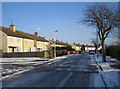
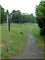
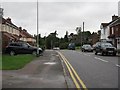
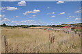
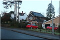
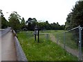
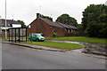
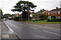
9 photos from this area
Area Information
Key information about the LU7 3AF including its size, population, and administrative classification.
- Area Type
- Postcode
- Area Size
- 1.5 hectares
- Population
- 2144
- Population Density
- 7000 people/km²
House Prices in LU7 3AF
68
Properties
£243,864
Average Sold Price
£56,000
Lowest Price
£445,000
Highest Price
Showing 68 properties
| Address | Type | Beds | Baths | Last Sale Price | Last Sale Date | |
|---|---|---|---|---|---|---|
| 35 Drakes Avenue, Leighton Buzzard, LU7 3AF | Terraced | 2 | 1 | £285,000 | May 2025 | |
| 113 Drakes Avenue, Leighton Buzzard, LU7 3AF | Terraced | 4 | 2 | £350,000 | May 2025 | |
| 1 Drakes Avenue, Leighton Buzzard, LU7 3AF | Detached | 4 | 3 | £445,000 | Mar 2025 | |
| 91 Drakes Avenue, Leighton Buzzard, LU7 3AF | Detached | 4 | 2 | £170,000 | Dec 2023 | |
| 43 Drakes Avenue, Leighton Buzzard, LU7 3AF | Terraced | 2 | 1 | £110,000 | Oct 2022 | |
| 49 Drakes Avenue, Leighton Buzzard, LU7 3AF | Terraced | 2 | 1 | £108,000 | Mar 2022 | |
| 103 Drakes Avenue, Leighton Buzzard, LU7 3AF | Semi-detached | 4 | 2 | £325,000 | Nov 2021 | |
| 97 Drakes Avenue, Leighton Buzzard, LU7 3AF | Terraced | 4 | 2 | £295,000 | Jul 2021 | |
| 95 Drakes Avenue, Leighton Buzzard, LU7 3AF | Terraced | 4 | - | £305,000 | Jun 2021 | |
| 79 Drakes Avenue, Leighton Buzzard, LU7 3AF | Detached | 4 | 2 | £368,000 | Mar 2021 |
Page 1 of 7
Energy Efficiency in LU7 3AF
Amenities
Schools
| Rank | School | Type | Entry gender | Ages |
|---|
Explore more schools in this area
Go to Schools tabDemographics
Household Size
Family (3-5 people)
most common
Accommodation Type
Houses
most common
Tenure
49
majority
Ethnic Group
White
most common
Religion
N/A
most common
Household Composition
N/A
most common
Age
47
median
Adults (30-64 years)
most common
Household Deprivation
N/A
with no deprivation
NS-SEC
28
in Lower managerial occupations
Explore more demographic insights in this area
Go to Demographics tabPlanning
Planning Constraints
- Flood RiskPremium
- Ramsar Wetland SitesPremium
- Area of Outstanding Natural BeautyPremium
- Protected Nature ReservePremium
- Protected WoodlandPremium